-2")

Strong coastal storm to develop on Wednesday
The second coastal storm in as many weeks will develop on Wednesday off the shores of the Mid-Atlantic, swinging northward towards New England while strengthening. By Thursday morning, the system will be located near Eastern New England, and may be strong enough to set monthly low pressure records in some areas.
Last weeks coastal storm, while impressive and subtropical in nature, was situated further offshore and moving much slower. This storm is occurring as a result of a dynamic “phase” in the mid levels of the atmosphere. This occurs when two disturbances interact with one another, often forcing the development of a strong low pressure system at the surface.
What’s causing this storm in the first place?
As mentioned above, two disturbances phasing over the Northeast United States will help to facilitate the development of a strong low pressure system somewhere off the Mid Atlantic and New England shores from Wednesday into Thursday.
Phasing is a very intricate process, as you probably imagined. The timing and intensity of the storm system will depend on the very specific interactions that occur in the mid and upper levels of the atmosphere, and forecast models will struggle to pin down these details.
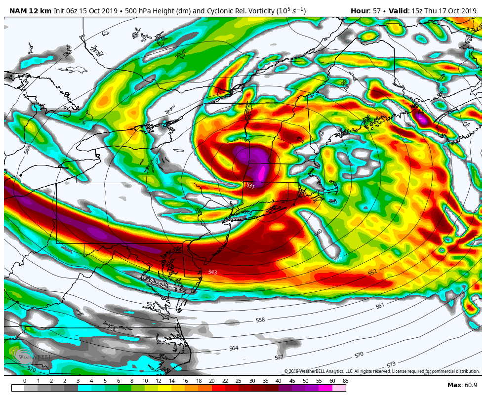
For instance, a slower phase or more disorganized interaction could lead to a slightly more progressive, weaker system. A faster or “cleaner” phase of the two disturbances could lead to a slower, more dynamic storm system in New England.
Regardless, the atmospheric setup is impressive. There is plenty of support for the phase to happen, and ensemble guidance suggests an increasing possibility that this system will challenge monthly low pressure records in New England (which are near 980hPa around Boston, for example).
What to expect in and around New York City
The main impact from this system in the NYC Metro Area will be heavy rainfall. Moisture from the storm system will advance quickly northward on Wednesday afternoon and evening, encompassing New Jersey, Eastern Pennsylvania and the NYC Metro Area by the early to mid afternoon hours.
Unusually high atmospheric moisture content combined with impressive dynamics will lead to the potential for multiple periods of heavy rainfall. Localized flooding is a distinct possibility, especially near the area coasts as the storm system begins to quickly deepen offshore.
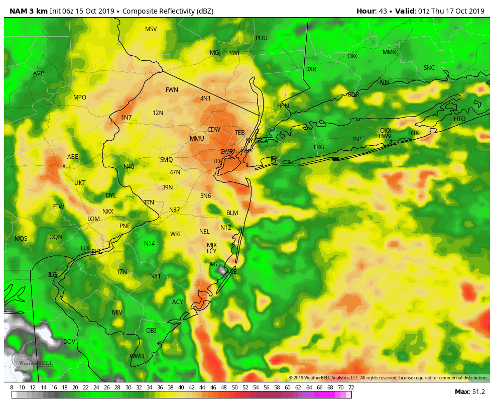
The worst of the system will likely come during the early to mid evening hours, as the low pressure passes near and then slightly north of our latitude. A period of torrential rainfall, flooding and perhaps even a rumble of thunder is expected. Localized flooding is likely at this time.
Winds are also likely to become increasingly gusty from Wednesday evening into Thursday. Gusts over 30mph are possible across most of New Jersey, the NYC Metro Area and throughout New England.
It is very likely that the Yankees and Astros ALCS Game 4 will need to be cancelled as a result of this storm. Heavy rainfall and wind will lead to unplayable conditions from the afternoon through the evening hours. If you have tickets to the game, have an alternate plan and prepare for changes.
The system is expected to wrap up to the north of the area on Thursday, with improving weather conditions. A few showers may persist into the morning hours, but clearing is expected by the afternoon despite a continued threat for very gusty northwest winds.
Trackbacks & Pingbacks
2regulation
Leave a Reply
Want to join the discussion?Feel free to contribute!