-2")

PM Briefing: More warmth and humidity is on the way, but it could be worse
There will be a moment sometime next week when you will find yourself complaining (or wanting to complain) about the warmth and humidity in New York City. It may be advantageous for you to consider that it could be much worse.
Take Montana, for example, where it appears increasingly likely that a significant, severe and highly anomalous winter storm will occur this weekend. The National Weather Service is forecasting blizzard conditions with 18 to 36 inches of snow and widespread tree damage – including the potential for extreme impacts to the agricultural and power infrastructure.
The very same trough and disturbance causing blizzard conditions in the Northwest US will be responsible for ramping up a ridge in the Central and Eastern states. This will, in turn, lead to the warming temperatures and rising humidity in the NYC Area.
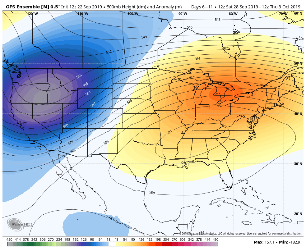
An anomalous and near record-breaking ridge
Most forecast guidance is in good agreement that a very large ridge will build across the Central and Eastern United States starting this weekend. By early next week, this ridge could be one of the strongest on record for this time of year in the mid levels of the atmosphere (the ECMWF is forecasting heights at the 99th percentile).

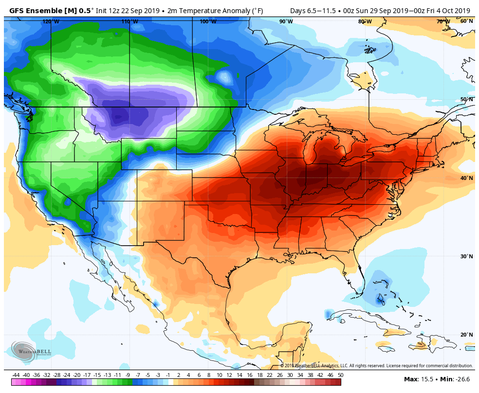
Temperatures will average 10 or more degrees above normal across a large part of the Ohio Valley, Tennessee Valley and Mid Atlantic States. This ridge of high pressure is expected to persist until the first few days of October.
What does this mean in terms of sensible weather? Summer-like conditions. The average high temperature in New York City is falling to near 70 degrees this time of year, and most forecast models suggest high temperatures will reach at least the middle 80’s for multiple days. Rising humidity levels won’t help, either.
An equally anomalous trough and storm to our west
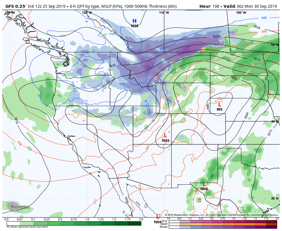
While we suffer through unusually warm temperatures and humidity, parts of Montana, Idaho, and Washington – as well as British Columbia and Saskatchewan – will experience blizzard conditions. Almost all model guidance is in good agreement in an unusually early and severe winter storm in those areas this weekend.
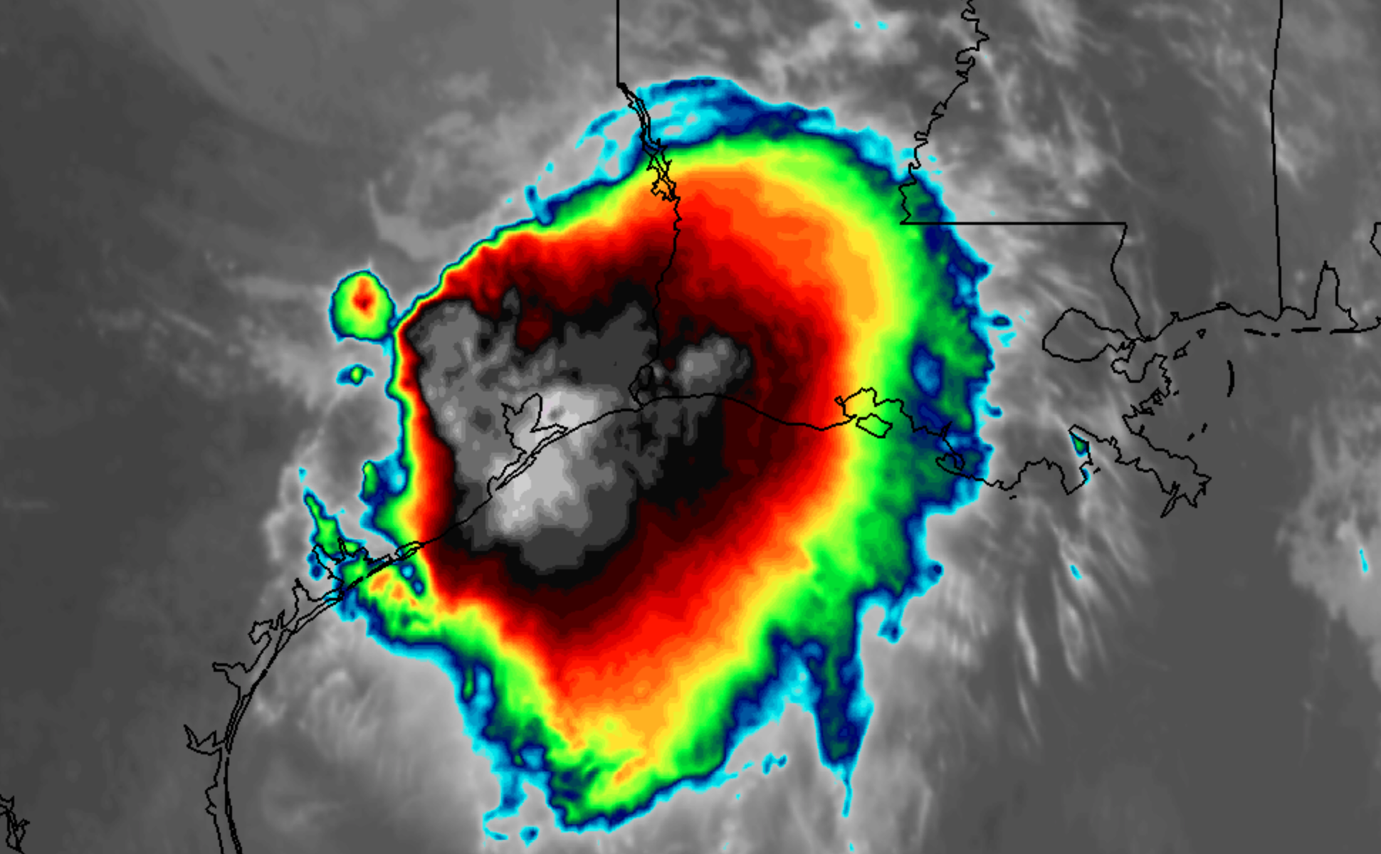
GFS Model showing snow in the NW this weekend 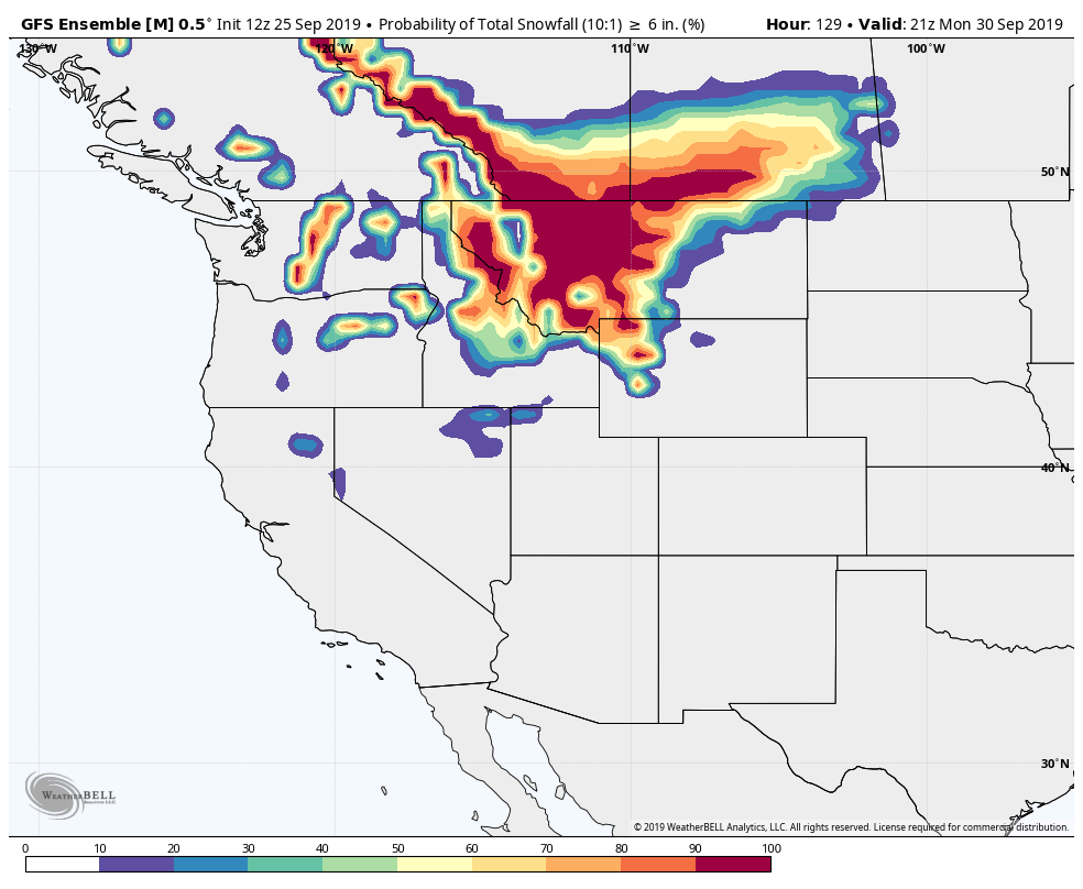
Probability of 6″ of snow (GEFS)
A large trough will swing into the Pacific Northwest states this weekend, forcing the development of a strong surface low pressure system. Unusually cold air lingering to the north of the storm will get tugged southward, and precipitation is expected to change to snow across the aforementioned areas, especially the higher elevations.
Winter Storm Watches have been issued for parts of the mentioned states, with the potential for significant snowfall. High winds are also expected, resulting in the potential for tree damage and power outages.
Pattern will change, but it will take some time
By the time we move into the second week of October, the weather pattern is likely to change across the United States. This change will allow a more progressive pattern to take hold – kicking out the heat and humidity and allowing more typical Autumn weather to take over.
The timing of this change remains in question, but we’re currently targeting the second week of October for the change. Stay tuned for more as we draw closer – and stay cool!