-2")
NYC Forecast: Enhanced Risk for severe storms on Tuesday
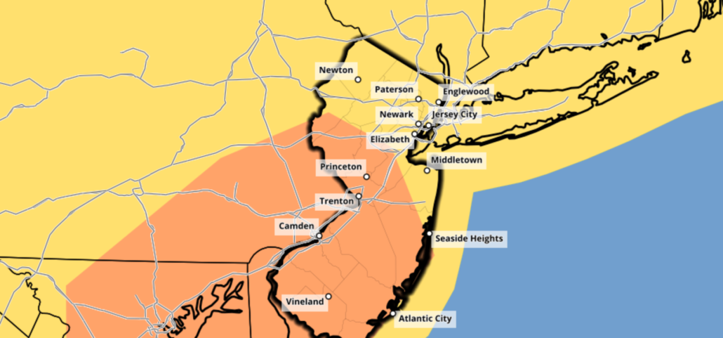
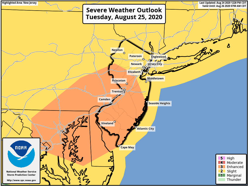
The Storm Prediction Center has placed parts of New Jersey and Pennsylvania in an Enhanced Risk for severe thunderstorms on Tuesday. The main threat with thunderstorms that develop will be strong, damaging wind gusts. Dangerous lightning and small hail also cannot be ruled out.
A frontal boundary is forecast to sink south from New England beginning this afternoon. This will act to tip off some showers and thunderstorms, some of which could be severe. Coverage should be scattered and biased towards New England.
Technical severe weather setup breakdown
A low pressure system will develop north of New England on Tuesday. As it does so, an associated mid level disturbance will move into the Northeast states. Strong mid to upper level winds will also move into New England as this occurs.
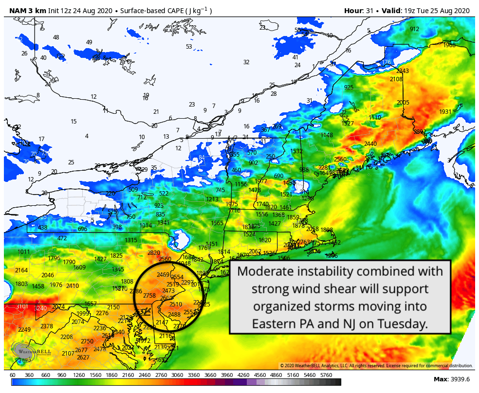
The airmass from New England into parts of the Mid Atlantic will become moderately unstable by the afternoon hours to the south of a frontal boundary. The approaching disturbance, modest instability, and ample wind shear will combine to allow for organized thunderstorms to develop.
The most favorable juxtaposition of instability and shear supportive of organized storms appears likely to occur across Eastern Pennsylvania and New Jersey. Accordingly, the Storm Prediction Center has placed that area in an Enhanced Risk for severe thunderstorms.

Forecast soundings throughout the area show favorable wind profiles for multicellular storm clusters, with lines and segments of storms progressing quickly southeastward. Ample downdraft cape suggests the potential for strong wind gusts in thunderstorms as they organize. The potential exists for gusts over 50 miles per hour. Given relatively cold temperatures aloft, the potential will also exist for hail in stronger thunderstorm cores.
Storms should develop first near the frontal boundary across the Hudson Valley and perhaps parts of Northeast PA during the early afternoon. Favorable west-northwest flow aloft should allow for organization as these storms shift into moderate instability. Expect fairly quick development from discrete cells into multicellular clusters and lines, which could quickly pose a threat for wind damage.
The most focused threat for wind damage and perhaps hail will be in the Enhanced Risk area, from Eastern PA into New Jersey. High resolution models suggest an localized instability maxima as well as storm development on the nose of 40-50kt 500hPa winds. This suggests a locally enhanced (get it) threat for downdraft winds and possibly gusts over 50-60mph at times in this region.
Briefing: What to expect on Tuesday
Tuesday should begin quietly across the Northeast and Mid Atlantic with warm temperatures and partial sunshine. By early afternoon, the development of showers and storms is likely to occur. This will begin first across Northeast Pennsylvania and Southeast NY – perhaps in parts of the Hudson Valley.
After 2pm, storms are expected to begin to move southeastward into Eastern Pennsylvania and New Jersey. By the mid afternoon hours, expect strong to severe thunderstorms to be traversing southward through Central New Jersey and perhaps parts of the Philadelphia Metro Area.
By the early evening, storms should be approaching the Southeast NJ shore. They will eventually exit the coast and the severe weather threat should wrap up after sunset.
The pattern will remain active, with additional rounds of strong and severe storms possible as soon as Thursday.
Hard to say right now. It’s most likely that it will remain to the south of the NYC Metro, closer to parts of Philadelphia and Central NJ. Still, severe storms are possible throughout the Slight Risk area.
Do u think nyc will be extended in the enhanced risk ?