-2")
NYC Forecast: Showers Sunday, pleasant otherwise
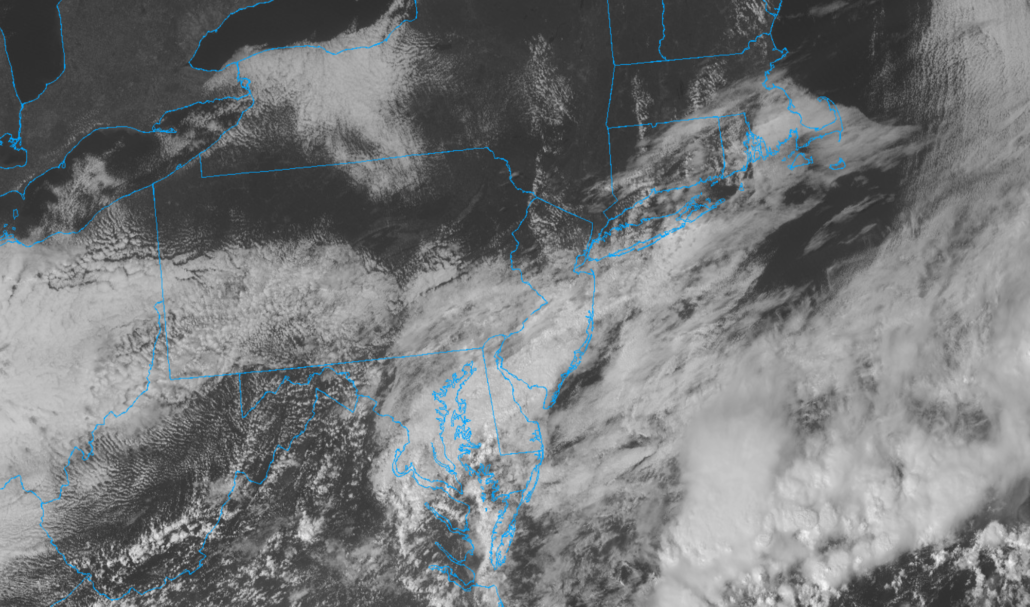
Seasonable conditions are expected for the remainder of Friday and Saturday. Temperatures will average near or slightly below normal, with lower humidity. Showers are expected as a front approaches the area on Sunday. Pleasant weather will return next week.
QuickCast
This afternoon: Calm conditions are expected to continue with temperatures in the low to mid 70’s.
Tonight: Mostly clear with temperatures falling into the 50’s. Low dew points will keep the air feeling crisp and refreshing.
Saturday: Plenty of sunshine, with pleasant weather expected. High temperatures will reach the lower to middle 70’s once again. Clouds will increase later Saturday and Saturday evening.
Discussion: Showers Sunday, pleasant conditions return thereafter
Forecast models are in good agreement that a frontal boundary will approach the area on Sunday. This will lead to increasing clouds and showery conditions throughout much of the day. It remains to be seen exactly how quickly these showers actually approach the region, as recent model guidance has slowed the frontal boundary down. A slower frontal approach could mean showery/drizzly conditions, but no true steady rainfall on Sunday. Either way, showers are expected later Sunday night.
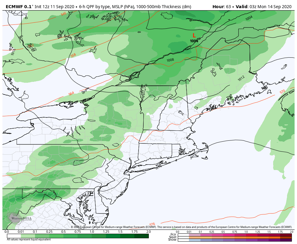
Recent runs of the ECMWF, for example (pictured above) have continued a trend towards a later frontal passage. That trend has also been accompanied by a drier tendency, which is obviously good news if we hope to salvage Sunday. Forecast soundings show relatively limited moisture in the atmosphere until the front approaches, but that moisture is in the low levels. This suggests that cloudy and drizzly conditions are most likely on Sunday. When the front does approach, some periods of steadier rain are possible – but the rainfall amounts won’t be the real story.
After showers wrap up later Sunday into Monday morning, high pressure will return to the area. Calm and cool conditions are likely on Monday, with high temperatures only reaching near 70. Plenty of sunshine and gradually more noticeable warmth is expected throughout the week. Temperatures will return towards 80 F by the middle to latter half of the week, particularly from Wednesday into Friday.
Tropical activity expected to ramp up again next week
The National Hurricane Center is monitoring several different areas for tropical development, in addition to tropical systems Paulette and Rene, which are already ongoing. Both of those systems are expected to recurve harmlessly away from the United States.
In the Gulf of Mexico, NHC is monitoring Invest 96L, which may form into a tropical system after it passes Florida this weekend. The system will remeerge into the Gulf of Mexico and may strengthen again before it reaches the coasts of the Northeast Gulf of Mexico.
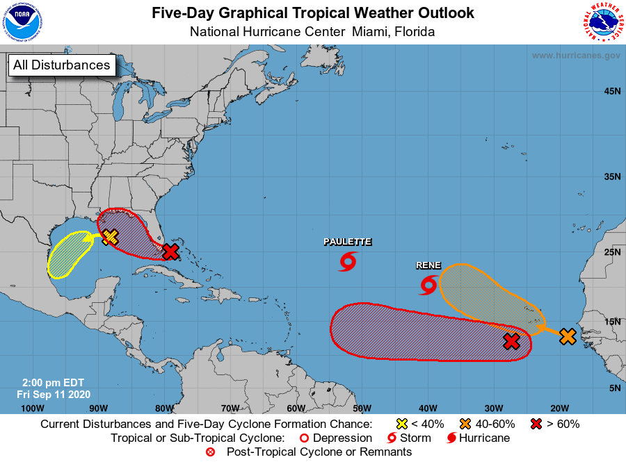
Meanwhile, Invest 95L is organizing itself off the coast of Africa and will continue its trek westward over the next few days. NHC says this system has a high chance of developing into a tropical system. Most forecast model guidance suggests this is a system to watch closely as it evolves towards the Caribbean in the next several days.
There is a great deal of uncertainty regarding 95L’s organization over the next few days. Much of that uncertainty stems back to the systems convective developments in the next 24-48 hours, and where the low level center organizes and becomes dominant. There are multiple convective complexes currently battling for control, and forecast models are struggling to pin down which will become the “leader” so to speak.

Trends over the last few runs of deterministic and ensemble guidance have suggested a more westerly surge of convection, with a dominant low level center organizing by Sunday. This tends to support a more westerly track with the system instead of an early recurve into the Atlantic Ocean.
At this range, there is not much for us to do other than monitor the convective organization of the system and monitor resulting ensemble trends. There is a good chance that the system will end up somewhere near 50 W by early next week, at which point we should have a much better idea where it will be heading – notice the inflection point among ensembles near that point, where some are heading northward and others almost due westward.
If you’re like me, you’ll be watching satellite all weekend. If you’re not, check back in for updates in the next few days! Have a great weekend y’all.
Leave a Reply
Want to join the discussion?Feel free to contribute!