-2")
NYC Forecast: Cool, pleasant weekend ahead
The past few days have been sunny, cool and pleasant. You wouldn’t know it though, as smoke from wildfires has obscured much of the sunshine. Hazy skies will persist for another day or so until a frontal boundary swipes the smoke away later Thursday. The weekend will feature cooler temperatures and pleasant conditions.
NYC QuickCast
This afternoon: Pleasant and warmer than yesterday. Highs in the mid 70’s. Hazy skies continue with wildfire smoke overhead.
Tonight: Partly cloudy, with lows in the mid 60’s. A bit warmer than the past few evenings.
Thursday: Warmer and hazy again. Highs in the middle to upper 70’s. Increasingly cloudy late, with a chance of showers after sunset.
Weekend Forecast: Wonderful Autumn weather
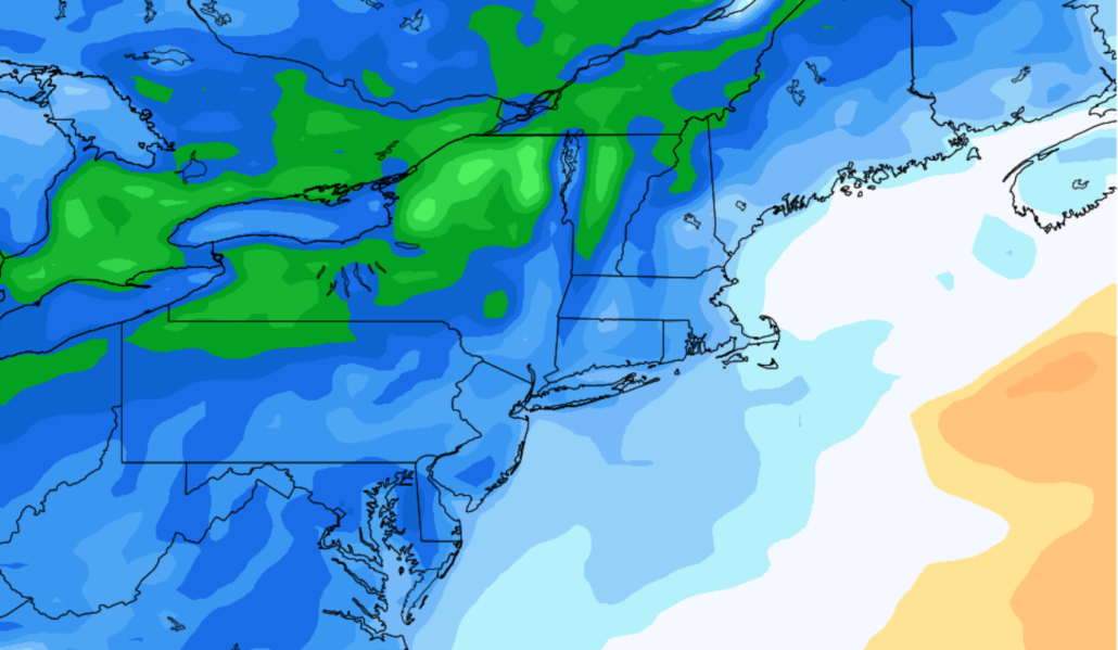
A frontal boundary will approach the area late Thursday into Friday, with the opportunity for clouds and showers. These will mostly be sporadic in nature and low in terms of coverage. The front will cross the area on Friday, sweeping away the thick plume of wildfire smoke which has remained over the area for several days.
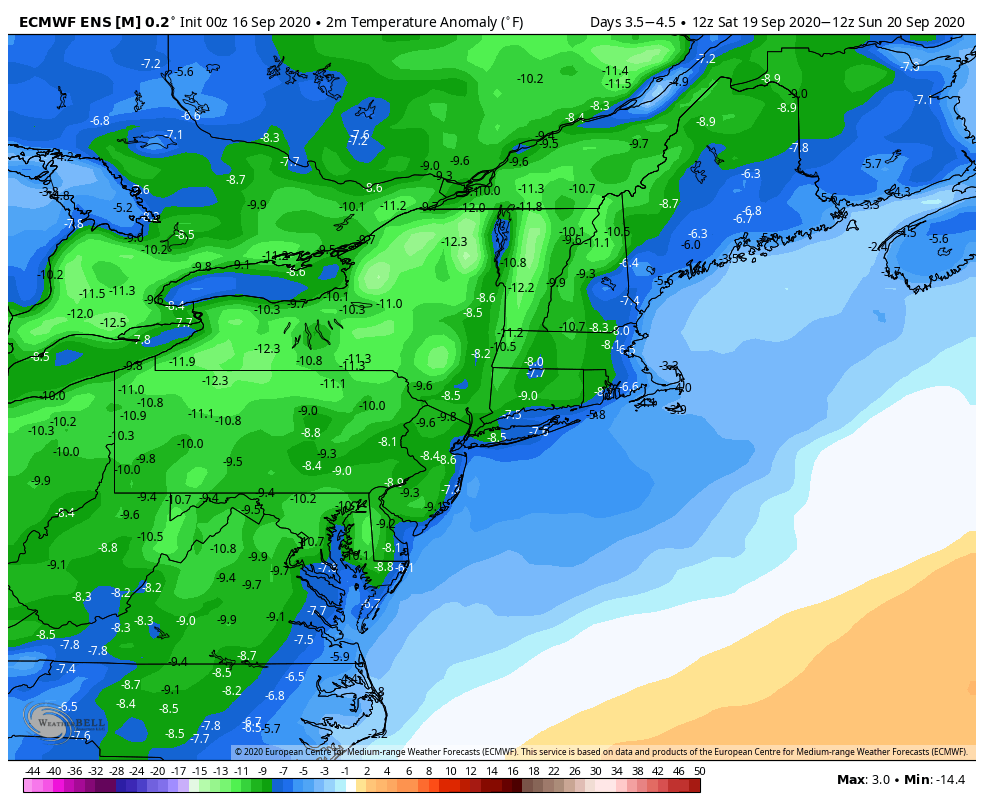
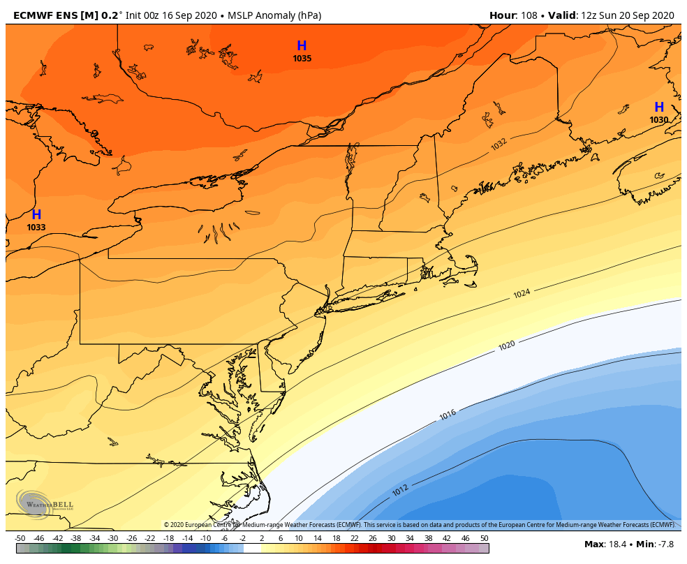
Later Friday into Saturday, a large area of high pressure will sink southward into New England. A northerly component to the wind will usher in cooler air from Canada. The airmass will be characterized by temperatures several degrees below normal.
With a large high pressure overhead, expect plenty of sunshine (no haze, either!) on Saturday and Sunday. Temperatures will be quite cool, with lows in the upper 40’s and lower 50’s and highs in the mid 60’s. It truly does look like a spectacular Autumn weekend with very few hazardous weather concerns to speak of.
Teddy will pass off the East Coast early next week
Tropical Storm Teddy, which is currently thousands of miles away in the Southern Atlantic, will move northwestward towards Bermuda this weekend. The system is expected to strengthen quite a bit as it does so, with the National Hurricane Center predicting a Major (Category 3) Hurricane.
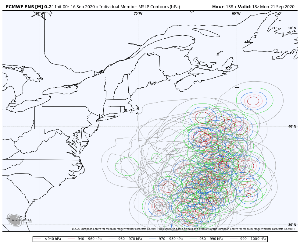
Forecast model guidance suggests that the storm will then turn northward, interacting with another disturbance over the northwest Atlantic Ocean. This will bring Teddy close to parts of the Gulf of Maine or Newfoundland by next week.
Impacts in the NYC area are expected to be limited, but may include rough surf and large waves as the storm passes by off the coast. Interests in New England and Eastern Canada should pay close attention to forecasts over the next few days as the track of the system may still change.
Trackbacks & Pingbacks
1pollution
Leave a Reply
Want to join the discussion?Feel free to contribute!