-2")

NYC Forecast: Dreary conditions through Tuesday morning
Briefing: A weak low pressure system will develop off the Mid-Atlantic coast this evening. This will lead to continued dreary and showery conditions through Tuesday morning. Temperatures will remain chilly, in the 40’s and 50’s. Conditions will gradually improve by the afternoon. Additional rainfall possibilities return by this weekend.
NYC QuickCast
Tonight: Gross. Cloudy with showers continuing. Lows in the lower to middle 50’s. Northeast winds between 10 and 20 miles per hour with occasionally higher gusts.
Tuesday: Showers and dreary weather during the first half of the day. Gradually improving conditions later in the afternoon. Highs in the middle 60’s. Winds turning northerly around 10 miles per hour.
Wednesday: Much improved! Sunny with highs in the lower 70’s, light northerly winds.
Discussion: Improving midweek, trouble by the weekend?
Rain will continue through Monday night as a low pressure system develops off the Mid-Atlantic coast. While weak, this surface low will act to enhance an onshore flow and draw moisture in off the Atlantic. Some occasional periods of steady and heavy rain will occur closer to the shore.
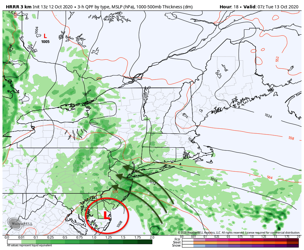
Dreary conditions will continue through Tuesday morning before a front drags the moisture out and brings drier air in from the west. Improving conditions will move back into the area by later Tuesday afternoon, and high pressure will return to the forecast by Wednesday. This will result in calm and comfortable conditions through Thursday, with temperatures several degrees above normal. By Thursday, highs could reach into the middle and upper 70’s.
While we are enjoying pleasant conditions, trouble will be brewing in the Arctic. Forecast models are in good agreement that anomalous blocking will develop in the higher latitudes of the Arctic and Atlantic Oceans. These blocking ridges of high pressure can act to disrupt the flow of the atmosphere in those regions, which eventually has a ripple effect on our weather too.
That effect could be felt as early as this coming weekend. With strong ridges of high pressure across the Arctic and Greenland, disturbances from Canada will be forced southward into the United States. The ECMWF and GFS Ensembles both suggest that a deep trough will form across the Ohio Valley and Northeast by Friday, resulting in increasing chances for rain in our area once again.
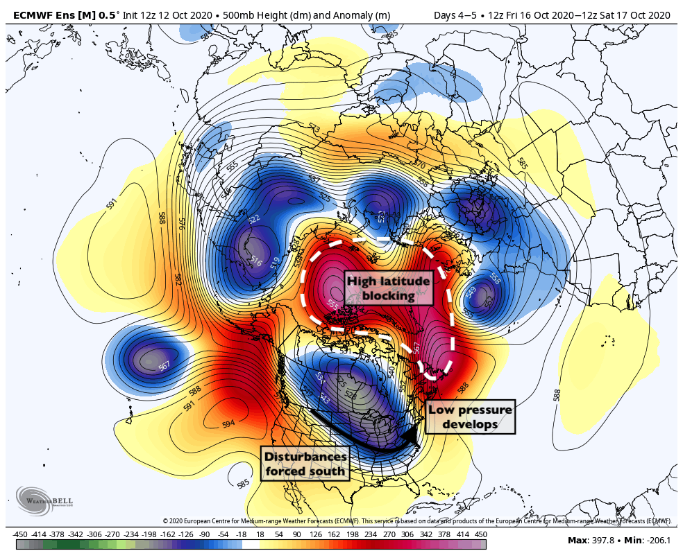
As the high latitude blocking does its thing and, well – blocks – the atmospheric pattern, the developing system in New England will have the opportunity to slow down and amplify. There’s a reason why high latitude blocking patterns are known to produce stronger, more amplified storm systems in the Northeast: Ridges over the high latitudes slow down atmospheric “traffic” and cause more interaction between storms.
As a result, we’re closely watching the most recent ensemble data. The trends over the past 24 hours have been for a slower, more amplified system. An impressive jet streak and atmospheric dynamics would support heavy rainfall. In New England, it could even support the possibility of some… wintry precipitation in higher elevations (Michael Scott yikes dot gif).
We’ll be closely monitoring trends on ensemble data over the next few days.
Trackbacks & Pingbacks
2gourmet
Leave a Reply
Want to join the discussion?Feel free to contribute!