Winter weather expected in the NYC Area early next week
The Winter of 2020-2021 has been very quiet in terms of winter weather thus far, as expected. The winter storm which brought nearly 10″ of snow to NYC on December 15th seems like a distant memory at this point, as warm temperatures and below normal precipitation have taken over since. This will change next week, with a winter storm expected to impact the area later Monday and Tuesday.
A low pressure system is expected to develop into the Ohio Valley on Monday morning, and then redevelop off the coast of the Mid-Atlantic states by Monday evening and Tuesday morning. Wintry precipitation will spread into the Northeast states as a result, with bands of snow impacting the region through midday Tuesday. By the time all is said and done, light to moderate snow accumulations appear possible.
What’s causing the potential for snow?
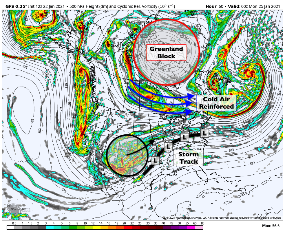
This particular winter storm threat is originating from a disturbance in the Southwest United States. The disturbance will eject out of the Four Corners region, traverse through the Mississippi River Valley, and then move towards the Northeast states early next week. While the system may have a tendency to amplify and would normally try to move west of the area, a strong blocking high pressure near Greenland will force it to redevelop off the coast.

Greenland blocks are effective at blocking atmospheric “traffic”. These large, anomalous areas of high pressure send cold air southward into Canada from the Arctic, but also stop warm air from advancing very far northward into the Northeast states. Instead, storms are often forced to redevelop off the coast, leading to more wintry scenarios for the NYC Area. Greenland blocks are, for this reason, notorious predecessors to wintry weather patterns in our area.
As a low pressure system moves into the Ohio Valley, it will start to feel the effects of the traffic “block” ahead of it. A confluent atmospheric flow will help force the redevelopment of the storm as a coastal low off the Mid-Atlantic coast on Tuesday morning. The system is then expected to pull away from the area later Tuesday.
What uncertainties still exist regarding this storm?
While we are confident that the storm will redevelop to our south, leading to wintry precipitation, we’re far less certain regarding exactly how precipitation will behave as it traverses the area. As the storm redevelops, it will begin to meet increasing resistance from dry air to our north. The dynamics of the system will begin to wane and oscillate. This won’t be a particularly strong storm.
As a result, bands of snow will be more unpredictable than usual. It is still uncertain just how far north the best moisture – and resulting snow – will get. Forecast models are still at odds regarding just how heavy precipitation will be, too. There is still quite a bit to suss out over the next few days.
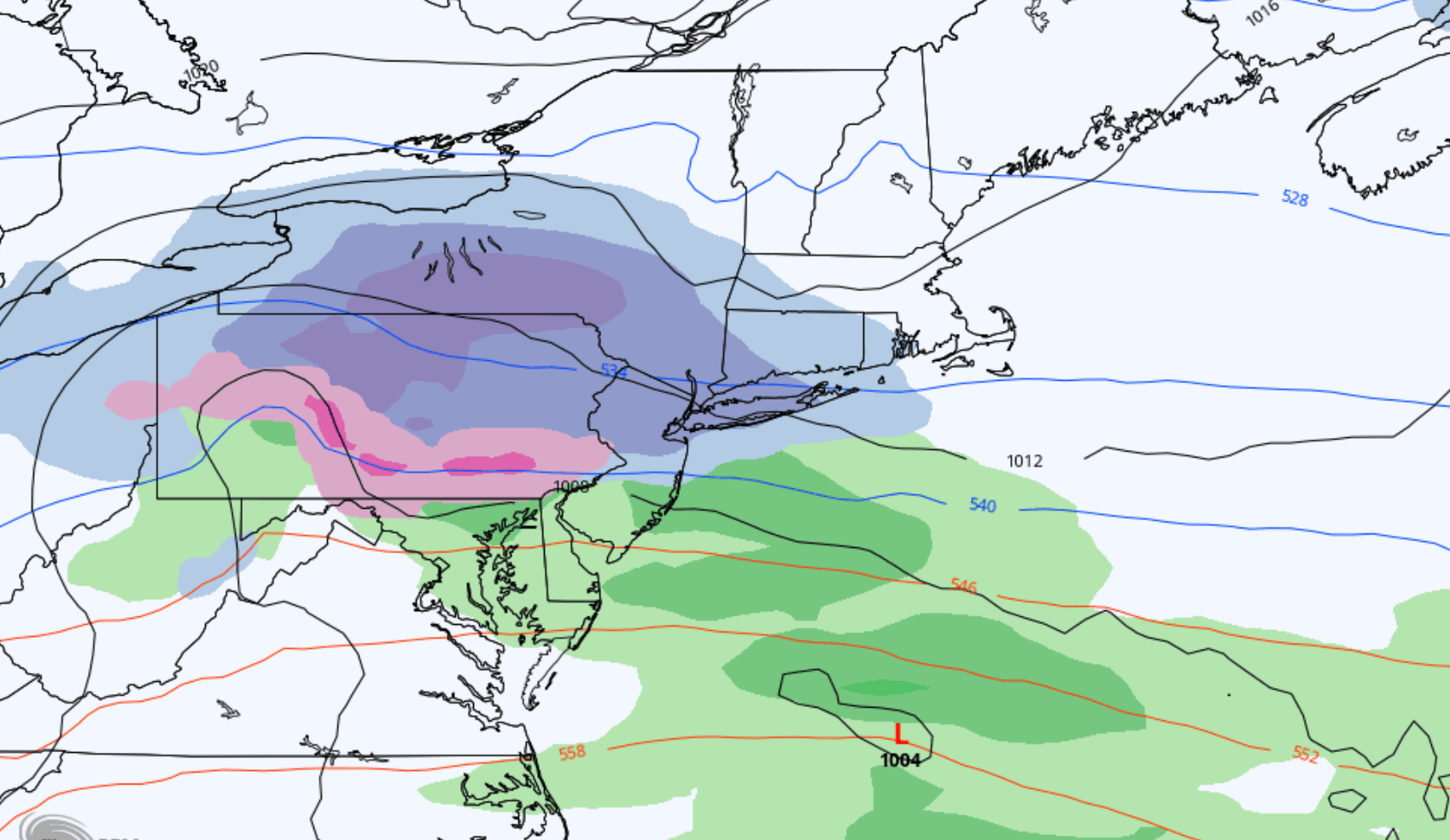
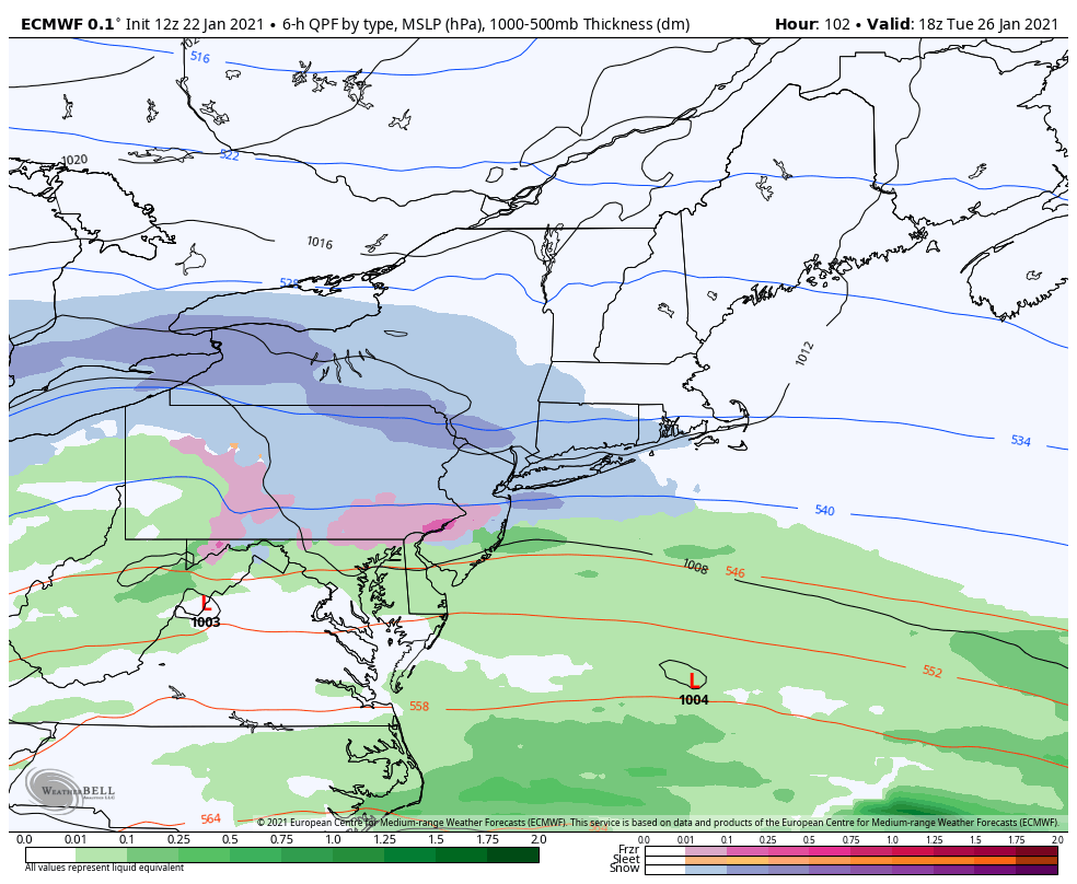
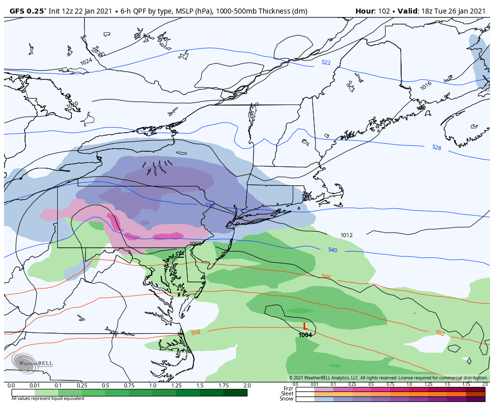
The ECMWF model (pictured above and left), for example, has recently trended lighter with precipitation totals. It suggests light and sporadic precipitation, with snowfall amounts generally near 2-3″ in the NYC Area. The GFS (above right), and some other guidance are a bit more bullish with precipitation totals and dynamics, leading to snowfall totals closer to 4-5″.
Our forecast currently lies somewhere in between, with moderate (40-70%) confidence in at least 3″ of snowfall in the NYC Metro area. Confidence is slightly higher (70-90%) further west in parts of Pennsylvania, where atmospheric dynamics are expected to be more favorable for steady and heavy snowfall.
What are the anticipated impacts and timing?
This is not expected to be an overly intense winter storm. Snow should begin during the late afternoon or evening hours on Monday, and is expected to continue into the overnight hours and through Tuesday morning. Snowfall rates should oscillate between light to moderate for the majority of the time, with some bursts of heavier snow possible.

Light to moderate snowfall should continue through Tuesday morning, tapering off slowly through the afternoon. Given the light to moderate snowfall intensity and anticipated snowfall totals, this is expected to be a low to moderate impact event for the majority of the NYC Metro Area. This means that travel and commute impacts are possible, but are mostly expected to be manageable.
Stay tuned over the weekend, as we anticipate the forecast will become more clear. This will give us the ability to hone in on details and provide further context on what to expect in terms of sensible weather impacts.


