-2")

MDW Forecast: Unsettled start, gorgeous finish
Good morning, NYC! The humidity has returned today, and it signals increasing moisture and instability in the atmosphere. This will eventually lead to the potential for showers and thunderstorms later this afternoon. Some of the storms are expected to be severe, with the potential for strong wind gusts and a few isolated tornadoes. Scattered storms are also anticipated on Saturday before conditions dramatically improve on Sunday and Monday.
Today began with clouds and drizzle across a large majority of the area. Clouds are expected to remain in place over the next several hours. Cooler, onshore winds will keep the air stable and humid near the shores and on Long Island. Meanwhile, from the NYC Metro westward the atmosphere will destabilize this afternoon with warm and humid conditions anticipated.
Three key ingredients required for organized thunderstorms are expected today – instability (hello warmth and humidity), wind shear and lift. The mechanism to lift air parcels will come in the form of a cold front which will approach the area this afternoon. This front will aid in the development of storms, which will then get themselves organized thanks to the instability and wind shear present.
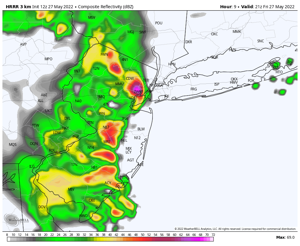
The threat for heavy rain and lightning is anticipated as these storms move through, with the timing currently favoring 4-6pm in the NYC Metro. In addition, the potential or damaging wind gusts and a few isolated tornadoes will also exist – specifically in parts of Eastern Pennsylvania and New Jersey. SPC has placed parts of our area in a Level 2/5 (Slight) Risk for severe thunderstorms as a result.
Improving, but still unsettled on Saturday
The frontal boundary will slide east of the area tonight, with showers and storms continuing into parts of the overnight hours. By Saturday morning, it would appear to be largely east of the area. But an upper level system swinging through the area on Saturday afternoon is expected to touch off another round of showers and storms.
Much of the day on Saturday is likely to be relatively pleasant, with high temperatures in the mid 70’s and partly cloudy skies. But scattered showers and storms during the afternoon hours could bring the potential for locally heavy rainfall and blustery winds – along with the outside chance of some small hail.
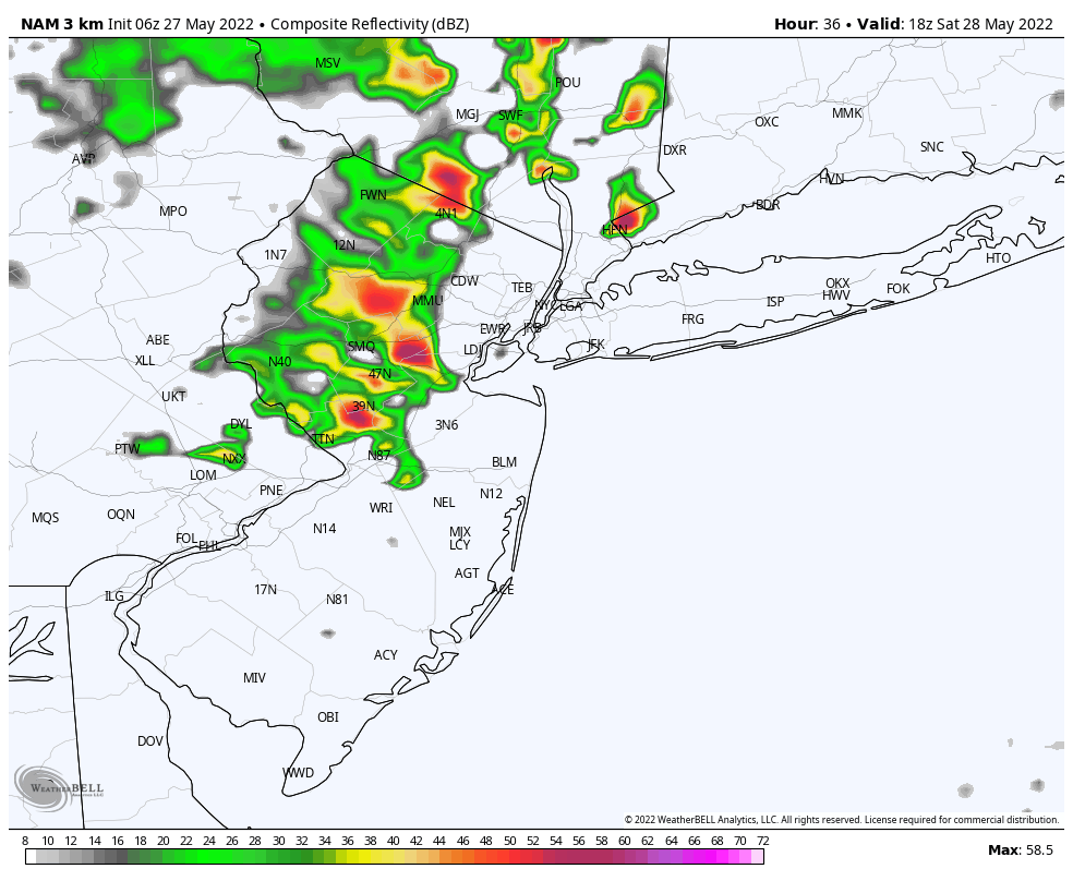
These are largely expected to be hit-or-miss, but bring an umbrella along just in case. If you have outdoor plans, make sure you’re aware of the potential for storms during the afternoon hours. Conditions should largely improve after sunset with the storm system finally moving away.
Sunday and Monday win the weekend
For a while, we were worried this storm system would stick around through the weekend. The good news is that after Saturday evening, it gets the heck out of here. This will set the stage for the development of a large and expansive high pressure, which will park itself over the Eastern United States from Sunday into the early part of next week.
As a result, Sunday and Monday are expected to be the winners of the weekend by far. High temperatures on Sunday will still be near seasonable levels, reaching into the middle 70’s with plenty of sunshine and a nice breeze.
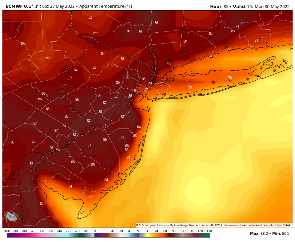
By Monday, high temperatures will have warmed all the way into the mid 80’s. A light southerly breeze and still relatively-not-terrible humidity is also expected. From this range, Sunday and Monday both currently look like two of the nicest days of weather so far this year.
The warmth will persist into the middle of next week with temperatures eventually trending anomalously warm for this time of year. High temperatures are expected to reach into the 90’s by Tuesday.