-2")
NYC Fourth of July Forecast: Great summer weekend with one exception
The weather on Independence Day weekend is always a point of contention. It is humidity and thunderstorm season after all – and on a weekend when almost everybody will be spending lots of time outside, the weather forecast can be very tricky. This year is no different, with transitional weather conditions anticipated.
Warm and humid weather on Friday will give way to pleasant, sunny and less humid weather on Sunday and Monday. The 24-hour period from Friday evening through Saturday evening appears the most precarious, with showers and storms are likely. Some of them may be severe on Saturday afternoon. Here’s the deal:
Friday: Humidity will be on the rise, much to the dissapointment of pretty much everybody that was enjoying the pleasant conditions this week. In fact, Friday is likely to feel quite hot. Temperatures in the 90’s are likely to combine with rising dew points to lead to uncomfortable Heat Index values. Another one of those instant-sweat-upon-walking-outside type days.
The majority of the day is expected to be dry, but a few isolated to scattered storms are possible during the afternoon and early evening hours. These should wane in coverage and intensity by the evening as the sun sets. A warm, summery evening is anticipated.
Saturday: Saturday is likely to be the loser of the weekend – although not a complete washout. The day will begin with more warmth, more humidity, and more instant sweat weather. By early afternoon, models are in good agreement that a frontal boundary will approach the area. With plenty of instability and sufficient wind shear in the atmosphere, it appears likely that a thunderstorms will form – and a few of them could be strong to severe. The main threats will be heavy rainfall, lightning, small hail and gusty winds as these storms move through.
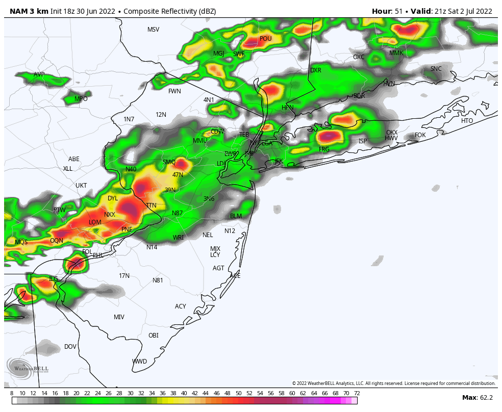
It’s not impossible that some areas experience localized flooding with these storms. Model guidance is indicating quite a bit of moisture content in the atmosphere, which given the projected intensity of the storms could easily be tapped into – leading to impressive rainfall rates over short periods of time. The good news is that this front keeps moving and storms will drop south and east of the area by evening.
Sunday & Monday: The winners of the weekend will be the back half, and Sunday morning will make it clear why. Humidity levels are forecast to drop and pleasant, sunny weather is expected for the vast majority of the day. West-norhtwest winds are expected behind the front with highs in the mid 80’s.
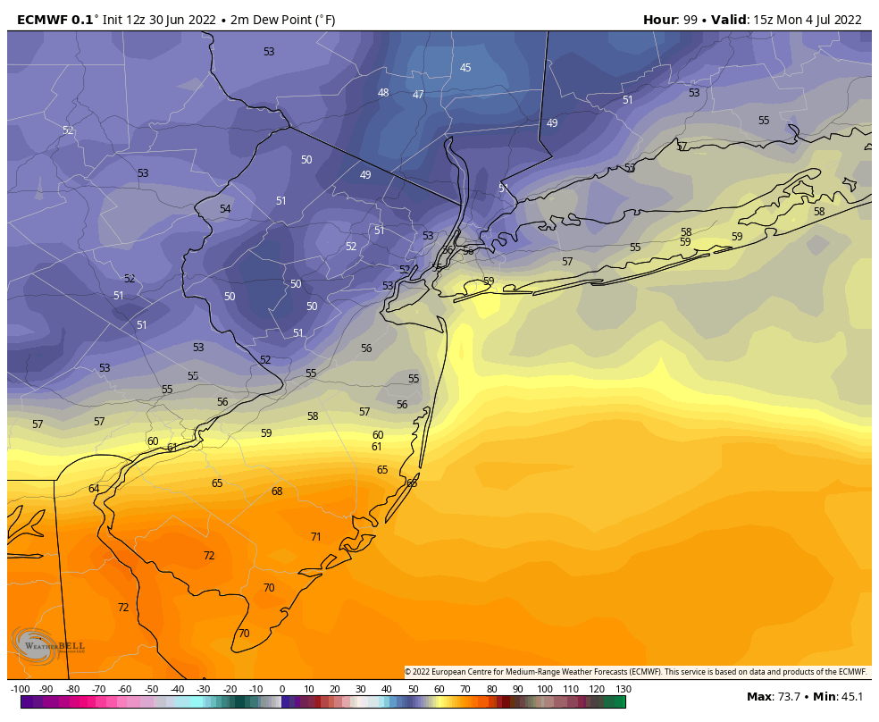
Much of the same can be expected on Monday – manageable humidity and warm, summer temperatures in the mid 80’s. These will be two glorious days packed in to a holiday weekend. We will take it.
Overall, the forecast for the weekend looks pretty solid. We’ll have to work through some hazardous weather on Saturday, but the majority of time we spend enjoying ourselves over the next few days will be spent with pleasant weather conditions and sunshine. Sunday and Monday will be the outright winners. We hope you all are able to enjoy them.