-2")

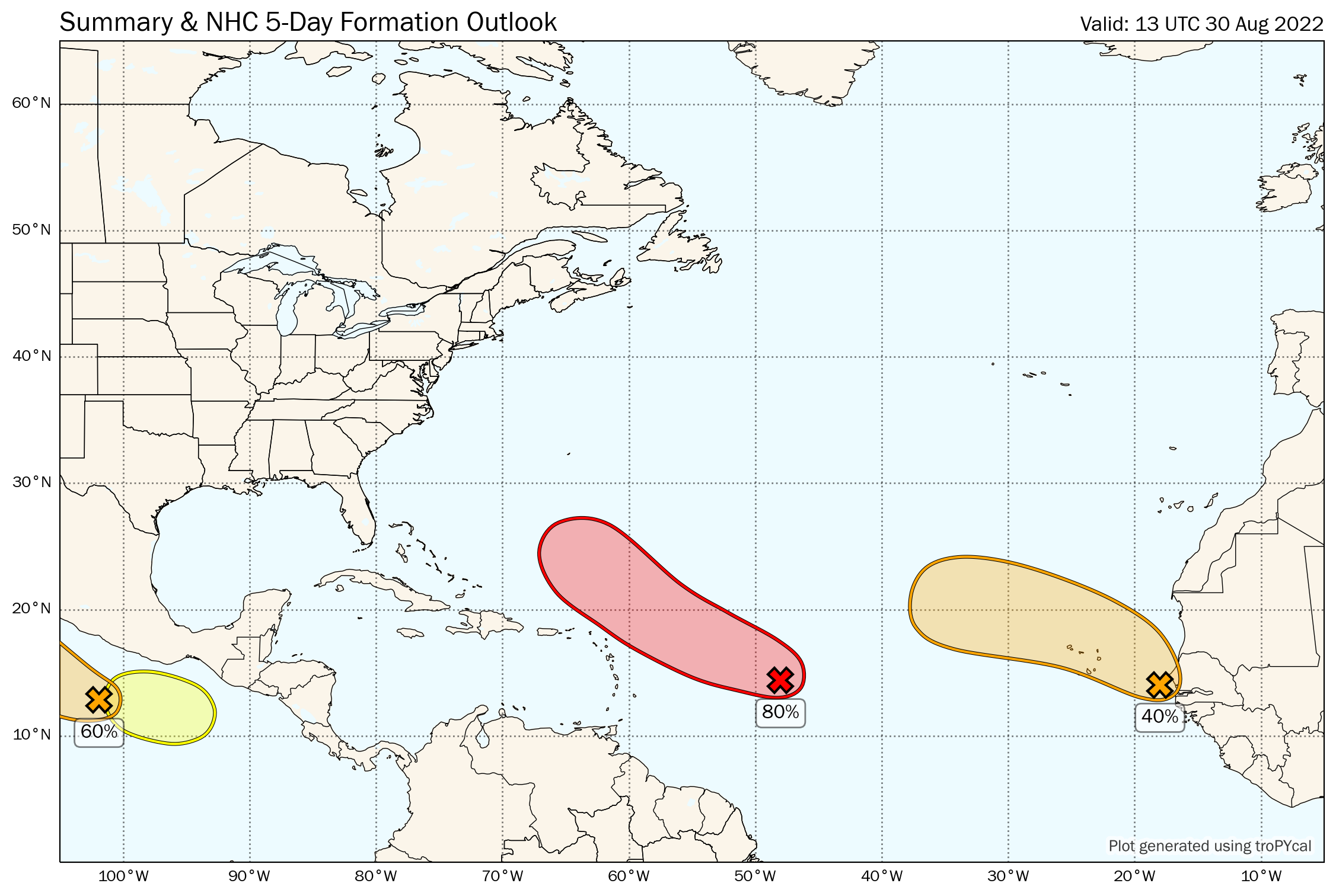
NHC monitoring multiple areas for tropical development
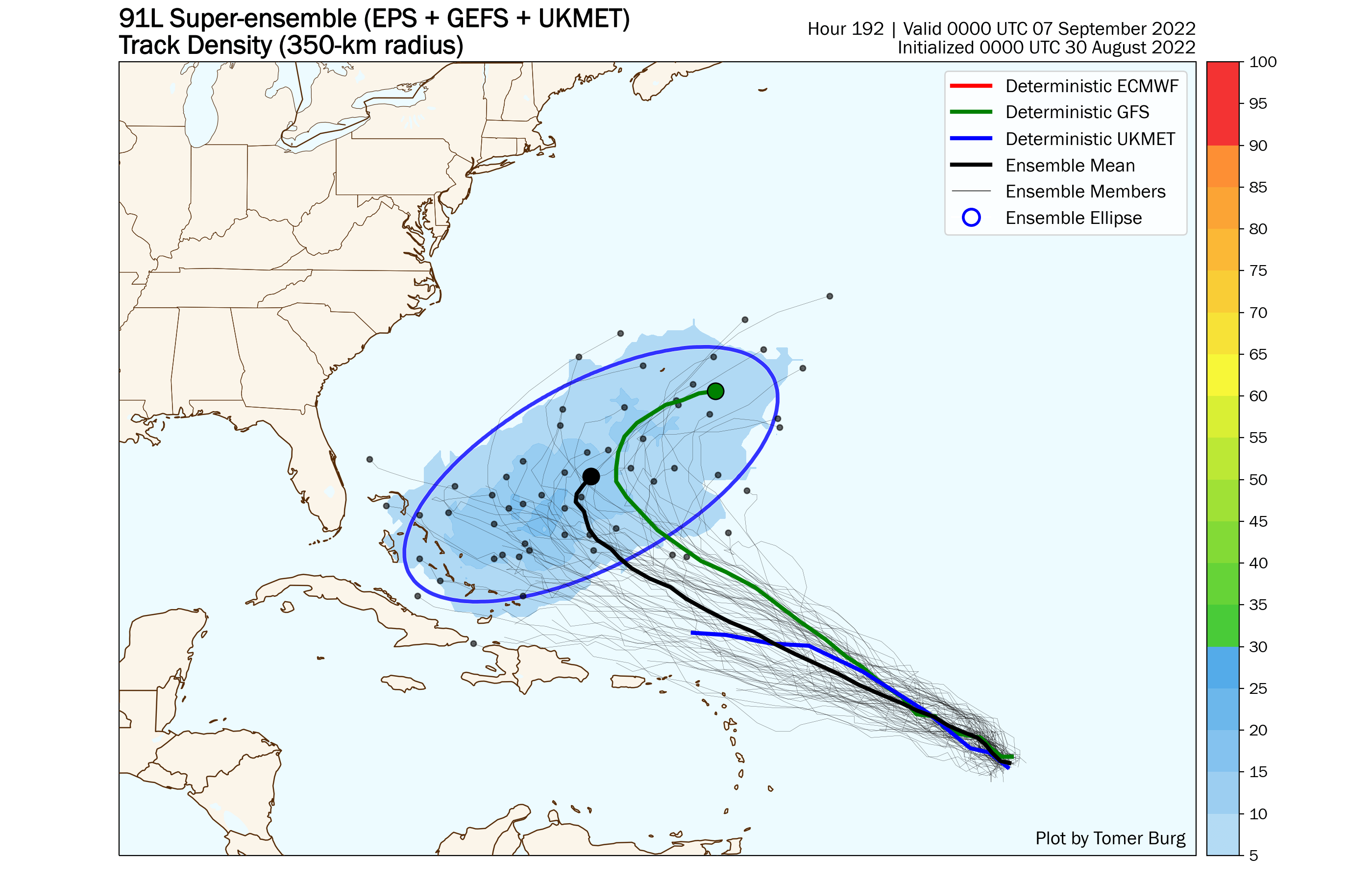
Forecast model guidance suggests that the pattern could guide the system closer to the United States eventually, but its also possible that the storm recurves out to sea as well. Much of that will depend on how the storm gets its act together over the next few days, as well as where it finds itself relative to a ridge of high pressure over the Southwest Atlantic Ocean.
It’s entirely possible that the storm could struggle to organize at all. Guidance also suggests strengthening wind shear and a hostile environment for development through this week. How the storm evolves through the weekend will be critical.
In addition to uncertainty regarding the storms organization, model guidance shows quite a bit of spread as to where the system will be located a week from today. In a general sense, a system that is further south and southwest will have a better chance of impacting the United States in some way, while a system that is further northeast will have a better chance of staying out to sea.
Additional tropical development is possible in the North-Central and Eastern Atlantic over the next five days, but NHC currently is forecasting a lower probability of development in those regions. Those additional systems would have a very low chance of impacting the United States even if they were to form.
We’ll keep an eye on how things evolve in the coming days.