-2")
What to expect from the remnants of Hurricane Ian in NYC
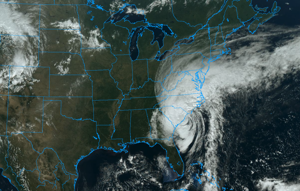
Hurricane Ian is making landfall once again, this time as a Category 1 Hurricane along the coast of South Carolina. The storm is expected to bring substantial impacts to the Southeasts US coastline including heavy rain, wind and storm surge. Eventually, the remnants of the storm will begin making their way northward later tonight.
The storm system has, thus far, been essentially trapped in the Southeast United States by a large and sprawling area of high pressure over New England. This is what caused the storm to slow down to a near-stall as it made landfall in Florida. The high pressure system is fighting a losing battle, though – as the remnants of Ian will expand northward tonight.
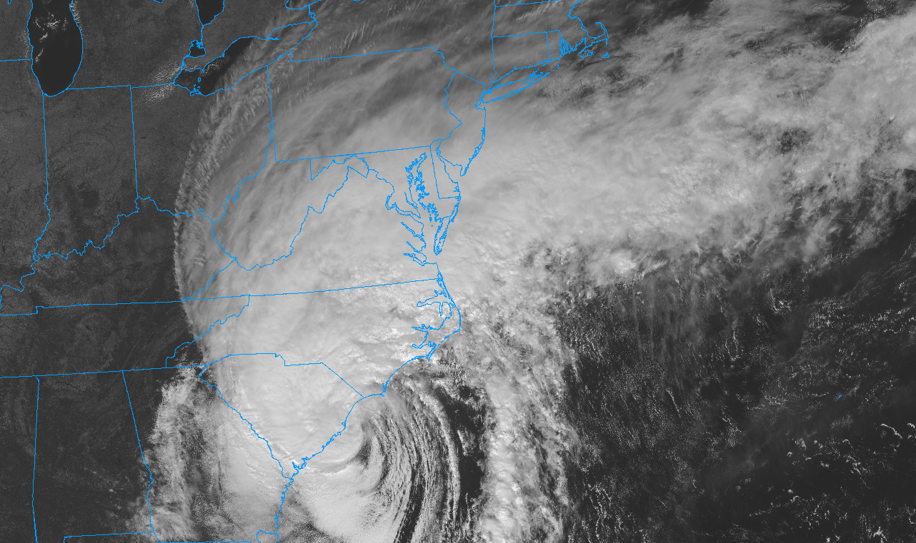
Let’s start out with some straightforward and important context: The impacts from the remnants of Ian will not be comparable to the remnants of Ida which flooded the NYC Metro area last summer.
With that being said, we are still expecting periods of heavy rain, winds and localized flooding. Here’s the timeline and how we expect things to transpire:
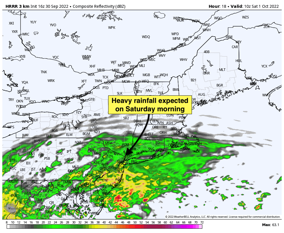
Friday Evening: Showers are forecast to slowly move northward from the Mid-Atlantic states into the NYC Metro Area. They’ll reach New Jersey first, with rain likely waiting until after sunset in the city itself. The rain is expected to become steadier as we move through the mid to late evening hours.
Saturday Morning: The steadiest and heaviest intensity rainfall is expected during the early morning hours on Saturday, as tropical moisture moves into the area. Torrential downpours are possible for a few hours and localized flooding is anticipated. By the late morning hours, rainfall could begin to taper off in intensity, but at least scattered showers are likely to persist with dreary conditions continuing. Gusty northeast winds are also possible with most guidance suggesting that wind gusts could reach 25mph in the city and slightly higher long the shore. We expect some travel delays and difficulties, but no widespread cancellations or major shutdowns are expected as of now.
Saturday Afternoon: Dreary weather is forecast to continue with scattered showers and drizzle. While it won’t be raining constantly, most forecast models still suggest that showers will be intermittent across the area and the weather will remain unsettled. Gusty northeast winds are expected to continue during this time frame.
Saturday Night: A break in the overall action could occur from the mid to late evening hours on Saturday and into the early morning hours of Sunday, with models suggesting that high pressure may temporarily reinstate its hold over the area, drying out the atmosphere and allowing for a break in the intermittent rainfall.
Sunday: Intermittent rain showers will return on Sunday as a secondary disturbance nears the area. Clouds and on-and-off showers are expected throughout the day. At the moment, the rainfall doesn’t appear to be overly heavy but it does look like it will be at least dreary and unsettled during the majority of the day. Model guidance is all over the place with the evolution on Sunday in particular, leading to a low confidence forecast overall.
Some unsettled weather could continue into Monday as well, but we are currently expecting that the weather will gradually improve as we move into the early part of next week.
Tl;dr: The worst of the rain and wind comes from very late Friday into Saturday morning, with dreary and unsettled weather continuing through the weekend. Another burst of steady rain is possible Sunday, but confidence is lower than usual regarding that. Very gradually, conditions will improve early next week.
Stay tuned for further updates throughout the weekend. We’ll be right here tracking along with you!