-2")

Chilly weather continues in NYC, gradual warmup through the weekend
Good morning NYC!
It was a chilly morning on Wednesday, with low temperatures falling into the 30’s in the suburbs and near 40 in the city. Real-feel temperatures were much lower than that, thanks to a stiff breeze and low dew points. It’s still feeling quite chilly out there, but temperatures will warm up into the 50’s as we move into the afternoon hours.
A cool and pleasant weather pattern will remain in place for the next several days. High pressure will be in control for the rest of the week, with plenty of sunshine expected. Low temperatures tonight are once again forecast to drop into the upper 30’s and lower 40’s. Consistent westerly winds will continue, with real-feel temperatures falling into the 20’s and 30’s once again.
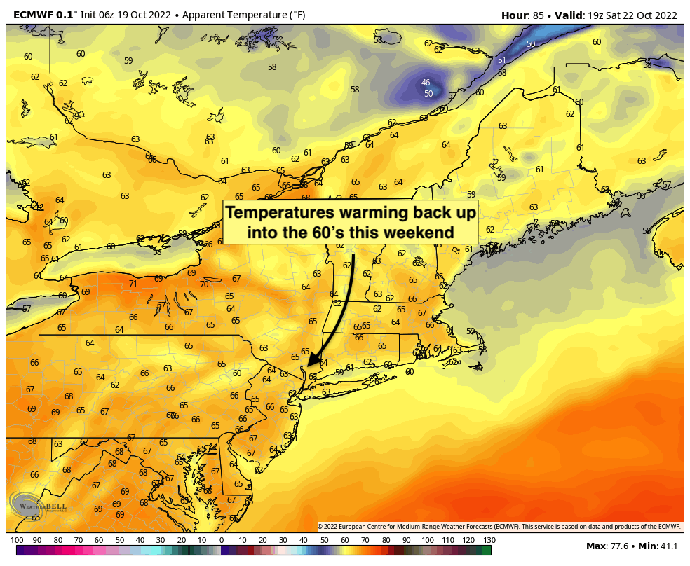
As we move into the latter part of the work week, temperatures are forecast to gradually warm up. Cold air from Canada which has sunk into the region today will finally begin to move away from the area. High temperatures are forecast to reach back into the 60’s by Friday and Saturday with plenty of sunshine and light winds. It looks like the late week and weekend could feature some top-tier weather conditions in NYC once again.
The next chance for unsettled weather doesn’t arrive until later this weekend and the early part of next week. Forecast model guidance suggests that a storm system could develop in the Western Atlantic and gradually move northward up the coast, particularly late on Sunday. If this were to occur, clouds and unsettled weather would return to the region during this time frame.
A more consistent chance for clouds and showers could approach on Monday, perhaps lingering into Tuesday, as a frontal system approaches from our west and interacts with this moisture. Model data suggests the possibility of clouds, showers and blustery winds during this time frame.
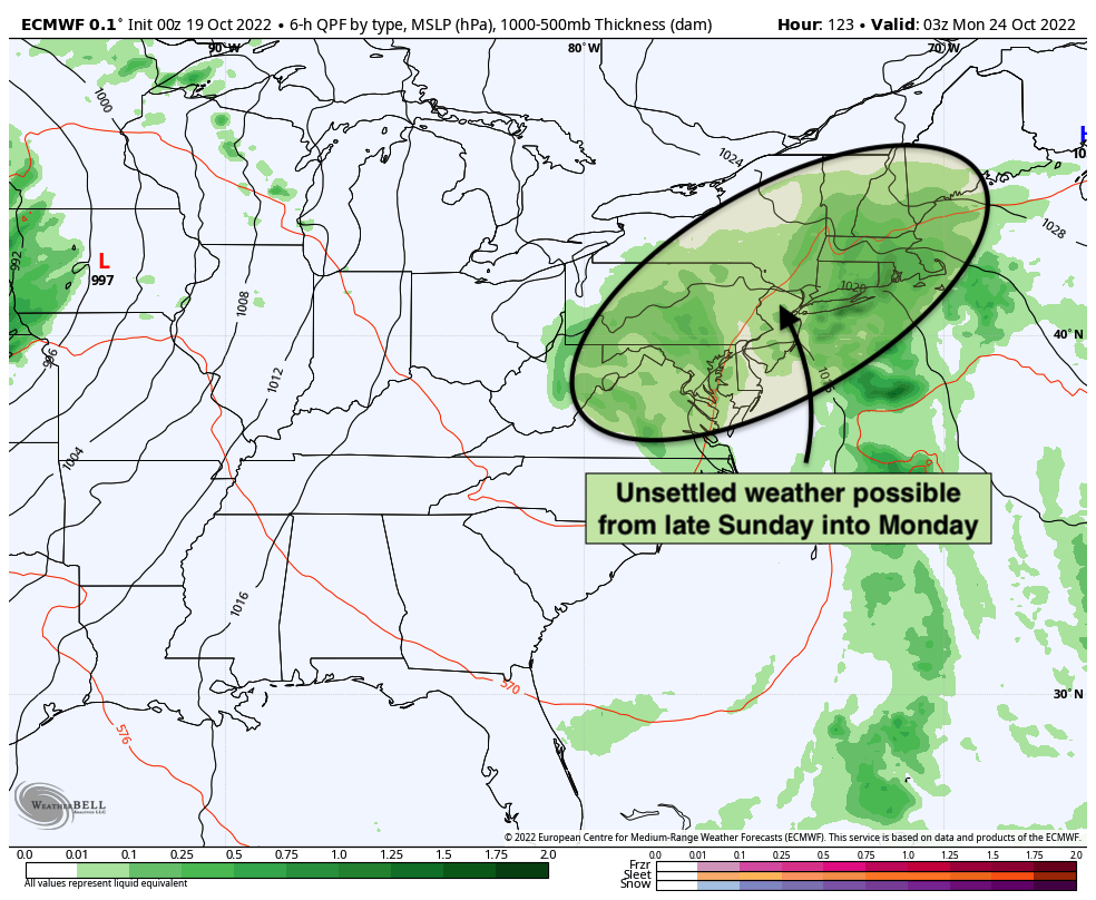
Obviously, at this extended forecast range the timing and details of the impacts from the storm remain uncertain and difficult to pin down. Still, it appears increasingly likely that the period from late Sunday into Tuesday of next week will be unsettled and could include clouds and showers in the forecast as well.
We’ll have more on the potential storminess as we head through the week. Generally, forecast confidence increases as we move into the medium range (Days 3-5). We should begin to get a much better idea as to how this potential storm system will evolve in the next day or two.
For now, we recommend enjoying the gorgeous weather which we’re set to experience for the rest of the week and weekend. Have a great Wednesday!