-2")

Potential coastal storm creates a complex weekend forecast in NYC
Good afternoon, NYC. The weather is crisp and exceptionally pleasant this afternoon and is forecast to stay that way for the next few days. Temperatures will fall back into the 40’s tonight leading to another cool morning on Friday, but a warmup is on the way.
By Friday afternoon, high temperatures will be back into the lower 60’s. They’ll likely end up even warmer on Saturday, when some models suggest high temperatures could approach the upper 60’s. These next two days will undoubtedly feature some very pleasant fall weather conditions.
While pleasant weather is occurring in our area on Friday and Saturday, a weak coastal storm will be organizing to our south. The storm system develops as it splits off from a larger disturbance to its north, meanders in the Southeast US then slowly makes its way up the coast.
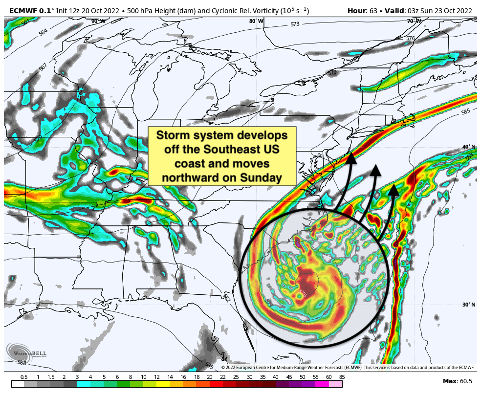
Normally, a system like this would likely drift harmlessly out to sea. But the pattern in place for this one actually favors it moving towards our area thanks to an expansive jet streak and anomalous moisture. As a result, confidence is building that unsettled weather will head towards our area on Sunday and perhaps linger into parts of Monday.
The timing and details obviously remain a major uncertainty and are likely to be a headache for the next few days. Models are split in regards to how the storm will begin its northward trek, and that will have major implications for the forecast locally. Some guidance suggests the storm will pass our area by Sunday afternoon, while others bring showers and blustery winds into the area from Sunday afternoon into Monday morning.
Given the placement of major features associated with this storm, the intensity of precipitation is also an uncertainty. There isn’t necessarily a big signal for heavy rain at this time – instead, models are sort of suggesting a period of unsettled and crappy weather instead. At the moment, we lean towards clouds and showers moving into the area later on Sunday afternoon and evening, and continuing on-and-off until Monday morning.
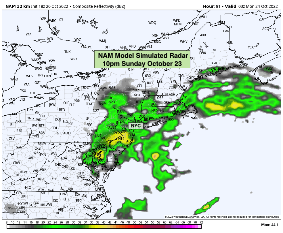
This will obviously have implications on the Yankees ALCS Game 4, which is currently scheduled for 7pm on Sunday. Most model guidance currently suggests that a period of unsettled conditions will begin right around game time and continue through the evening. Again, it’s way too early for details on timing and intensity – but right now it does appear possible that the game will be impacted by the weather…again.
In the next 24-48 hours, confidence should begin to increase regarding the timing and intensity of the rainfall associated with this system and how it will impact the NYC Metro Area. This will give us a better idea as to how the game will be affected.
Unsettled conditions may also linger into Monday, but rainfall intensities and coverage are currently expected to be much lighter and more sporadic in nature. The forecast generally improves as we move into the middle part of next week as well as the system moves away from the region.
We’ll have further updates in the coming days as the forecast becomes more clear. In the meantime, we’ve got some beautiful autumn weather to enjoy!