-2")

Unsettled weather returns to NYC on Tuesday, big warmup expected late this week
Good morning, NYC!
Another gorgeous fall day is in progress with comfortable temperatures and low dew points. Clouds will begin to increase as the day goes on today, signaling the approach of a weak storm system from the west and southwest.
As this system moves closer to the area, the forecast will turn unsettled on Tuesday. We’re expecting scattered showers from late tonight into Tuesday morning, persisting into the afternoon hours as well. It won’t be a washout with heavy rain or flooding, but it certainly won’t be pretty either.
Showers could begin as early as 8:00pm tonight. They’ll be scattered in nature, but could bring periods of rain through the overnight time frame. The steady rainfall should hold off long enough to let most outdoor activities for Halloween continue without disruption tonight. If you’re heading out, bring a jacket just in case.
The good news? The systems impact on the area will be short-lived. The storm system and associated moisture will exit the area by Wednesday, with improving weather conditions expected as we move into the latter part of the work week.
The main story as we move into the late week and weekend period will be temperatures. Forecast model guidance suggests that a large ridge of high pressure will develop overhead, with warmer Pacific air flooding into the area. Southwesterly winds will usher in warmer temperatures and higher dew points.
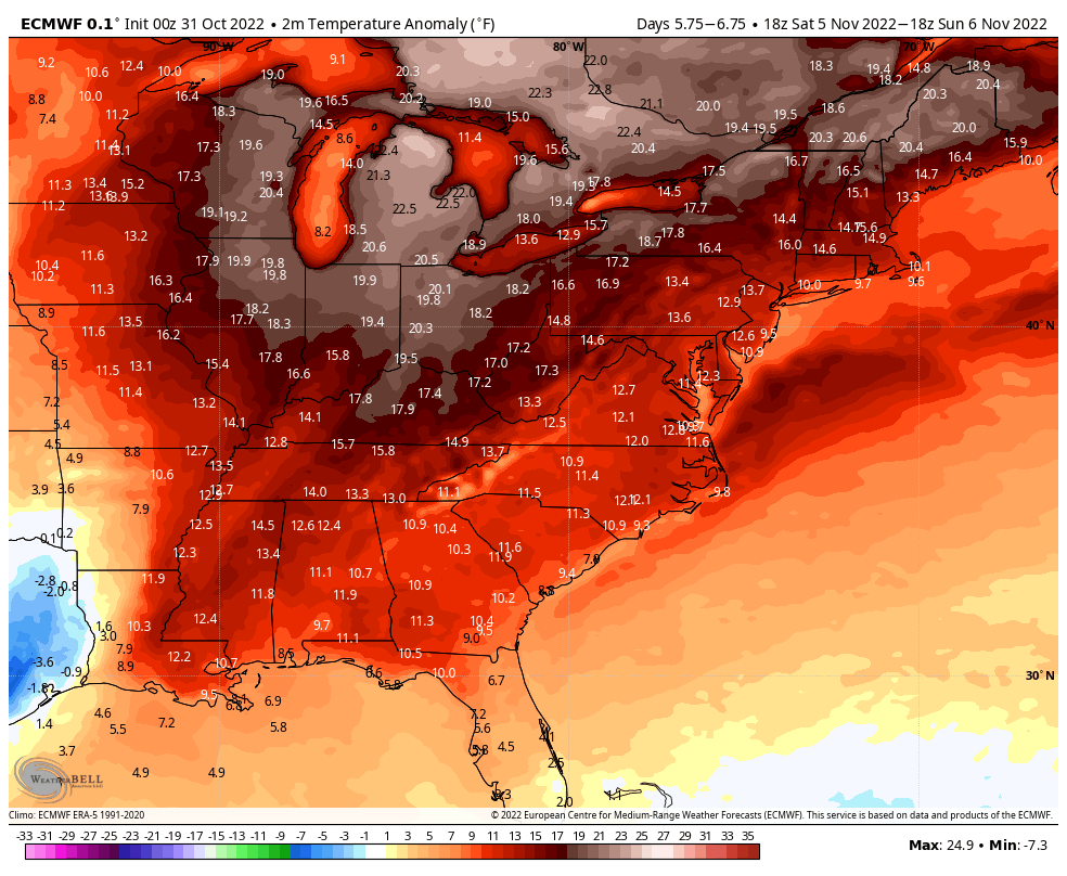
The result will be a period of abnormally warm weather from Thursday into the weekend. Temperatures on Saturday and Sunday could reach into the lower 70s for afternoon highs – way warmer than normal for this time of year. The warmth looks to continue into the early part of next week before a cold front eventually sweeps it all away.
Weather conditions for the NYC Marathon on Sunday currently look substantially warmer than normal. There’s also the chance that dew points and humidity start to increase on Sunday, with models suggesting the possibility that dew points could reach over 60 F during the late morning and afternoon. This would obviously make conditions a bit more uncomfortable than we’d like.
We’ll have further updates on the warmth over the next few days, and details on the incoming unsettled weather on Tuesday as well. Have a great Monday morning!