-2")
Tropical Storm Nicole: Periods of rain and wind expected in NYC from Friday into Saturday 
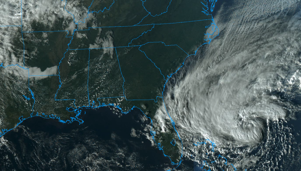
Tropical Storm Nicole formed earlier this morning in the Southwest Atlantic Ocean, and is expected to gradually strengthen as it moves towards Florida over the next few days. Moisture from the storm system will eventually be carried northwards towards the NYC Metro area late this week and weekend. Periods of heavy rain and gusty winds are possible from late Friday into Saturday.
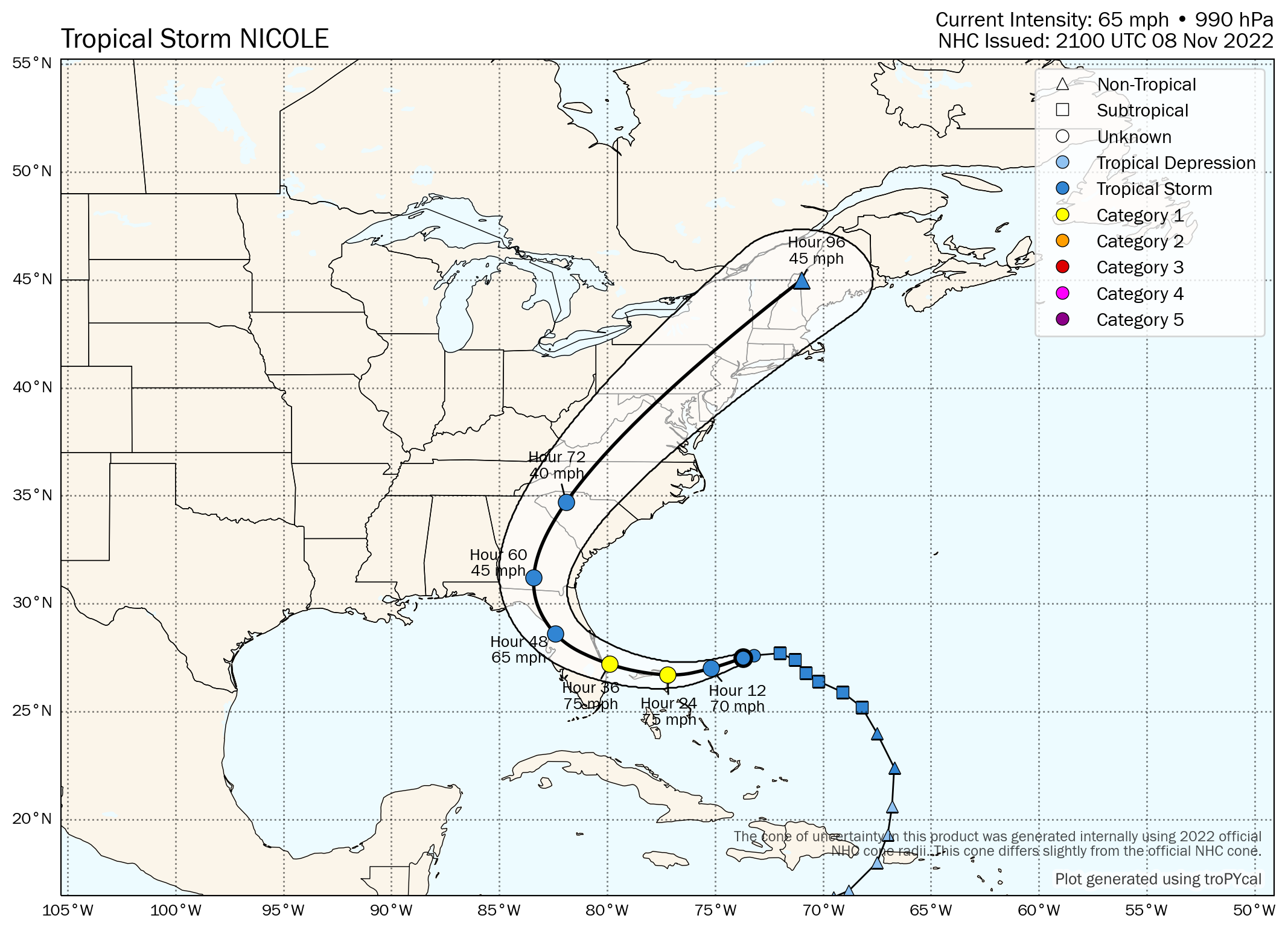
Originally designated as a subtropical storm, Nicole was upgraded to a tropical storm this morning by the National Hurricane Center. The storm is expected to strengthen into a Category 1 hurricane as it moves towards the southeast coast of Florida over the next few days.
The storm will eventually turn inland and weaken over land. The moisture from the system will begin tracking northward towards the Southeast US later this week. As it does so, it will receive an extra boost from an amplified upper level jet stream. Divergence aloft will allow precipitation to expand rapidly northward.
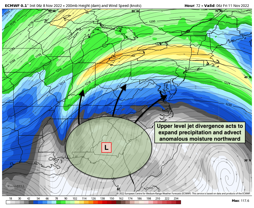
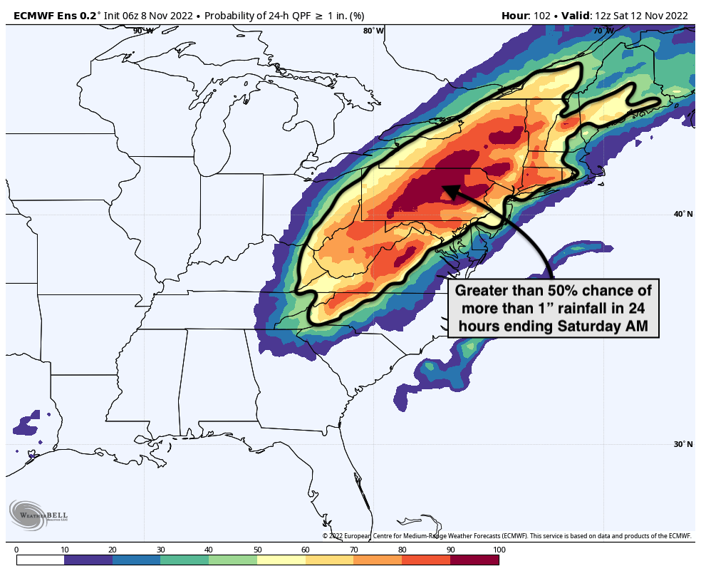
This will help to carry anomalously high moisture northward into the Mid Atlantic and Northeast states from Friday into Saturday. Periods of heavy rain are expected. At the moment, the heaviest rainfall looks likely to set up west of the NYC Metro area across interior portions of Pennsylvania and Upstate New York.
Still, the threat for showers and storms with locally heavy rain is anticipated. Some of these storms could be strong and we can’t totally rule out the possibility of an isolated tornado, either. European ensemble data currently suggests that the possibility of greater than 1″ of rain exists throughout the area, with the highest probabilities just west of the NYC Metro.
In addition to the threat for heavy rainfall, model guidance is picking up on a strong low level jet stream. This jet stream will move over the Northeast states from later Friday into Saturday morning. Strong wind gusts are possible, especially near the area coasts.
Here’s how it currently looks like things will play out:
Friday: The day will start off calm, but clouds will increase and showers are possible by early afternoon. Periods of rain are then likely from late afternoon into the early evening hours.
Friday Night: Periods of rain are expected, with locally heavy rain also possible. Winds will become gusty out of the south and southwest.
Saturday: Rain is expected early, clearing as the morning goes on. Conditions will improve by afternoon with westerly winds and drier weather.
While the details of the hazardous weather are still undetermined and will become more clear in the next few days, it’s apparent at this range that unsettled conditions are likely in NYC from Friday into Saturday. The potential will exist for heavy rainfall, gusty winds and isolated severe thunderstorms.
We’ll have further updates in the next few days as the details of the system become more clear.