-2")

Weather pattern set to turn colder and more wintry in NYC by mid December
Changes in the high-latitude weather pattern, specifically an anomalously strong high pressure over Greenland, are expected to bring a colder and more wintry weather pattern to NYC during the second half of December. The changes are already underway, and threats for wintry weather could begin to appear on weather models soon.
Last Monday, we wrote about the development of a possibly record-breaking high latitude ridge over Greenland. This ridge (also known as a negative North Atlantic Oscillation ,or -NAO) has already developed and is forecast to significantly disrupt the weather pattern across the Northern Hemisphere over the next few days.
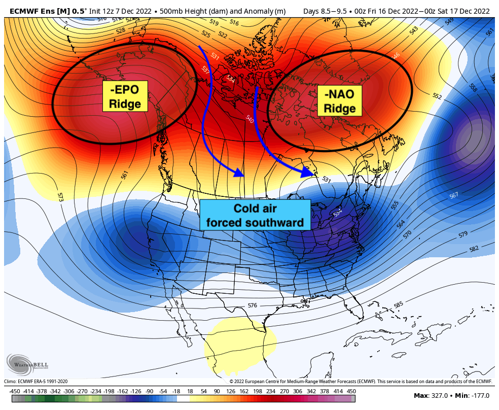
Forecast model guidance is struggling mightily with this feature, as one might expect in such an unusual weather pattern. The -NAO ridge is not only strengthening, but also retrograding – moving west/southwestward as opposed to the usual easterly flow through that region. This buckles the jet stream and slows down the weather pattern considerably – and also wreaks havoc on weather models.
But there’s more! As the NAO block retrogrades west of Greenland into Canada, forecast models are now suggesting that ridging will form on the west coast, too. This ridging will further exacerbate issues and disrupt the Arctic high latitudes even more, sending cold air southward into Canada and the United States.
All of this is technical mumbo-jumbo for one thing we’re growing increasingly confident in: The second half of December is likely to be colder than normal, and perhaps wintry, in the NYC Metro Area. As mentioned last week, we’ve seen a barrage of warmer than normal Decembers over the past decade which will make this one feel quite different.
When will cold and winter weather begin in NYC?
At the moment, it is unclear when significant winter weather threats could begin. But we don’t have to look very far to find the possibility of winter weather in the area on forecast models. Both the ECMWF and GFS model today have suggested that a weak low pressure system will slide underneath the aforementioned blocking in Greenland from late Sunday into Monday.
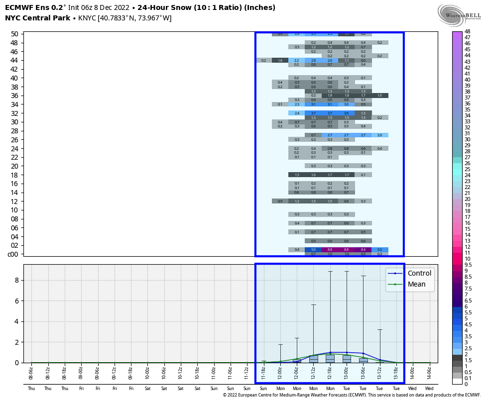
The result could be wintry weather, especially in the interior parts of the Northeast. This afternoons Euro Ensemble indicates a small percentage chance of snow in the NYC Metro, while the GFS model suggests that NYC will see its first snow on Monday morning. Given the fact that the airmass hasn’t truly flipped into our colder pattern yet along the coastal plain, our confidence in any snow in the NYC Metro proper is quite low at this time.
Regardless, the cold will come flowing in and the blocking will remain to our north. That sets the stage for the weather pattern to become more supportive of winter weather over time. We’ll have to keep our eyes peeled for any potential winter weather threats during the second half of the month.