-2")
Accumulating snowfall expected in NYC from Monday evening into Tuesday morning
A winter storm will evolve throughout the Mid Atlantic and Northeast states Monday evening, with substantial accumulating snowfall possible in the NYC Metro for the first time this winter season. The current forecast calls for 1 to 3 inches of snow in the city and more inland.
Forecast models have come into better agreement regarding the evolution of a storm system across the Eastern US on Monday. A primary low pressure system will move into the Great Lakes while a secondary low pressure forms off the Mid-Atlantic coast. Enough cold air exists prior to the approach of this system for wintry precipitation in the NYC Metro on Monday evening.
Snow will begin after sunset and could continue through the evening hours. There is some degree of uncertainty regarding how quickly warm air moves into the area. A faster approach of warm air aloft would turn snow to a wintry mix, limiting accumulations. A stronger wedge of cold air would keep precipitation snow for longer and result in additional accumulations.
Either way, snow and a wintry mix are forecast from Monday evening into Tuesday morning from the NYC Metro northwestward. Precipitation will gradually wrap up on Tuesday during the mid to late morning hours. The morning commute may be slick and/or slippery as a result of the wintry precipitation during the overnight hours.
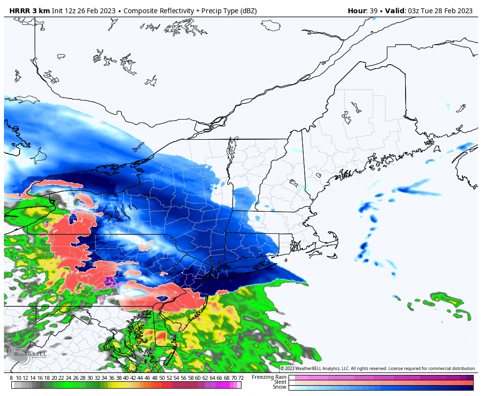
1 to 3 inches of snow is forecast in the NYC Metro Area at this time. Higher snowfall totals, on the order of 3 to 6 inches, are expected in the interior and higher elevations. Lower snowfall totals, from a trace of snow to 1 inch, are expected near the south shore and in Central New Jersey.
Model trends over the next 12-24 hours will be closely monitored. Any small change in the forecast temperature profile could lead to changes in the snowfall forecast. We’ll be streaming the latest information on our website, Patreon and social media platforms!