-2")

Heat wave expected in NYC later this week
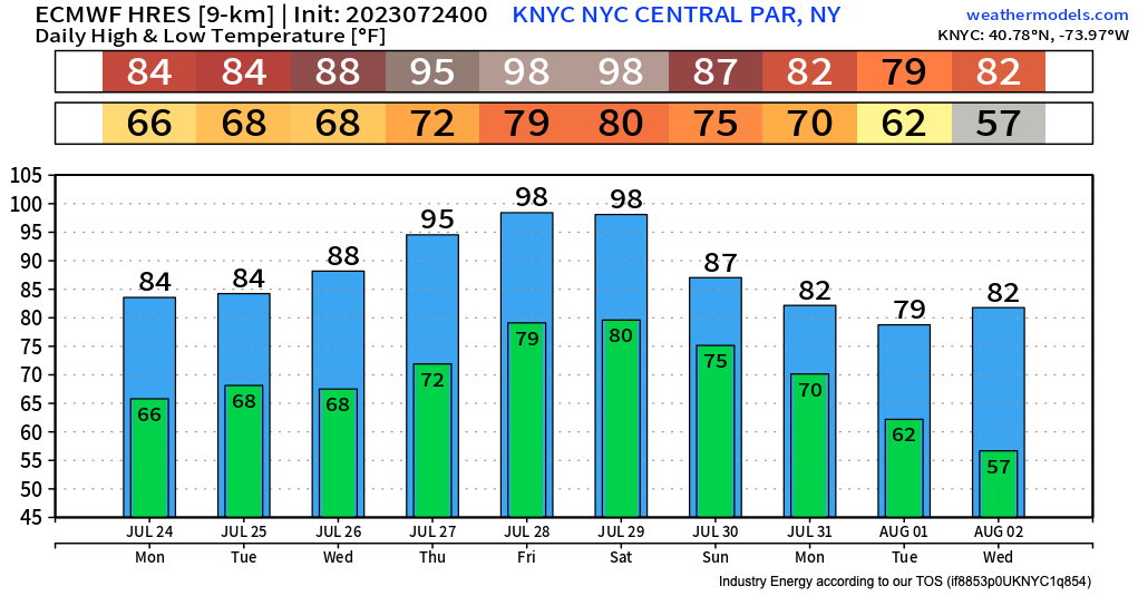
A ridge of high pressure will bring warmer temperatures into the Northeast US later this week. For the first time this summer, a heat wave is expected in NYC – defined by three straight days of high temperatures over 90° F.
The summer of 2023 has largely been defined by unsettled weather and humidity in the NYC Metro area. It has been uncomfortable for long stretches and there have been several days with unusually high humidity. Rainfall has also averaged above normal, especially in the interior and suburbs.
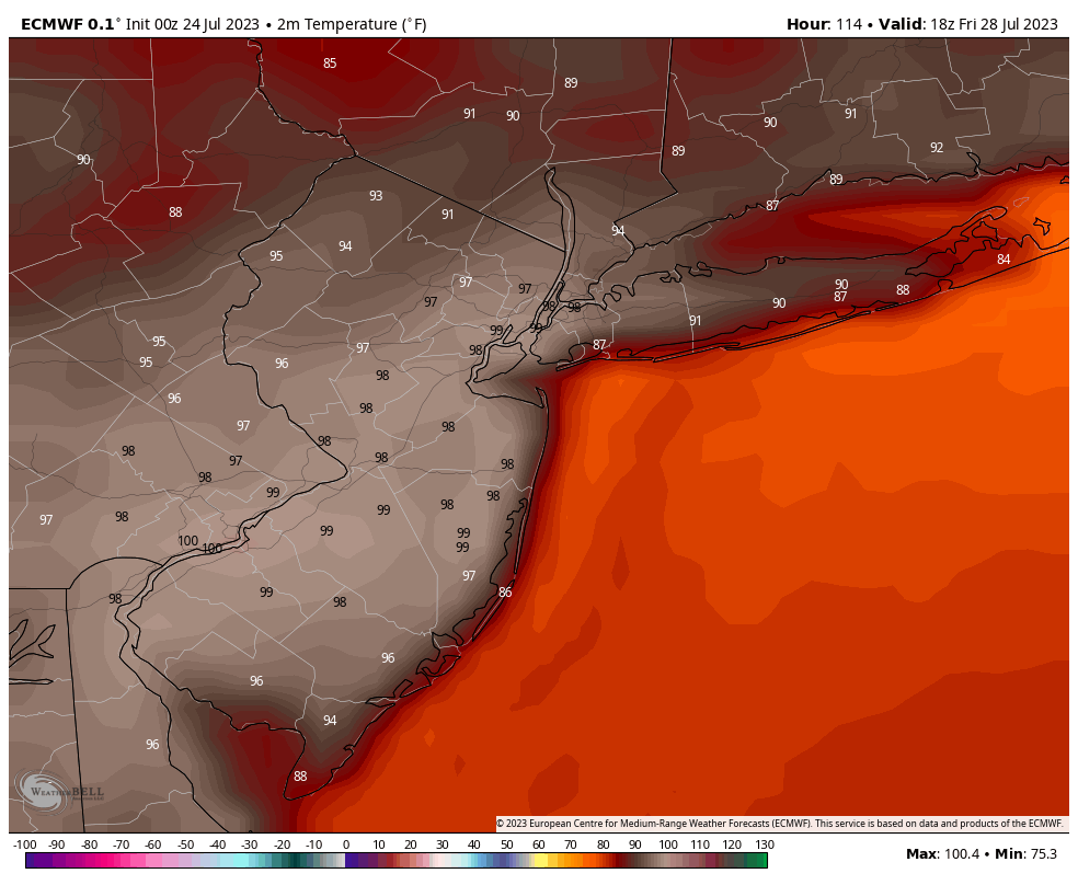
The one thing that we have been able to avoid so far has been heat – Central Park is yet to record an official heat wave. That will change later this week.
Forecast model guidance is in good agreement that ridging will develop in the Eastern United States, with warm temperatures from the Central US advecting towards our area. High temperatures are forecast to reach the lower 90s by midweek, but could reach into the mid or perhaps upper 90s on Thursday and Friday.
Humidity is also likely to build, with most guidance suggesting above-normal moisture content in the atmosphere from Thursday onward. It goes without saying that it’ll be very uncomfortable out there later this week.
Showers and thunderstorms will also be possible starting later this week and weekend. Models are all over the place in regards to the timing and details, but it appears that scattered storms could occur each afternoon. A more focused potential for thunderstorms could emerge on Saturday and Sunday when a frontal boundary sinks southward towards our area.
Eventually, a cold front will sink southward from New England and bring some relief to the area during the early to middle part of next week – 7 to 10 days from now. Ensemble data suggests temperatures falling closer to normal during that time frame.
Until then, we’ve got some real summer heat and humidity on the way.