-2")
Tropical Storm Lee forms, expected to become a major hurricane this weekend
Tropical Storm Lee formed this afternoon, designated by the National Hurricane Center just hours after the same system was declared Tropical Depression Thirteen. The storm is forecast to strengthen into a major hurricane as it moves towards the Lesser Antilles this weekend. The track thereafter remains uncertain, but east coast impacts cannot be ruled out.
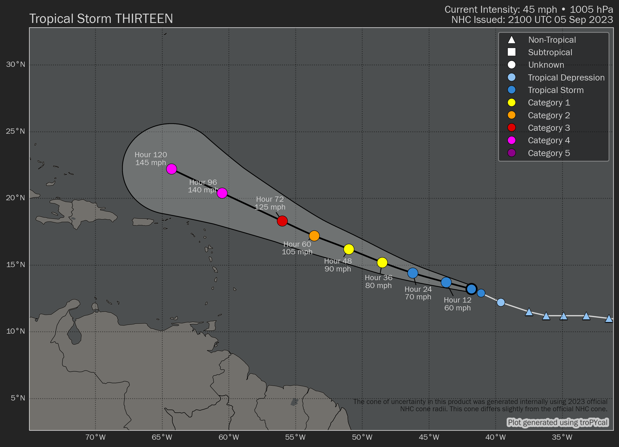
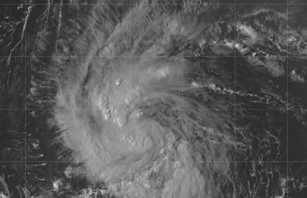
An area of disturbed weather being monitored by the National Hurricane Center (NHC) has been declared Tropical Storm Lee this evening, with maximum sustained winds now at 45mph. The storm is forecast to continue to gradually organize over the next few days and will become a hurricane this week.
Lee is forecast to continue its long trek westward through the tropical Atlantic Ocean through the week. As it does so, it will encounter increasingly warm water and ocean heat content as well as low wind shear. In fact, the storm will approach nearly ideal atmospheric conditions for strengthening by later this week.
Accordingly, the NHC is making an unprecedented forecast from the jump – Lee will strengthen to a Category Four hurricane with 140mph sustained winds by Sunday. At that time, the storm will be north of Puerto Rico. Still, the forecast for such strengthening ties a record for the most aggressive forecast that NHC has ever issued.
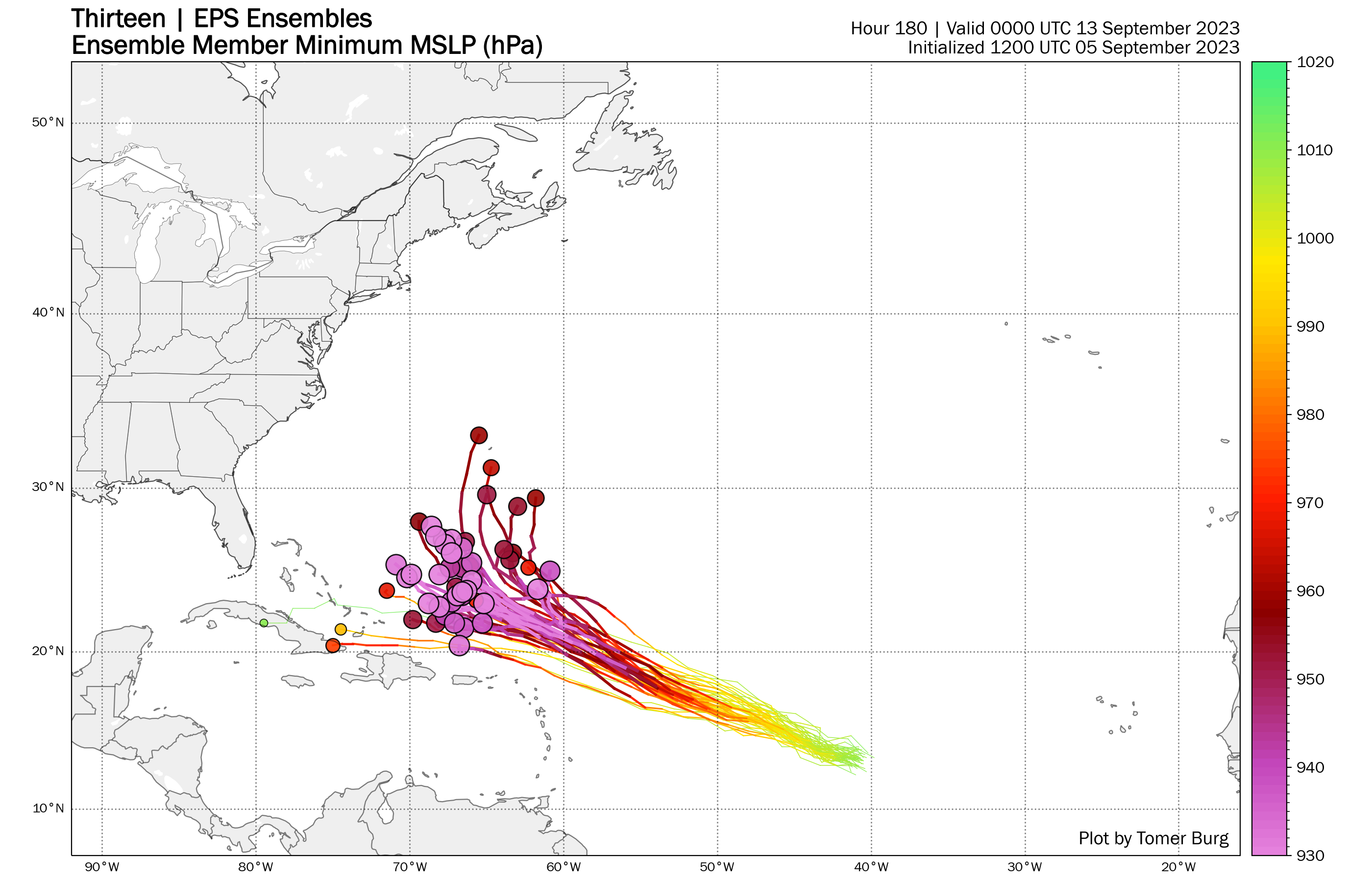
Forecast models are in good agreement that the storm will pass north of the major landmasses of the Lesser Antilles and move north of Puerto Rico this weekend. After that, all bets are off. The synoptic pattern becomes much more uncertain, which is to be expected at a 7-10 day lead time. Still, models are showing very little consistency with the major features that will guide the storm.
Of particular interest will be a mid level ridge north of the storm which is responsible for steering it to the west, a trough amplifying over the Eastern United States and a surface high pressure building in over the Northwest Atlantic. All three of these features could eventually have an impact on where Lee eventually tracks.
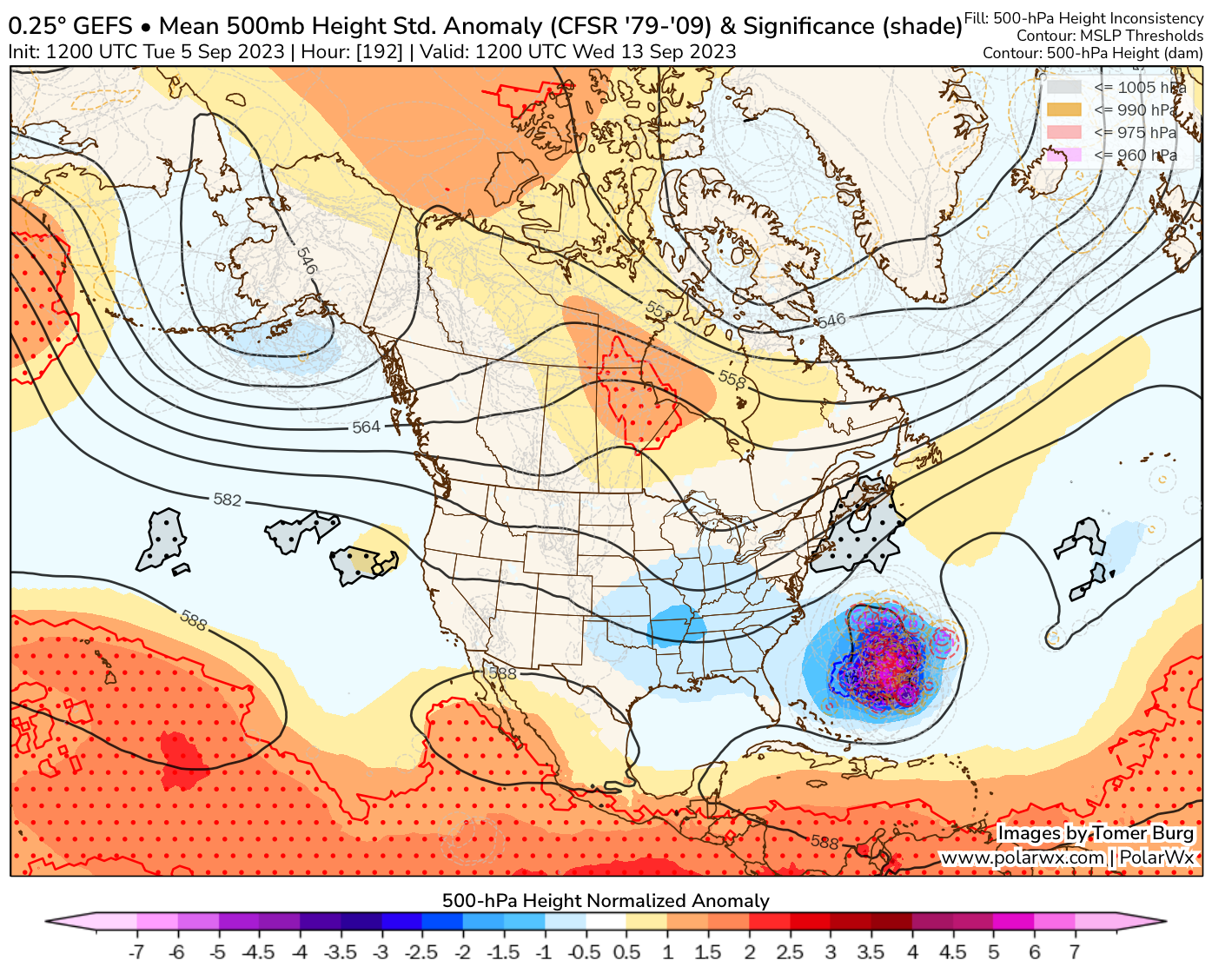
The westernmost solutions currently take Lee close to the east coast, while the easternmost solutions keep the storm well out to sea. Impacts along the east coast (including here in NYC) can’t be ruled out, but also don’t seem likely at this time with the majority of models taking the storm offshore. Uncertainty is likely to remain high for at least a few more days as model guidance continues to hone in on the intricacies of the storm and the weather pattern around it.
If you live on the east coast, there’s no reason to panic. The best thing to do is simply to keep an eye on the forecast and monitor Lee over the next several days. Forecasters will be able to begin to pin down the specifics as we get through this week, and should have a much better idea as to where Lee is heading as we approach the weekend.