-2")

Weekend Outlook: Comfortable weather, watching PTC9
Beautiful, lower humidity air has moved into the Northeast this morning in the wake of a frontal boundary. It comes as a great relief after temperatures and humidity skyrocketed to midsummer levels on Thursday. Comfortable air is expected to remain in place through this evening.
Dew points will gradually rise again as we move through Saturday, although the weather will stay mostly pleasant for the majority of the day. As we move into the evening, a storm system will approach the area from the west. Clouds will increase, as will the opportunity for showers and storms.
These are expected to hold off until the evening hours, but will be fairly widespread in coverage when they move through from later Saturday into Sunday morning. Instability will remain quite low, so we aren’t anticipating a severe weather threat. Instead, showers will be capable of producing briefly heavy downpours as they move through.
The weather improves again on Sunday, with low humidity and sunshine returning. Attention will then turn to a period of unsettled weather during the middle part of next week, as well as the potential future of PTC9, which is still located in the Bahamas.
PTC9 still not organized this morning
The NHC declared Potential Tropical Cyclone 9 (PTC9) on Thursday evening, but the system has remained unorganized this morning and is yet to form a coherent center. The official NHC forecast still takes the storm toward the coast of Florida, but then begins to recurve it off the Southeast Coast.
Most reliable model guidance suggests that the storm will strengthen into a Tropical Storm at some point this weekend, but exactly when that occurs remains uncertain. Forecast model guidance is also split in regards to the systems track, and much of that stems back to when exactly the storm organizes.
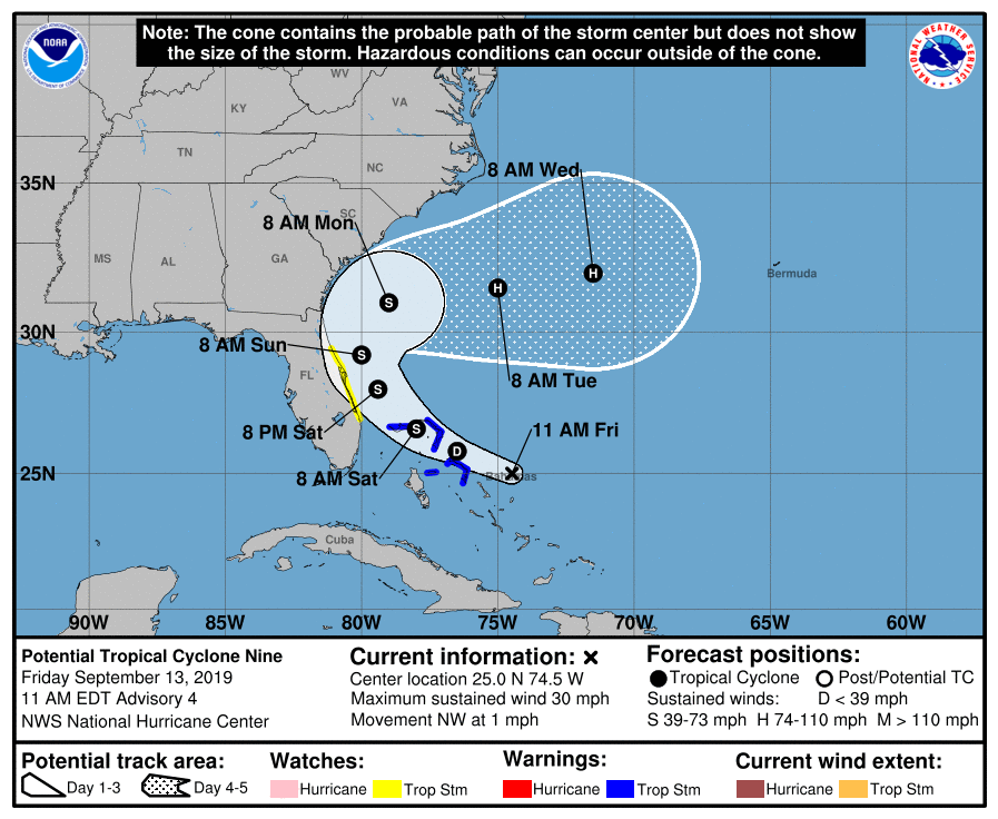
Once the storm moves off the Southeast US coast, it could potentially be blocked from moving seaward by a large high pressure to the north. This will create additional uncertainty as to the storms track and speed, potentially leaving it meandering off the coast for a few days.
Stay tuned for further updates as we move through the weekend – and most importantly, enjoy the day today!
Leave a Reply
Want to join the discussion?Feel free to contribute!