-2")

NYC Forecast: Warm week ahead, Epsilon forms in Atlantic
Briefing: Generally quiet weather is expected this week. Temperatures will warm well above normal as the week goes on with only a few chances of scattered showers on Tuesday. Pleasant weather will then return through the weekend. Tropical Storm Epsilon formed in the Atlantic this morning, continuing a record breaking hurricane season.
NYC QuickCast
Tonight: Increasingly cloudy with temperatures in the upper 50’s to lower 60’s. A few stray showers are possible late in the evening. Light southeasterly winds.
Tuesday (10/20): Cloudy with a chance of showers. Coverage should be scattered (not a washout) but the weather will be unsettled all day. Highs in the lower 70’s.
Wednesday (10/21): Showers in the morning with some fog. Improving conditions late. Very warm with highs in the mid 70’s.
Thursday (10/22): Sunny and warm with highs in the 70’s. Light westerly winds.
The upcoming week of weather in NYC will be defined by transient conditions and anomalous warmth. The main unsettled weather highlight comes on Tuesday, as a frontal system approaches the area. Increasing moisture will lead to clouds and showers. Most models agree that it won’t be a washout by any stretch of the imagination, but that conditions will be unsettled.
As warmer and more moist air moves into the region Tuesday evening and even Wednesday morning, fog and drizzly conditions will persist. It won’t be a very pleasant stretch of time. Temperatures, however, will be quite warm – more than 10 degrees above normal with highs in the mid 70’s on Wednesday.
The rain and fog clears out by Thursday, and with plenty of sunshine we can expect highs near 70 once again. It’s almost difficult to remember that we’re in mid October. Highs in the 70’s are well above normal this time of year, and we expect the warmth to continue through Friday.
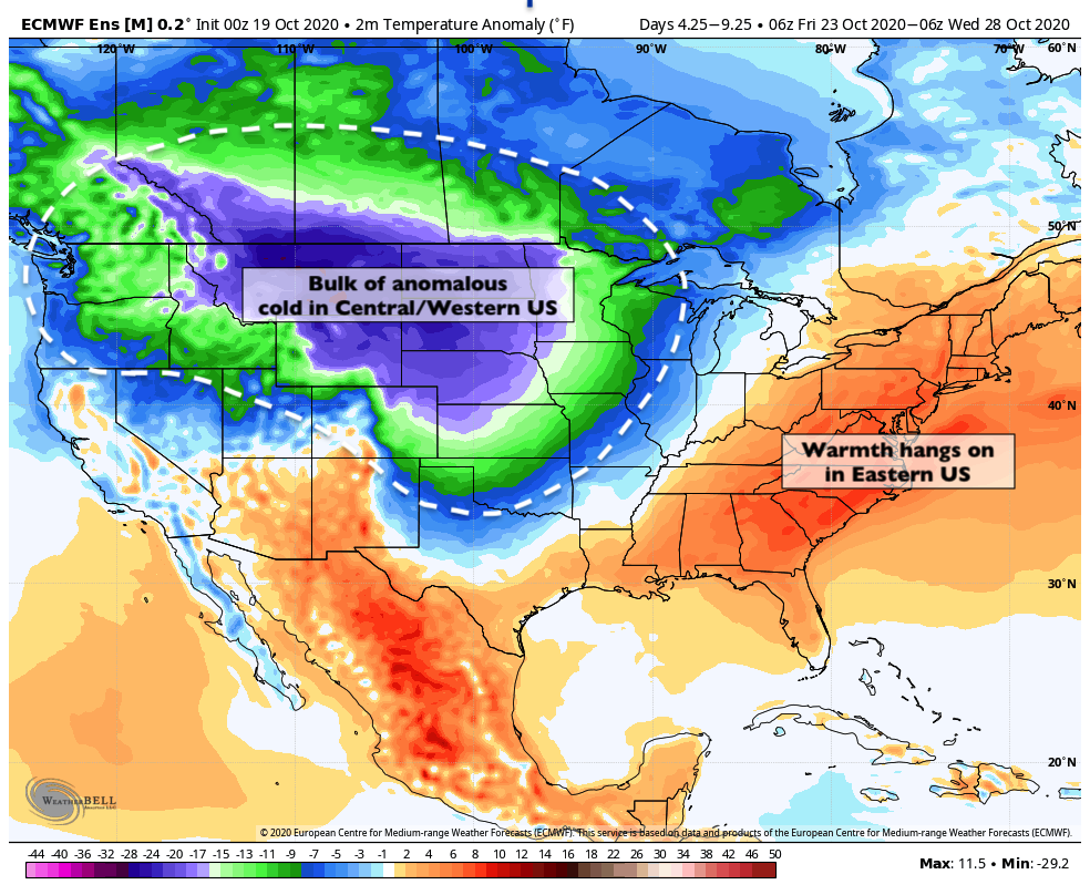
By the weekend, a bit of a cooler breeze will become noticeable. Anomalous cold will remain to the west of the area in the Northern Plains and Great Lakes (thank you, weather gods) but chillier air will gradually make its presence known here as well.
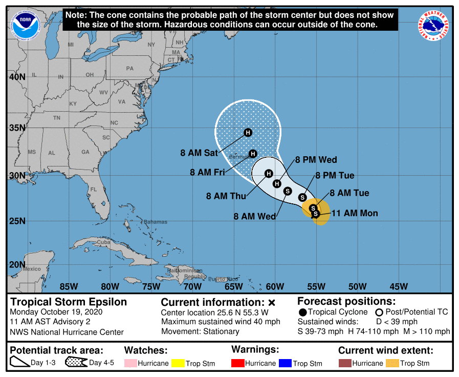
Meanwhile, out in the Atlantic, the record breaking 2020 hurricane season marches on. Tropical Storm Epsilon formed this morning and will become a hurricane over the next few days. The storm will track close to Bermuda (the third storm to do so this year) and then meander out to sea. No threat is expected from this storm along the US East Coast.
Epsilon is the 26th named storm of the 2020 Atlantic Hurricane Season and yes, it is named so because we ran out of names in the regular alphabet. The greek names will continue if any further storms are named in the next few weeks, with Zeta next on the docket.
Trackbacks & Pingbacks
1idiotic
Leave a Reply
Want to join the discussion?Feel free to contribute!