-2")
PM Forecast: Period of wintry weather through Tuesday AM
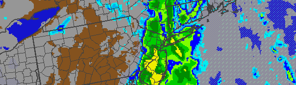
Snow was falling early Monday evening throughout most of the area, and was expected to continue for a few hours. Precipitation will change over to rain with time and continue into Tuesday morning.
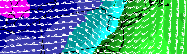
A storm system tracking to our north and west will redevelop off the New Jersey coast and south of Long Island tonight, bringing steady precipitation to the area overnight into Tuesday morning. Warm air advection (increasing presence of warm
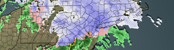
NYMetroweather snowfall forecast through Tuesday at 12pm.
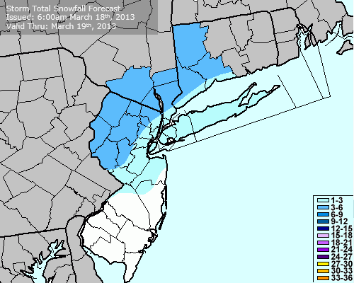
air in the atmosphere) will begin in the evening, changing precipitation from snow to sleet and rain from southwest to northeast with time. However, a period of snow and sleet is likely even near the coast. Across the interior, several hours of snow and sleet are expected to bring moderate accumulations. Travel could become difficult overnight tonight, especially across the elevated interior areas. Eventually, precipitation is expected to change to all rain throughout the area by Tuesday morning before ending. Total snowfall accumulations of 1-3″ on cold surfaces are expected in Northeast NJ, NYC, and Long Island. Mainly wet roads are expected in the city. Across the interior, 3-6″ of snow/sleet is possible before the changeover to rain.
Although we opted not to issue a Storm Alert Brief due to the short-fused nature of the travel difficulties, our storm total snowfall forecast is available…attached to this post. The official 3 day forecast is also included below. After the storm system on Tuesday, attention will turn to a potential winter storm next weekend which has become a feature on almost all medium range forecast model guidance. Stay tuned.
Tonight: Periods of snow and sleet, changing to rain. Low near near 32, colder inland. East winds 10 to 20 miles per hour, gusting near 30 miles per hour.
Tuesday: Rain likely in the morning, then clearing. High near 47. Northeast winds turning west in the afternoon around 15 miles per hour.
Tuesday Night: Partly cloudy, with a low near 30. West winds around 15 miles per hour, gusting to 25 miles per hour.
Wednesday: Sunny and breezy, with west winds around 20 miles per hour. High near 45.