-2")
Not done yet: Light snow likely on Friday
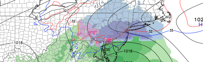
I can almost hear the collective groan of thousands throughout the New Jersey and New York City area. Yes, snow is returning to the forecast and it will bring the potential for a few inches of snow on this coming Friday. A low pressure system approaching from the Ohio Valley will move through the Mid Atlantic states on Friday, spreading moisture north of it into the Northern Mid Atlantic states. As moisture surges north into the cold sector, snow will develop within a small axis from West to East on Friday.
While the low pressure system is fairly weak, and passing well to our south, the increase in moisture and lift should be just enough to allow for snow to develop. Light snow is expected as early as Friday morning, especially over Western parts of the forecast area. With increased lift for precipitation, steady snow is expected during the day on Friday. The low pressure system will eventually shift offshore, allowing for lightening precipitation and clearing overnight Friday into Saturday.
The main issue for forecasters, at this point, becomes accumulation. While snowfall rates are expected to be sufficient for moderate precipitation — it is currently unclear if the snow will be heavy enough for widespread accumulations. Forecast models have been wavering back and forth a bit with the intensity of precipitation during the afternoon. With the storm occurring during the day, diurnal heating on the ground and other surfaces will make it very difficult for light snow to accumulate well. With snowfall events this late in the year, it typically takes moderate to heavy precipitation rates for accumulations to occur.
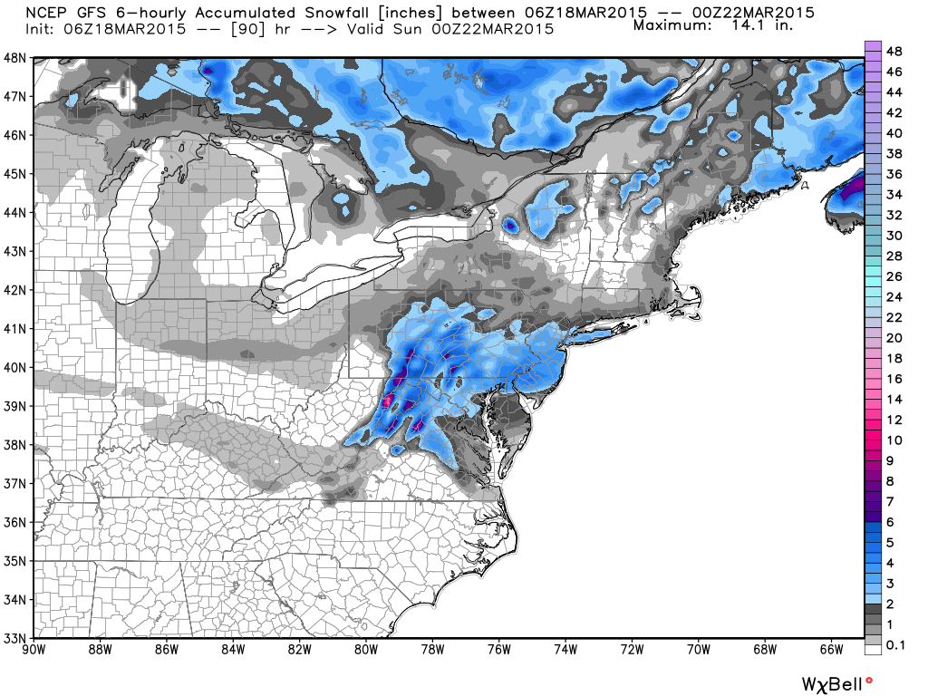
GFS model snowfall accumulation forecast for Friday. (Not our forecast).
With fluctuating precipitation rates and marginally cold air, we anticipate accumulations in the city to be rather light. Heavier precipitation rates in a band from Southeast Pennsylvania to Central New Jersey currently look likely — supporting a band of 2-3″ of accumulating snow. Elsewhere, generally 1 to 3 inches of snow is anticipated. Small scale temperature differences will have impacts on accumulations; i.e places like New York City will see less accumulation on warm ground than places just inland in Union and Essex counties.
Nevertheless, the snow will likely hamper travel and create a headache of a commute on Friday. Roads will be slick and travel will be hazardous when snow is falling. Be sure to leave extra time and bring your winter jacket. We will have further updates and a live blog as the storm draws closer.