-2")
Unsettled weather hangs on before the weekend
It has been an uncharacteristically cool week — at least for the standards of May. It has also been an uncharacteristically wet week. After the driest May on record at multiple reporting stations in our area, this week featured rainfall amounts of 2 to 3 inches in many areas. Some received upward of 4 inches in Northeast New Jersey. The main story over the next few days won’t necessarily be widespread heavy rain, but it will be a continuation of unsettled weather.
An onshore flow, owing to a persistent and weakening mid level low over the Mid Atlantic States, will continue to promote the intrusion of a marine airmass from much of the Mid Atlantic into the Northeast. While some areas to the north and south of this persistent east/southeast onshore flow will see pleasant weather on Thursday, the unfortunate fact is that our area won’t be one of them.
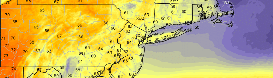
Low clouds will rebuild into the area on Thursday and, additionally, increased moisture and lift will bring about additional showers. the rain may be moderate to occasionally heavy at times — but widespread heavy rain isn’t anticipated. Still, high temperatures will remain rather cool — in the 50’s and 60’s — and we won’t see the warm sun for many moments throughout the day.
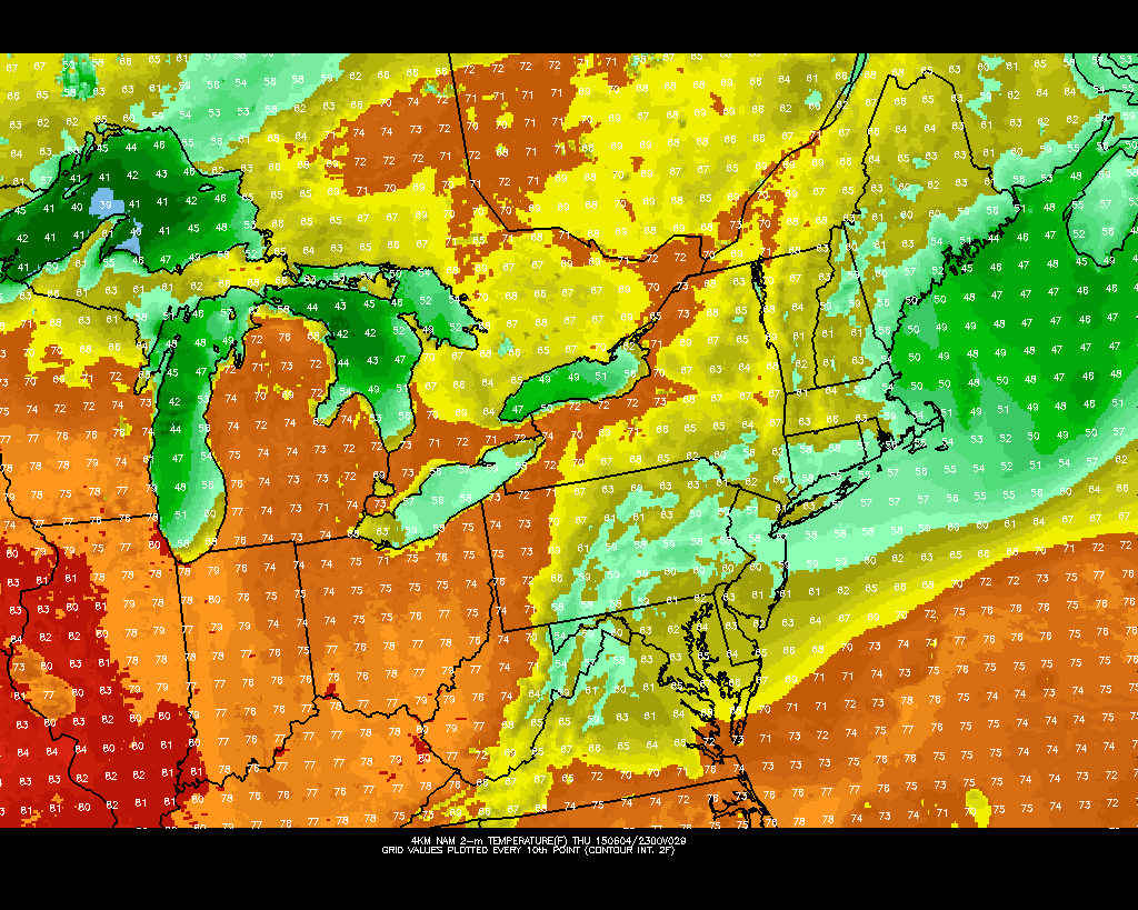
NAM model showing cool temperatures late this week over the Northeast US.
While much of the same is expected on Friday, the weekend looks much improved. The onshore flow will finally be scoured out, and southwesterly winds will aid in a warmer airmass moving into the area by Saturday. Warmer mid level temperatures advecting into the area, as well, will mean high temperatures rising into the 80’s in many locations.
The cool, marine and unsettled airmass doesn’t look to be returning for any prolonged period after this weekend, but an unsettled and active weather pattern looks likely to continue.