Forecast: Pleasant, crisp weekend

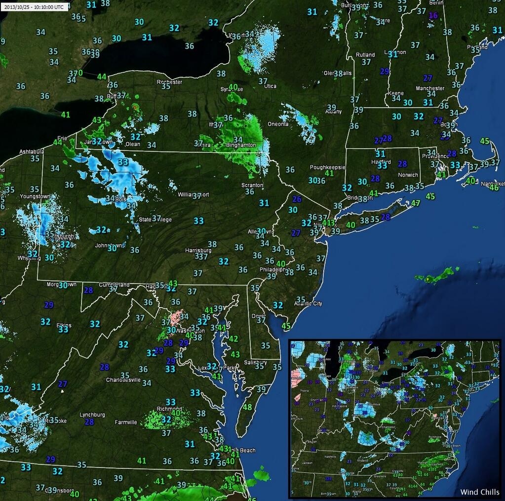
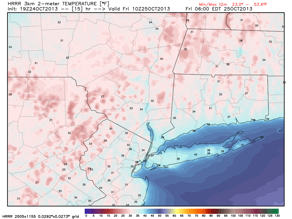
Another cold morning throughout the area on Saturday began what will turn out to be a pleasant — albeit cool — weekend. The cold Canadian airmass which settled into the area a few days ago has since modified a bit, but remains stout. Temperatures plummeted for the third straight night into the 20’s and 30’s across the interior, and upper 30’s to lower 40’s in urban areas. Clear skies and light winds made for favorable radiational cooling conditions. Saturday looks to feature pleasant weather, despite a noticeable wind shift from west-northwest to southwest. Winds could be a bit gustier than the past few days by afternoon.

NAM model, forecasting high temperatures in the middle 50's (cooler inland) on Saturday afternoon.

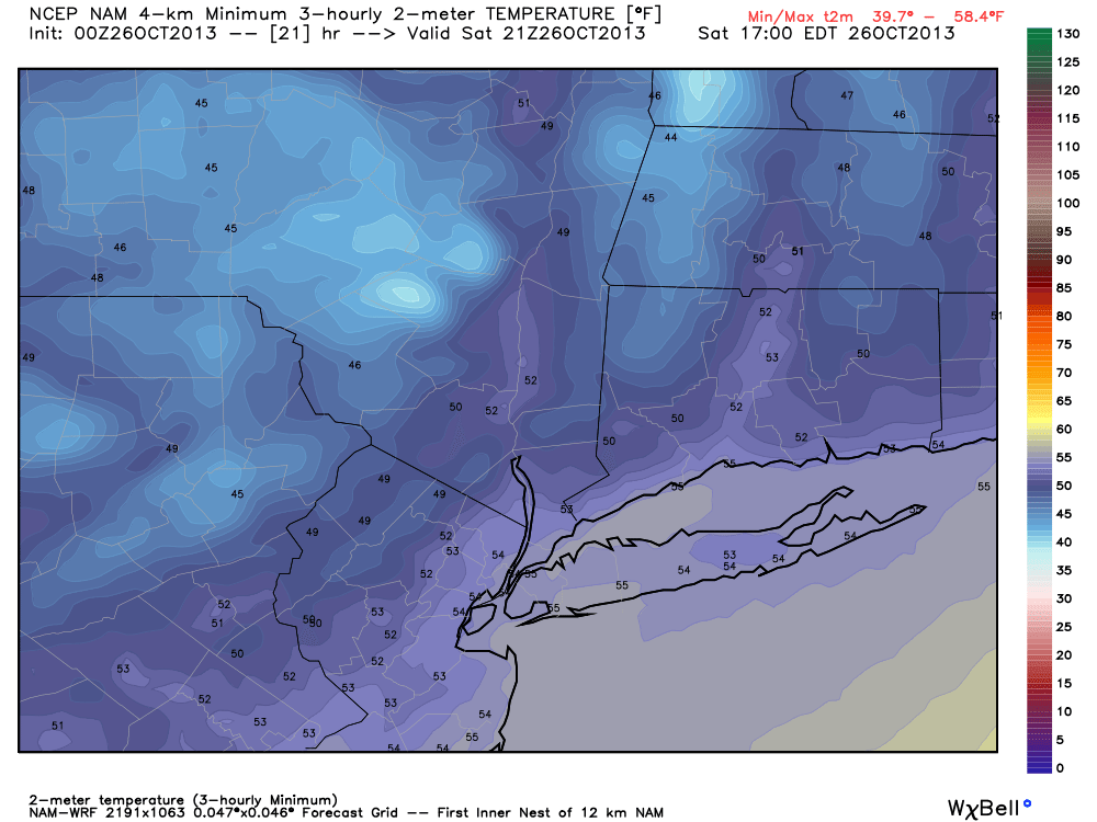
NAM model, forecasting high temperatures in the middle 50’s (cooler inland) on Saturday afternoon.

Read more

PM Update: Freeze Warnings expand through NJ, NY

The growing season has been ending rather progressively throughout the forecast area over the last several days. The colder than normal airmass has been enough to end the growing season officially across much of Northern New Jersey, Southeast New York and interior Connecticut. Tonight, the growing season looks to come to a close across much of the Central New Jersey Pine Barrens. Accordingly, the National Weather Service has issued Freeze Warnings for Middlesex, Western Monmouth, Mercer, Salem, Ocean, Cumberland, Atlantic, and Southeastern Burlington County — which are valid from 3:00 – 9:00 am Saturday. Freeze Watches are in effect for parts of Southeast New York and Southern Connecticut.

With temperatures expected to fall into the lower 30’s for the third straight evening and overnight period, Saturday will mark a continuation of a chilly and dry airmass. The dry airmass is becoming more notable as we approach the final week of October. New York City’s Central Park, for one example, has recorded only 0.30″ of rainfall for the month. The average to date for October is around 3.00″ — and the departure is enough to put New York City in a D-0 drought stage. The drought breaker may not come until next week, when a storm system moves through he Great Lakes and brings a cold front through the area.

NAM model, forecasting low temperatures in the lower 30's throughout much of the area early Saturday morning.

NAM model, forecasting low temperatures in the lower 30’s throughout much of the area early Saturday morning.

Read more

Brisk, but sunny end to the week

Friday morning was the coldest of the Autumn thus far, with temperatures falling into the 20s and 30s throughout much of the interior. Even urban locations fell into the upper 30s, owing to a very cold airmass aloft and excellent radiational cooling with clear skies and light winds. The growing season officially ended across much of the area suburbs. Friday will remain feeling chillier than much of this Autumn season has, with high temperatures topping out in the middle 50s and an occasional westerly wind gust.

The plus side of the cooler airmass settled into the area will undoubtedly be the presence of abundant sunshine. Dry air remains in place — as has been the case this entire month. In fact, October 2013 is shaping up to make a run for the top 5 driest Octobers on record in New York City. The pattern, not surprisingly, looks dry through the early to middle part of next week at the very earliest. This weekend will be pleasant, albeit a bit chilly, similarly to Thursday and Friday.

Observations and radar in the Northeast early Friday morning (WeatherNut, Twitter).

Observations and radar in the Northeast early Friday morning (WeatherNut, Twitter).

Read more

PM Update: Even colder evening on the way

Temperatures plummeted into the upper 20s to low 30s early Thursday morning, and although it remained warmer in the city, many interior areas saw the growing season end. Such was the case for Sussex, Morris, Warren, Somerset and Hunterdon counties in New Jersey. Tonight will offer even colder temperatures, owing to a cold airmass settled in aloft as well as clear skies and light winds.

850mb temperatures have fallen to below -4 throughout much of the area — and temperatures responded today. Highs topped out in the 50’s with blustery west winds, a stark reminder that winter is in fact on the way. The same feel will be in the air tonight. Dew points have fallen dramatically, and the clearing skies and light winds will allow for better radiational cooling. Temperatures are expected to fall into the upper 20s across the interior — and the 30s even in the city.

NAM model, showing temperatures falling into the 20's and 30's overnight tonight into Friday morning.

NAM model, showing temperatures falling into the 20’s and 30’s overnight tonight into Friday morning.

Read more