-2")
Complex storm system wraps up later today
A dynamic and complex storm system (not a nor’easter by definition despite the efforts of some to call it such) continued to menace the East Coast early on Wednesday, during one of the biggest travel days of the year. Significant delays were reported this morning at several area airports, owing to the strong winds and heavy rain. Through this afternoon, periods of heavy rain are expected to continue. The center of low pressure has moved north and east of the area into Southern New England, but lower pressures extending southward and a noticeable thermal boundary will serve as a “highway” for continuing rainfall.
With time, however, this boundary will shift eastward and the low pressure center will shift north/northeast. The most noticeable effect of this will be the temperature and wind shift. Warm temperatures from earlier this morning (60’s observed throughout much of New Jersey and even into New York City) will become a distant memory as westerly winds behind the aforementioned thermal boundary will usher in colder air. Temperatures are forecast to fall back into the 40’s by later today, and 20’s and 30’s overnight tonight. Snow showers cannot be ruled out by later this evening throughout the area in the wake of the strengthening low pressure center. The heaviest rain is expected to wrap up by mid-afternoon, but will linger into the evening across areas North and East of NYC.
Water vapor satellite imagery from Wednesday 11/27/13, showing a tropical moisture fetch with a storm system in the Eastern US.
Cold Turkey
The new, colder and drier airmass will be becoming established throughout the area on Thanksgiving Day. High temperatures will only reach into the 30’s throughout much of the area — maybe even the 20’s over the interior — and there will be a noticeable and gusty northwest wind, which could gust over 30 mph at times during the afternoon. Definitely bundle up if you’re headed out and about on Turkey Day, it will be the perfect day to bundle up and stay in the warm house.
ISON’s final hours?
Comet ISON is approaching perihelion in just about 24 hours, during the afternoon of Thursday November 28th, 2013. The comet has recently shown some not-so-positive signs to astronomers, however. A noted increase in dust output has been observed, sometimes indicative of a disintegrating nucleus. In addition, new SOHO images of ISON show a bright extended tail separate from the main tail. Initial thought of this being an Ion tail has changed — as the tail is not pointed in an anti-solar direction as Ion tails are. Instead, it is feared this tail is an enhanced/concentrated area of dust..which may further indicate that the nucleus is no longer in tact or does not exist at all.
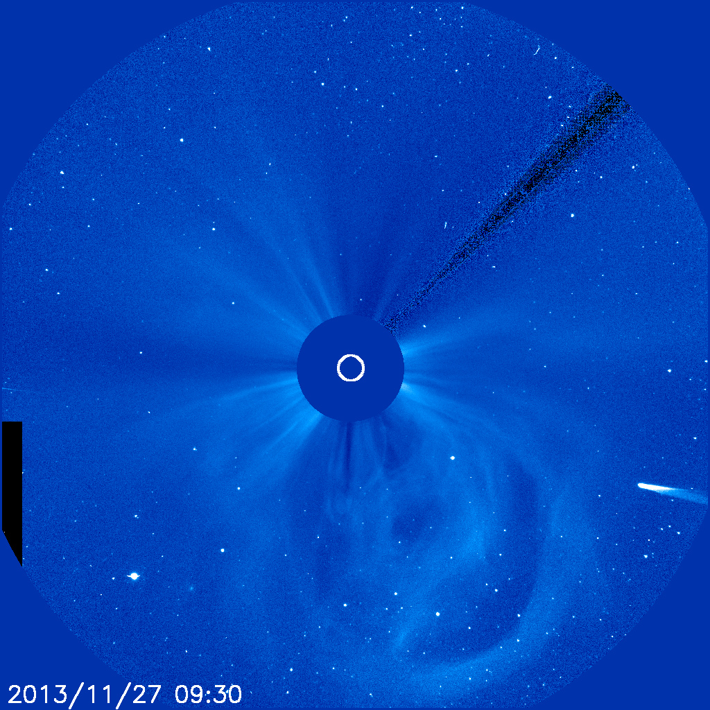
Comet ISON observed by SOHO satellites on Nov 27 2013. The sun is in the center, blocked out by the satellite image. You can also observe solar energy and wind emerging from the sun.
Regardless, ISON will graze the surface of the sun on Thursday — and we will then know for sure what the fate of the comet is. The comet began its journey towards the sun millions of years ago when it was bumped out of the Oort cloud. But now, it faces its most crucial moments in the most dire of circumstances…as it fights the intense solar wind and heat. If ISON escapes the sun in tact or rounds the sun without being completely disintegrated, it may put on quite a show in the night skies during the first and second week of December.
Leave a Reply
Want to join the discussion?Feel free to contribute!