-2")
To Spring or not to Spring? That is the Question.
Upon waking up to another chilly morning, most of us are probably wondering when Spring is coming. For those west of NYC, it probably arrives on Monday and Tuesday, but for those east of New York City, we might have to wait until April 15th or so. Forecast models are struggling immensely with the positioning of a warm front for next week, which throws lots of wrenches into the forecast.
A storm system will head up the coast on Friday and shoot into the Canadian Maritimes this weekend, and strengthen as it does so. That will help to keep things relatively chilly for the weekend, with the cooler northerly flow behind it. Once that storm system gets far enough to our north, heights will begin to rise, and this is when the potential warm-up begins. This is also when the European model and the GFS model really begin to diverge. The biggest difference is the way they handle a huge upper level low in Canada. The GFS splits the ULL into two and elongates it, while the Euro keeps it one large entity that dominates the pattern. The differences begin as soon as 84 hours (Sunday morning), as the GFS is already showing signs of splitting the feature and elongating it, while the Euro is much more powerful. Implications of this will be explained shortly.
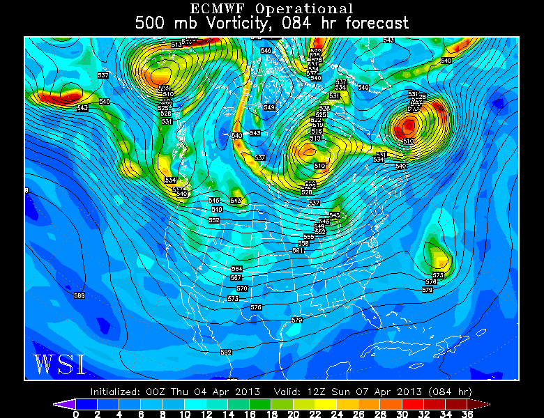
The 00z Euro at 84 hours has the ULL as a much more powerful feature.
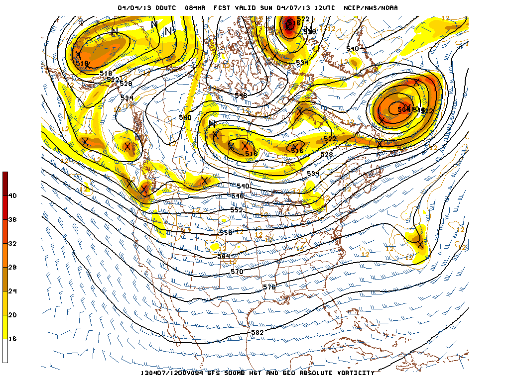
The 00z GFS at 84 hours is splitting the ULL and elongating it.
One thing we do know is that it is clear that there are still remnants of the past blocking pattern in place. There are cutoff portions of very high heights in northern Canada; thus favoring closed off ULLs to form downstream. These patterns do not tend to run very warm, but the good news is that the core of the blocking for the most part is oriented a bit to the west of the NAO regions. Both models agree on a vigorous shortwave entering the Pacific NW, but it will not be allowed to race eastward, due to the ULL and the blocking. Thus, it is instead forced southward, underneath the block.
Read more


