-2")
Unsettled trend brings heavy rain, cold front
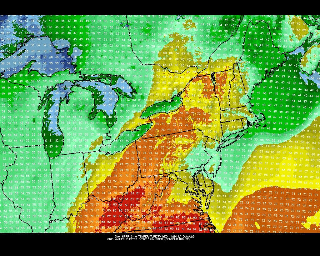
The backdoor cold front which we discussed a few days ago lived up to expectations throughout the area this week. Although not exciting by any means, the front brought cooler air and more clouds as it was expected to — essentially ending the brief period of warmth which saw temperatures on Monday reach into the mid 80’s. The east winds off cooler ocean waters are expected to keep temperatures in the 50’s and 60’s on Wednesday. Additionally, some low level moisture could lead to drizzle in many places, adding to the damp and dreary feel already in the air.
As a storm system approaches our area from the west later this week, the backdoor front will begin to lose some of its grip on the area’s weather. But the damage will have already been done in terms of spoiling what otherwise would’ve been a glorious period of warmth. Thursday looks likely to feature warmer temperatures in the 60’s and 70’s, but a continued trend of unsettled weather including clouds and some showers thanks to a southeasterly wind direction.
The passage of a cold front on Friday then becomes a topic of interest, as a significant mid level disturbance develops to our west over the Central US and Great Lakes. The front will push eastward with plenty of moisture and lift, allowing for a high likelihood of a period of heavy rain on Friday into early Saturday. Forecast models are in good agreement on the potential for an inch or two of rain in the area, which could potentially lead to re-developing river flood problems.
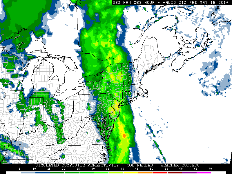
NAM model forecasting a period of heavy rain on Friday Night. Image courtesy Nexlab.
The news on the more positive side, for our area, is that the front will push through by Saturday morning leaving us with a generally pleasant weekend. The upper level disturbance we previously discussed over the Great Lakes will eventually shift eastward, meandering over the Northeast US by early next week. This will keep temperatures near or below normal — but won’t give us a washout by any means. The general trend, even on the medium range forecast models at this juncture, is to keep troughiness in the Northeast US and Southeast Canada while any sustainable warmth remains well to our south and west.
Leave a Reply
Want to join the discussion?Feel free to contribute!