-2")
Foggy Friday followed by heavy rain Friday night
A slow-moving cold front, along with a weak warm front that crossed the region on Thursday, will combine to create interesting changes to our weather — namely the potential for heavy rain on Friday afternoon. The warm frontal passage brought the introduction of a warmer, moist airmass — increasing dew points and precipitable water values. As the cold front shifts toward the area during mid-day on Friday, lifting in the atmosphere will gradually increase which will help to generate heavy rain and even the chance of a thunderstorm come Friday Night.
A large ridge in the Western Atlantic will act to provide plenty of clockwise flow increasing our warmth and moisture. Additionally, to the west, we have a potent trough and associated cold front with plenty of lift. The large ridge is what initially makes the front slow to move eastward, prolonging our fetch of moisture. This is a weather pattern we had often during the beginning of last summer, which is why we had such humid conditions. The initial slower movement of the cold front will keep the heaviest rain to the west of our area during the morning on Friday — but a slow shift eastward is expected.
The higher heights just west of the ridge will also initially serve as a “lid” to our lift, which will help to keep most of the rain during the morning on Friday relatively light. The further west you are (away from the ridge, and closer to the front), the higher chances you have to see more rain. That being said, showers are still likely, as well as areas of fog, but there may be breaks in the action, and heavy downpours will become more likely as the afternoon draws on.
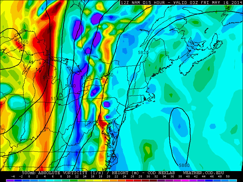
Today’s 12z NAM valid for Friday morning shows plenty of heavy rain to our west, but not much in the way of activity for our area (weather.cod.edu).
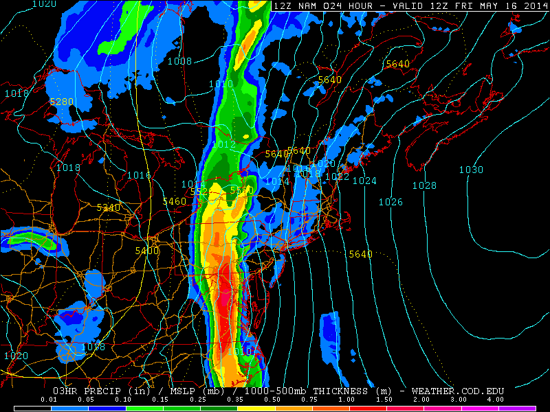
That heavy rain to the west will add up to rainfall totals between 4 and 6″ in Central PA, down through the DC area and Virginia. With time, however, the cold front will eventually move to the east, but we will not be receiving those same rainfall totals. This is because the areas to the west will have spent a lot more time near the cold front when it’s nearly stationary, and the ridge is further east of them. But with our area, when the front is nearly stationary, we get the “lid” from the ridge since we are so close to it, so we only start to lose influence from the ridge when the front has more forward motion to it, thus a much less prolonged time for heavier rainfall.
A potent vorticity maximum will also be developing on the base of the trough as it digs to our south and west, but will be moving just east of due north throughout the day Friday. This will allow the strongest lift to stay just to our west, and then pass to our north, so it “jumps” past us.
That being said, the front will still have enough influence, combined with abundant moisture, for a period of heavy rain and thunderstorms to finally move in on Friday evening and Friday night.
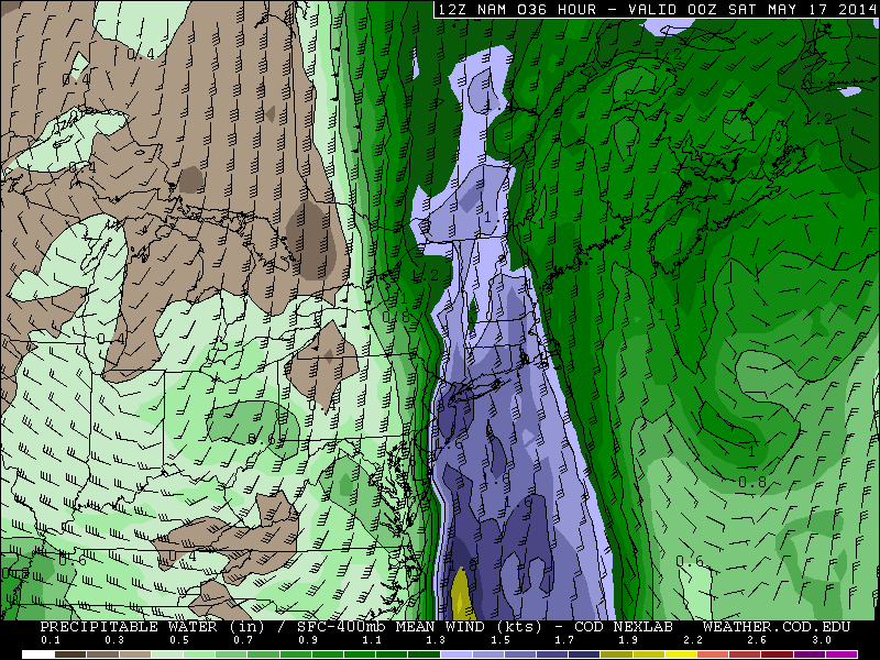
Today’s NAM valid for Friday evening shows high precipitable water values, which is an indicator that the entire atmosphere has plenty of moisture content (weather.cod.edu).
Thus, from Friday afternoon through Saturday morning is when the chances for heavier rain increase for our area, with the heaviest rain anticipated between the PM Rush Hour on Friday and 1:00am Saturday (earlier further west, later further east). Although the models are not particularly impressive with rainfall totals, they tend to be weak at forecasting precipitation amounts, and the abundant moisture with high precipitable water values should still allow most of the area to receive between 1 and 1.5″ of rain, with only a couple of tenths of an inch falling during the day on Friday, and the rest of it falling during Friday evening, Friday night, and early Saturday morning. Isolated higher amounts of 2″ are possible.
Fortunately, the skies should gradually clear after patchy fog on Saturday morning, leading to partly sunny skies with temperatures in the mid 70s; more of the same (without the fog) can be expected on Sunday.
Leave a Reply
Want to join the discussion?Feel free to contribute!