-2")
Beautiful this afternoon, thunderstorms midweek, delightful Memorial Day weekend
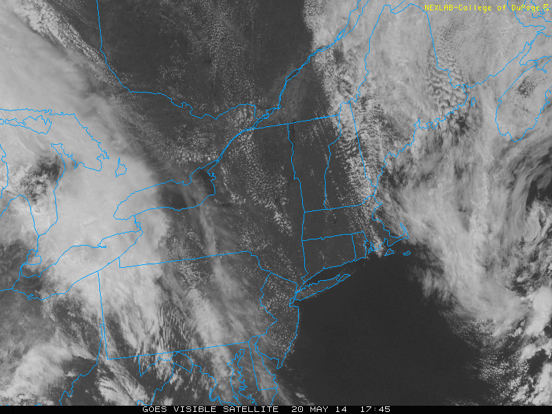
This afternoon and tonight: The large upper level cold pool which triggered clouds on Sunday and Monday afternoons has scooted out to sea, allowing a ridge to build in. This has resulted in warmer temperatures, and will also preclude any significant cloud formation. The rest of this afternoon looks great, with temperatures in the upper 70s and sunny skies. Continued downsloping westerly and northwesterly winds will prevent any seabreeze from forming, so an evening trip to the beach should be a great idea. There will be a few moderate breezes from time-to-time, but nothing that would ruin going outdoors or going for a walk on a beach boardwalk.
Moving forward to tonight is when the weather will start to change, as a shortwave and area of vorticity will be running along the top of the ridge and head towards us from the north and west. This will allow for an increase in clouds tonight, keeping our low temperatures a bit warmer — generally in the upper 50s. Any rain, however, should hold off until tomorrow, and perhaps even as late as tomorrow afternoon.
Wednesday: The reason the rain should hold off for a little while is because as the ridge continues to build in, the 500mb heights will continue to rise — meaning the ridging over our area will get stronger — despite the shortwaves moving in and a warm front approaching. When ridging gets stronger, it tends to put a lid on the atmospheric lifting for precipitation. However, starting at 2:00pm tomorrow is when heights will begin to fall as some troughing from the north and west tries to move in. These height falls will be associated with a stronger shortwave and a warm frontal boundary. This is when we can expect precipitation to develop in NE PA, and then move southeast as the afternoon goes on.
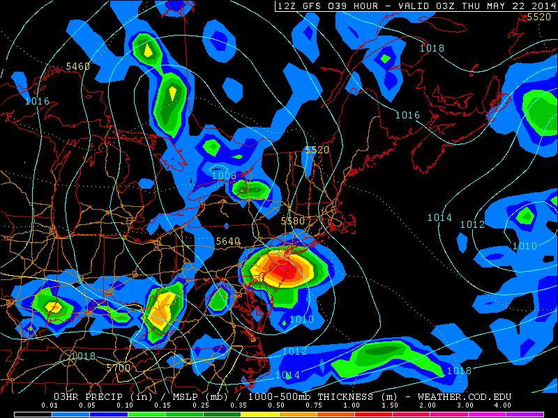
Today’s GFS valid for tomorrow evening shows a heavy cluster of showers and thunderstorms moving into the area. It also shows an area of low surface pressure as a trough from the north and west continues to move in. This will affect our weather for Thursday and Friday as well (weather.cod.edu).
Thus, the chance for heavy rain and perhaps a thunderstorm will increase from around 5:00pm and onward, for tomorrow. Overall, tomorrow will be mostly cloudy, increasing cloud coverage to overcast during the late morning, but rain should hold off. Scattered showers may develop during the afternoon, but the best chance of heavy rain will be in the late afternoon and onward. High temperatures will generally be around 70 or in the low 70s.
Thursday: The trough will have moved into the area, and combined with continued lower surface pressures, the chance for a shower or a thunderstorm will still remain, with generally mostly cloudy skies. High temperatures will be in the upper 60s to lower 70s.
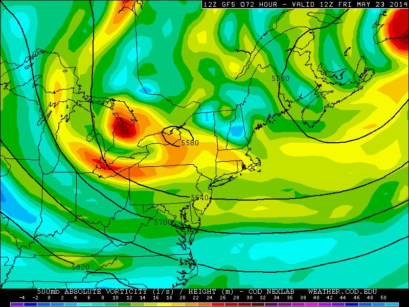
Today’s GFS at 500mb valid for Friday morning shows two upper level cold pools: one centered to our northeast, and one centered in Upstate NY. This will lead to an unstable atmosphere, and thus the chance for a shower or thunderstorm (weather.cod.edu)
Friday: A blocking pattern offshore will allow the upper level cold pool that is offshore to retrograde back to the northwest, and be stationed just to our northeast. Additionally, the trough moving into our area on Wednesday and Thursday will continue to be overhead, and its cold pool will become more organized. Thus, despite the surface low pressure system moving away, and perhaps a few more periods of sun, showers and thunderstorms will become likely during the afternoon, as the atmosphere becomes unstable. High temperatures should be in the low 70s.
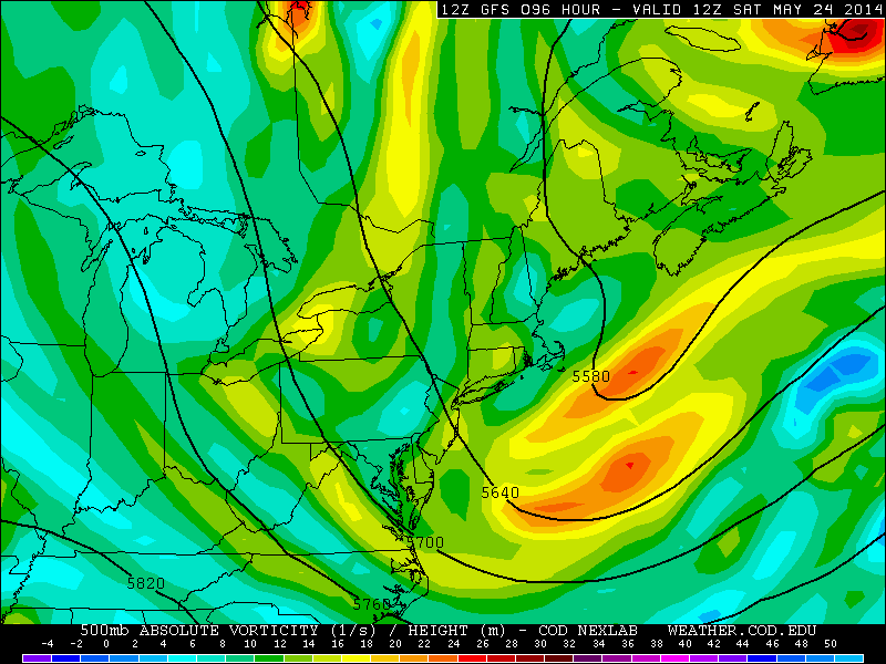
Today’s GFS valid for Saturday morning shows the trough moving out, and ridging moving in from the west. This should lead to a very nice Memorial Day weekend, overall (weather.cod.edu).
Memorial Day Weekend: It appears likely that the trough will be moving out of the area by Saturday morning, and be replaced by ridging. This will allow for a high pressure system to move in, leading to sunnier skies. The cold pool and trough will still be located just to our east, which could lead to some afternoon instability and the chance for a scattered shower or thunderstorm. However, most of the day should be nice, with temperatures in the mid 70s.
The trough will have completely moved out of the region by Sunday, leading to beautiful weather on Sunday and Monday. We expect sunny skies, with high temperatures around 80 on Sunday, and perhaps low-to-mid 80s on Monday.
Major meteor shower possible on Friday night: Earlier this afternoon, we published an article on a potential major meteor shower on Friday night. Hopefully, the trough scoots out early enough to clear out any clouds.
Leave a Reply
Want to join the discussion?Feel free to contribute!