-2")
Incredible photos of hail accumulation from Colorado supercell
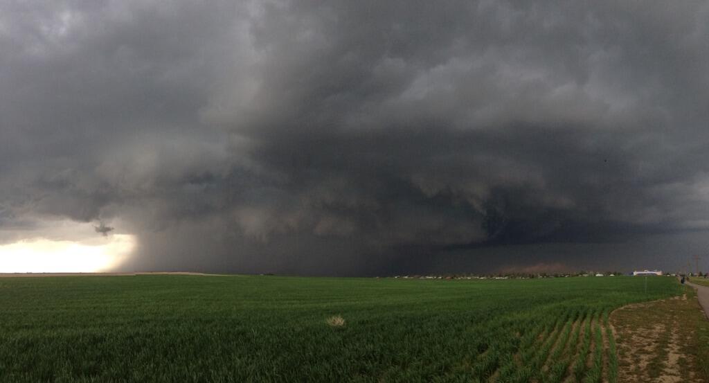
A large supercell, which formed and moved near Denver eastward past Aurora earlier on Wednesday, produced tremendous amounts of hail which accumulated in many areas. The storm also produced a lowering wall cloud, which was observed by many storm chasers, and a possible tornado touchdown east of Denver. The variety of pictures received via social media showed the accumulating hail (a relatively rare occurrence, but more common out west due to colder air aloft) for the second straight day in Colorado. 5″ (yes, 5 inches) of hail fell in parts of Denver.
The maturing supercell also tracked nearly directly over the radar site at KFTG and the Terminal Doppler radar site at TDEN. The “shadowing” effect and the black hole/circle in the middle of the storm is a phenomenon not too often observed. When heavier precipitation moves directly over a radar site, the radar beam cannot register precipitation which is immediately near it’s location. In essence, the precipitation is falling below the radar beams, which shoot outward and upward from the radar site.
Featured image courtesy Mike Oblinsky (Twitter).
The reported tornado has not been confirmed yet as of Wednesday afternoon. Nevertheless, multiple storm chasers tracked and observed the storm at it’s peak. This week and weekend is one of the busiest storm chasing weeks of the season, as many head west to track and observe organized severe weather events in the Central and Western United States.
Keep scrolling for some of the most recent incredible photos from social media showing the hail accumulation.
Wow!! look at the hail. This is north of downtown Denver!! MT Approximately 3" of hail fallen on @DSGpark field. pic.twitter.com/fRVacxv5sq
— Pete Delkus (@wfaaweather) May 21, 2014
MAJOR #hail at Denver International Airport looks like a winter storm just came through!!! @tvnweather @tornadotours pic.twitter.com/0FPVKfsetN
— Reed Timmer (@reedtimmerTVN) May 21, 2014
4:19p MDT: Denver #hail storm now 40 mi E of downtown. MT @islivingston: Storm north of Byers CO. … Strong inflow. pic.twitter.com/o3iliGqnoi
— TWC Breaking (@TWCBreaking) May 21, 2014
RT @ryanvaughan: Craziness in Denver RT @850KOA: Cars stuck in piles of hail on Tower Road pic.twitter.com/o74NMW4fZP
— 28storms.com (@28storms) May 21, 2014
WOW! Hail storm this afternoon at the #Denver International Airport. Photo: Max Mueller. #Hail pic.twitter.com/w1l6NtSt1R
— Mark Tarello (@mark_tarello) May 21, 2014
#hail in NE #Denver. As this melts, roads are flooding. Picture from our reporter @LindseySablan pic.twitter.com/coKlzV6SY0
— 7NEWS Denver Channel (@DenverChannel) May 21, 2014
Leave a Reply
Want to join the discussion?Feel free to contribute!