-2")
Unsettled, cooler than normal weather to continue
In a summer that seems to never want to fully arrive, cooler than normal weather will continue during the majority of the upcoming work week. Tuesday looks to be the warmest of the next few days, as southerly winds pump in a warmer and more humid airmass. Temperatures will respond, with highs reaching the mid to upper 80’s in most locations away from the beaches. But an approaching front will signal the end of this warm weather (what else is new this summer) with showers and storms during the afternoon hours on both Tuesday and Wednesday.
The tail end of the work week looks to feature cooler than normal temperatures once again, behind the aforementioned front, with west-northwesterly surface winds keeping humidity down. Weather that resembles late summer and early autumn will be more common in the next several days than the typical hot, humid weather of early August. The saving grace, in the cooler than normal temperatures, is the fact that the weather will remain relatively dry and won’t feature any significant precipitation events.
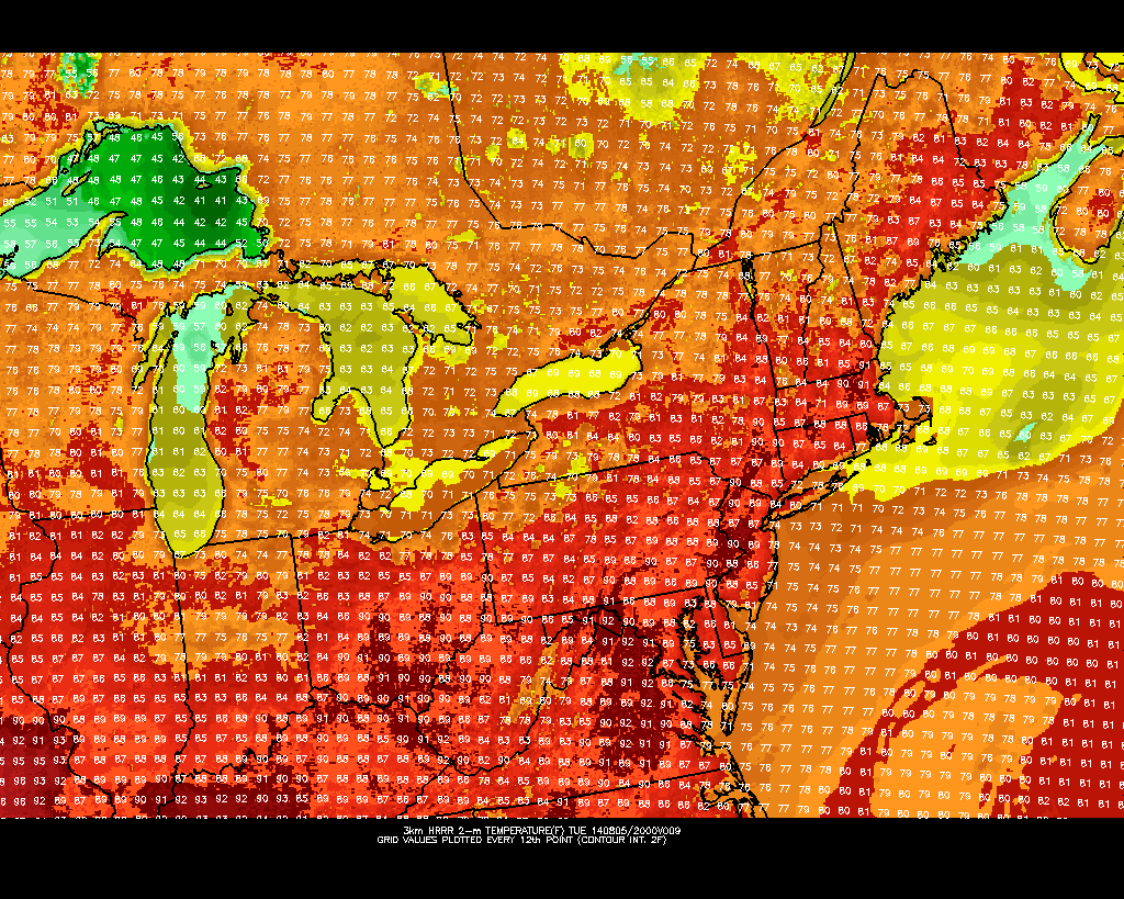
HRRR model showing highs in the upper 80’s on Tuesday.