PM Update: Warmup midweek, unsettled weather ahead

Monday was the first in a set of what will likely be three summery days — with high temperatures in the 80’s and a warm sun. Autumn-like weather has taken its grip on the areas weather over the last week or so with pleasant days and cool nights. But the below normal temperatures will take a hiatus, however brief it may be, during the next few days. A building ridge in the mid levels of the atmosphere will aid in the development of a southwesterly flow, which will yield increasing mid level temperatures and warmer surface temperatures as well.

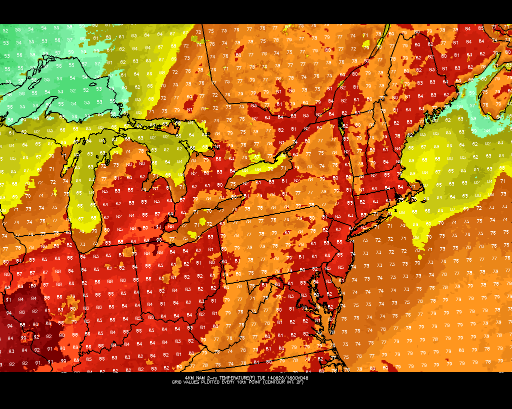
High temperatures on Tuesday will reach into the upper 80’s, feeling a bit warmer than Monday. Drier winds, as opposed to the onshore flow which has kept things cooler for the past few days, will make the air feel even pleasantly warm. Humidity will begin to increase as well, but won’t become noticeably uncomfortable until Wednesday. This will signal the approach of a frontal boundary later Wednesday, which will eventually bring an end to the warmer and more summery weather.

NAM model forecasting temperatures in the 90's on Wednesday afternoon with approaching thunderstorms. (Temperatures top left, precipitation top right).

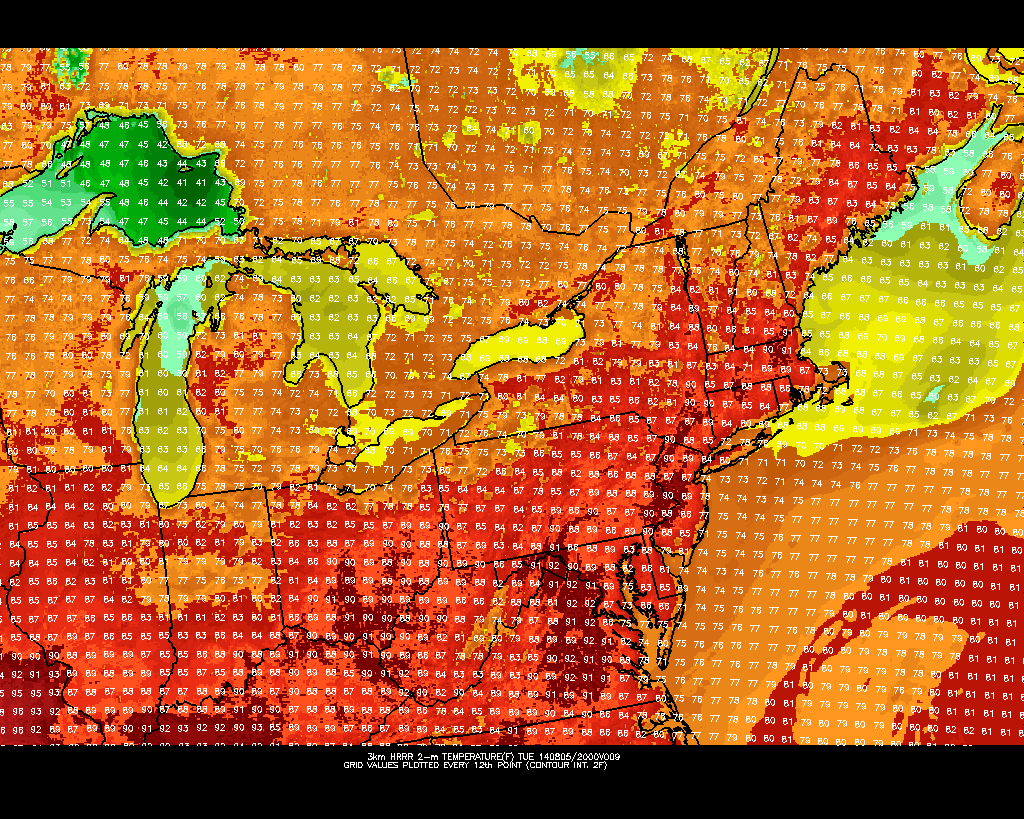
NAM model forecasting temperatures in the 90’s on Wednesday afternoon with approaching thunderstorms. (Temperatures top left, precipitation top right).

Read more

Muggier, warmer weather returns this week

Although the weekend may be coming to a close, too quickly as it always seems to be, there is some good news in the forecast for the upcoming week. A building ridge (we haven’t heard that statement in a while) will bring increasing mid level temperatures and rising heights aloft. The presence of high latitude blocking and a persistent ridge out west have, for the most part this summer, inhibited the development of any ridging in the Northeast United States. But, as is the case with all patterns, there are exceptions — and eventually changes. For this week, we’ll see the return of a southwesterly winds and warmer temperatures as well as increasing humidity.

High temperatures by the middle of the week could flirt with 90 degrees in the urban corridor of Philadelphia to New York City. This will be especially true on Wednesday, when mid level temperatures will peak around 18 C, typically supportive of temperatures over 90 degrees. The warm weather won’t last forever, but while it’s around during the early to middle part of this coming week it will certainly feel more like summer. Or more like August should feel, compared to the Autumn-like air we’ve become accustomed to over the last week or two.

NAM model showing temperatures in the upper 80's on Tuesday afternoon.

NAM model showing temperatures in the upper 80’s on Tuesday afternoon.

Read more

Announcing premium forecasts, weather models

Today, we are extremely excited to announce the overhaul and re-structuring of our premium and subscription forecast packages. For the past few years, New York Metro Weather has begun to offer subscription forecast packages to clients and subscribers who are looking for more detailed information or location-specific forecasts. Essentially, subscribing will allow you to have personalized forecast for your home or office, with 24/7 access to our staff of meteorologists. The features and benefits of the relationship which you develop with New York Metro Weather will bring you unprecedented accuracy in forecasting, and peace of mind regarding weather hazards and information. Additionally, the pricing on these packages will fall well under the market average for these services. For information regarding our subscription packages and availability, Click Here.

Upon subscribing, you will immediately receive an email from one of our meteorologists — and we will start talking with you to tailor our forecasts specifically to you and your location.

Despite offering these subscription packages, the core of what New York Metro Weather offers will remain free — as it always has. Our articles, Forecast Brief and Discussion will remain available to everybody — and our social media accounts will continue to work exactly as they have before. But we’re taking it further. On September 1st, 2014 we will be rolling out the Beta Version of our Forecast Model hub, a central place to access our own in-house weather models. This page will be completely free. We will never charge you for any of our forecast model images or information.

Subscribe Now | Check out samples of our new model page | Buy an awesome T-Shirt 

Read more

Unsettled, cooler than normal weather to continue

In a summer that seems to never want to fully arrive, cooler than normal weather will continue during the majority of the upcoming work week. Tuesday looks to be the warmest of the next few days, as southerly winds pump in a warmer and more humid airmass. Temperatures will respond, with highs reaching the mid to upper 80’s in most locations away from the beaches. But an approaching front will signal the end of this warm weather (what else is new this summer) with showers and storms during the afternoon hours on both Tuesday and Wednesday.

The tail end of the work week looks to feature cooler than normal temperatures once again, behind the aforementioned front, with west-northwesterly surface winds keeping humidity down. Weather that resembles late summer and early autumn will be more common in the next several days than the typical hot, humid weather of early August. The saving grace, in the cooler than normal temperatures, is the fact that the weather will remain relatively dry and won’t feature any significant precipitation events.

HRRR model showing highs in the upper 80's on Tuesday.

HRRR model showing highs in the upper 80’s on Tuesday.

Read more