A NASA rocket scheduled to launch at 6:22pm tonight from Wallops Island in Virginia exploded 14 seconds after launch. The rocket erupted into flames and crashed to the ground causing widespread flames and smoke which was detected on radar.
The rocket was unmanned. The cause of the explosion has not yet been determined. The rocket launch was originally scheduled for yesterday, but a sailboat in the waters near the launch site caused the launch to be scrubbed until today.
The cause of the explosion has not yet been determined. We will continue to update this post with information as we get it.
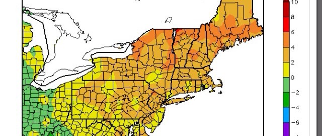
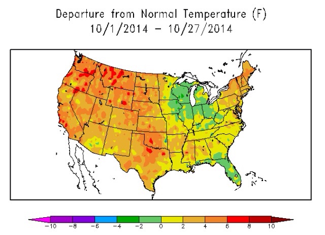
October is just about complete, and it was a very warm month both nationally and regionally.
It has been much warmer than average for most of the country this month (ACIS).
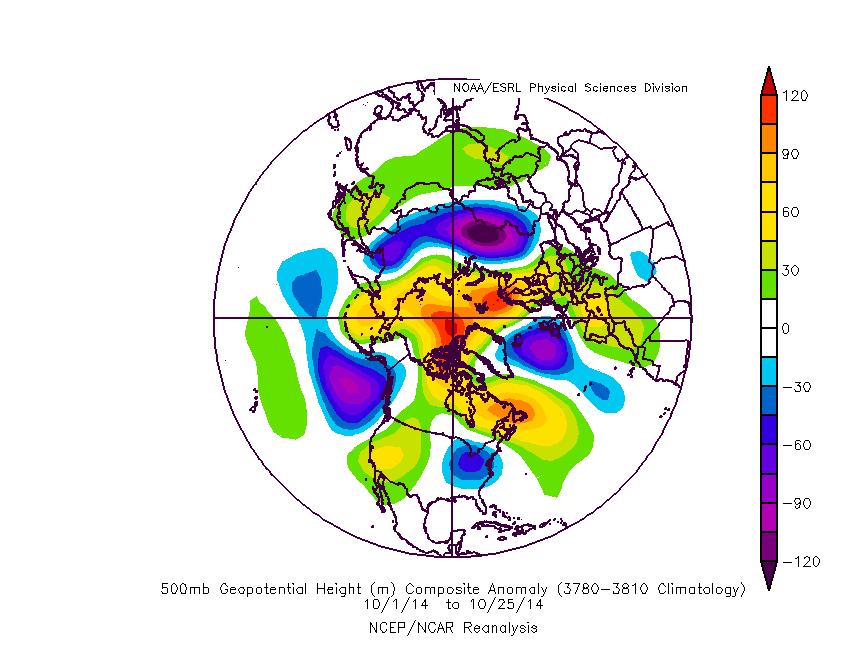
In predicting the future weather patterns, we often like to take a look at what has happened in the recent past, and roll forward with any expected changes to the pattern, or lack-there-of. Here is the 500mb pattern that has occurred in the Northern Hemisphere this month:
The 500mb pattern this October featured a large trough in the NE Pacific, which largely prevented Arctic intrusions.
The two big features that stand out are the large amount of blocking near the North Pole — particularly the Eurasian side of the Pole, and the large trough in the NE Pacific. The blocking supported a large amount of snow in Eurasia, as the snow cover this year in those regions is among the highest it’s ever been in October. This doesn’t affect our current weather pattern this month so much, but it does lead to the higher probability of a snowy winter.
https://www.nymetroweather.com/wp-content/uploads/2014/10/7.jpg480640Doug Simonianhttps://www.nymetroweather.com/wp-content/uploads/2024/02/Empire-2000-x-300-px-2.pngDoug Simonian2014-10-28 15:49:532014-10-28 15:49:53Despite cold weekend, November looks to start off warm
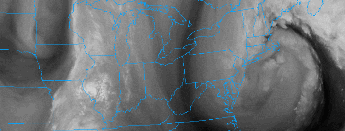
There, we used the “S word” in one of our posts for the first time this season. An energetic mid and upper level disturbance will shift from Central Canada through the Northeast United States late this week into the early part of this weekend, helping to develop a coastal storm. In addition to the coastal storm will come a strong cold front, and a cold Canadian airmass which will drop temperatures into the 30’s and 40’s at times after its passage. With models hinting at the development of multiple surface lows off the coast, the potential exists for not only rain and wind — but some snow in the higher elevations and the first flakes for others.
But the setup remains extremely complicated. The source region of the disturbance means forecast models are already working with a somewhat limited dataset. And, as is often the case with storms in our area, the mid level disturbances will be involved in fragile interactions, all of which will have a major impact on exactly how the storm develops. Confidence, as a result of these small nuances and features, remains very low.
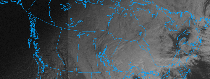
https://www.nymetroweather.com/wp-content/uploads/2014/10/canada.vis_.gif600800John Homenukhttps://www.nymetroweather.com/wp-content/uploads/2024/02/Empire-2000-x-300-px-2.pngJohn Homenuk2014-10-28 12:38:042014-10-28 12:56:01Rain, cold and even snow possible this weekend
As meteorologists, you sometimes just have to toss your hands up and admit defeat. And with this weeks Nor’Easter, we’re doing just that. The storm came in much more intense, much more organized, and much more impactful than we forecasted or anticipated it to be. And while our area saw periods of heavy rain and wind from the storm, the system itself was quite dynamic. Similar to winter Nor’Easters both aloft and at the surface, the storm featured a deepening surface low and a dynamically impressive mid level trough.
Enhanced lift from the developing surface low, which actually retrograded westward from the Atlantic toward Long Island last night, moved over New England and New York City overnight Wednesday into Thursday morning. The result was heavy rain, and more noticeably, strong gusty winds mixing down to the surface. The dynamic system featured strong winds just above the surface — and so heavy rain brought these down. Gusts over 50 miles per hour were common throughout New England and Long Island.
Hi friends! Our website uses cookies to provide an optimal browsing experience for you. New "Cookie Consent" laws mandate us to inform you of this. As long as you're cool with it, just hit OK. You'll only see this message once.
We may request cookies to be set on your device. We use cookies to let us know when you visit our websites, how you interact with us, to enrich your user experience, and to customize your relationship with our website.
Click on the different category headings to find out more. You can also change some of your preferences. Note that blocking some types of cookies may impact your experience on our websites and the services we are able to offer.
Essential Website Cookies
These cookies are strictly necessary to provide you with services available through our website and to use some of its features.
Because these cookies are strictly necessary to deliver the website, refusing them will have impact how our site functions. You always can block or delete cookies by changing your browser settings and force blocking all cookies on this website. But this will always prompt you to accept/refuse cookies when revisiting our site.
We fully respect if you want to refuse cookies but to avoid asking you again and again kindly allow us to store a cookie for that. You are free to opt out any time or opt in for other cookies to get a better experience. If you refuse cookies we will remove all set cookies in our domain.
We provide you with a list of stored cookies on your computer in our domain so you can check what we stored. Due to security reasons we are not able to show or modify cookies from other domains. You can check these in your browser security settings.
Other external services
We also use different external services like Google Webfonts, Google Maps, and external Video providers. Since these providers may collect personal data like your IP address we allow you to block them here. Please be aware that this might heavily reduce the functionality and appearance of our site. Changes will take effect once you reload the page.
-2")