-2")
PM Update: Periods of snow, light accumulations tonight
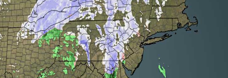
A quick blitz of snow will approach the area over the next several hours, especially across northern sections of the forecast area. Precipitation could briefly mix with sleet and rain in some areas, especially further south and near the coast. The precipitation comes out ahead of a low pressure system which is driving southeastward through Southeast Canada. Mid level energy will eventually force the low pressure system to redevelop in the Gulf of Maine, as a stronger low pressure system which could bring several inches of snow to the Maine Coast.
Closer to home,snow and mixed precipitation will lead to an increased risk of hazardous travel tonight. Although not a significant winter weather event by any means, briefly moderate snow could cover roads — especially those that are untreated. The precipitation is expected to pick up in intensity after dinner time and continue into the middle hours of the evening.
Some forecast models indicate that precipitation will linger into the morning as the aforementioned secondary low pressure develops. As a slight increase in moisture occurs, snow squalls could remain a possibility. Accumulations generally are expected to be light. But as is always the case with these events, intermittent snow squalls have the potential to bring up to an inch of snow. In the higher elevations of Northern NJ, Southeast NY and CT — up to 2 inches of snow remain possible.
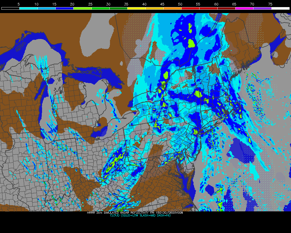
HRRR (High Resolution Rapid Refresh) model showing snow remaining in the area through Friday morning.
The system will be, more than anything else, a harbinger of the cold to come. As the storm moves east of our area by Friday morning, strong northwesterly winds will usher in a much colder airmass. Temperatures in the mid levels of the atmosphere — a few thousand feet above our heads — will drop to almost 20 degrees below 0 in Celsius. Surface temperatures will respond by falling into the teens and single digits on Friday Night. This will be especially true where there is solid snowcover.
With another winter weather event on the heels of this one by later this weekend, the pattern we have settled into will keep winter weather lovers happy through at least the middle part of next week.