-2")

Multiple winter weather threats to begin February
On the heels of two (arguably three) major winter weather events in the Northeast United States, many are wondering just when the pattern will slow down. The answer: Not soon. Medium and long range forecast models are in good agreement that an active pattern will continue in the foreseeable future as the Pacific Jet continues to send multiple disturbances into the United States. Fluctuating amplitude of both a ridge on the West Coast and high latitude blocking over the Arctic regions will keep things from getting downright snowy and cold for a prolonged period, but the potential for winter weather events for at least the first few weeks of February looks to be heightened.
The first threat will come as early as the tail end of this week — small, but nonetheless noteworthy as it comes on the heels of an arctic front. Short term forecast models are in agreement that a wave of low pressure will develop along this frontal boundary on Thursday, with moisture streaming north/northeastward along it. The best support for heavy precipitation will remain well offshore. But enough moisture looks to stream along the front within a coupled jet structure aloft to allow for steady precipitation to push eastward from Pennsylvania through New England and the Northern Mid Atlantic.
Snowfall amounts are likely to remain capped at a few inches, and more is likely in the higher elevations. But behind this front, as a coastal storm develops well to the northeast in the Gulf of Maine, arctic air will pour southward from Canada into the United States. The Pacific Jet will become active again, with an elongated upper level low over Southeast Canada providing continued cold air support especially in the low levels. And medium range forecast models have been keying in on a disturbance which will come ashore late this weekend into this weekend. As it pushes eastward and amplifies south and east, the potential would exist for snow to spread through the Ohio Valley and Northeast States.
The details, obviously, will remain fuzzy for several days. Much of this snow potential rides not on a huge phase or amplified storm, but on energy from a baroclinic zone. A baroclinic zone is an area where a temperature gradient exists on a constant pressure surface. These zones can become favorable areas for low pressure centers to deepen. Additionally, enhanced baroclinicity can lead to increased lift for heavy precipitation. Forecast models will struggle to pin down exactly where that baroclinic zone, or area of most enhanced baroclinicity, will set up. And thus, forecast models will struggle with the exact details of the storm system including precipitation types and amounts.
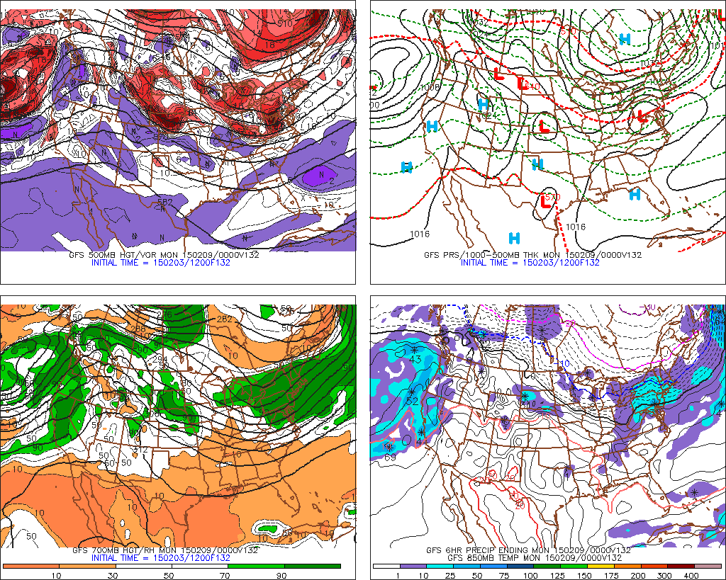
GFS model showing an overrunning snow event late this weekend into early next week.
What we do know, is that many models have been hinting at an impressively strong surface high pressure nudging southward into Southeast Canada during this weekend as a result of the upper level low which is elongated there. This would result in enhanced baroclinicity and low level cold. A process known as cold air damming (CAD) would keep cold air locked in place and the surface low could track into the Ohio Valley, while then reforming off the East Coast. Such scenarios have often produced snowstorms in our area.
Thereafter, there is more medium and long range model support for winter weather. The European model, GFS model, and Canadian model all agree on a heightened period of winter weather continuing into the middle part of next week. Some are indicating the potential for an amplified trough in the East Coast and a coastal storm, even after the initial “baroclinic zone event” late this weekend.
We’ll hestitate to talk further details at this point for one reason: Forecast models are inherently unpredictable at this range. The best idea is to use them as guidance, not fact. And the guidance right now is telling us that the potential is heightened for winter weather — and yes, snow — starting late this week and moving into the near future.