-2")
Prolonged period of wintry weather to start the week
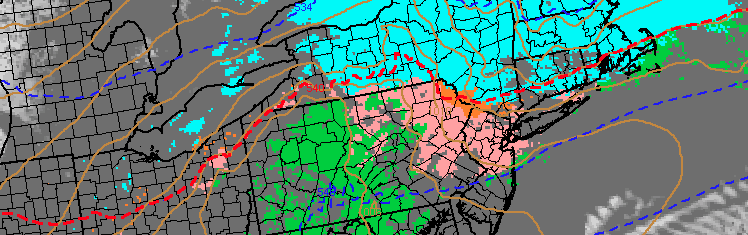
A winter storm affecting the Northeast United States will begin as early as Sunday throughout the area, as lift for precipitation develops along a baroclinic zone and thermal gradient near the area. The forecast in terms of precipitation type and amounts, however, is not as cut and dry as it may seem. The thermal gradient both at the surface and aloft will differ in location, creating widespread differences in precipitation type and a very sharp gradient in potential snowfall and winter weather impacts.
In the mid levels, warming will occur between 850-900mb (above our heads, but not very far up in the atmosphere). This warm layer will push northward to a position near New York City on Monday. What this means, is that any snowflake which forms farther up in the atmosphere will fall through a layer of air that is above freezing. Essentially, it will melt. But our problems don’t stop there — the surface layer of the atmosphere (where we are) is very cold. And that means any precipitation which falls as liquid is going to re-freeze on the surface.
This problem will admittedly be more prevalent over Northern New Jersey, New York City and much of the interior. Where the atmosphere isn’t cold enough for snow there, sleet or freezing rain will be likely. This will all but certainly create a very treacherous travel situation on Monday and possibly continuing into Tuesday as sleet and freezing rain create icy conditions. To the north, a band of moderate to heavy snowfall amounts is likely throughout New England.
Multiple rounds of light to moderate precipitation are anticipated from later Sunday into Tuesday. So this won’t be a situation where a heavy burst of precipitation will create immensely hazardous conditions over a short period of time. Instead, the prolonged light to moderate precipitation creates concern for slowly building ice accretion and light snowfall amounts. The snowfall will obviously be more of a concern farther north where a colder atmospheric column exists.
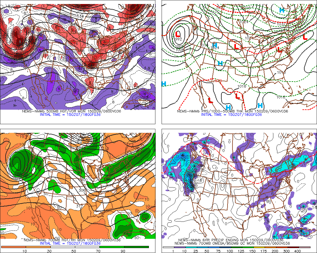
NAM model showing the mid and upper level atmospheric setup for this weeks winter weather event.
Forecast models are split and in some disagreement on precipitation amounts. With multiple shortwaves moving along a thermal gradient from Sunday into Tuesday, varying amounts of atmospheric moisture and lift are wreaking havoc on the forecast models. Still, moderate precipitation amounts over a prolonged period time are very likely to produce at least a moderate impact winter weather event.
Farther south, over Central and Southern New Jersey, the atmospheric column will be warmer — and the warm layer deeper — to support plain rain instead of freezing rain, sleet or snow. The boundary where this temperature difference exists will be quite sharp. Forecast models current place this boundary somewhere near New York City with a sharp cutoff in winter weather impacts as once heads south of Staten Island.
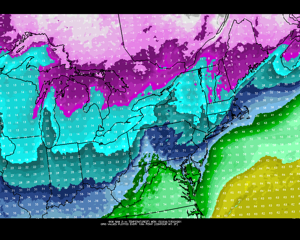
NAM model showing surface temperatures in the mid 20’s in many areas over Northern NJ, SE NY, CT during wintry precipitation on Monday.
Still, uncertainty is obviously rather high. Whenever these sharp gradients and boundaries exist, the forecast can change quite dramatically in specific locations if forecast models are incorrect in their placement of said boundary. Our main concern going forward would be the entrenchment of low level cold air. A stout high pressure to the north keeping low level cold locked in place could mean a more prolonged period of ice and freezing rain in parts of Northern NJ, NYC and the interior.
The National Weather Service agrees that up to 0.25″ of ice accretion will be possible even in New York City. Such an event would cause very slippery, slick conditions with quite hazardous travel on Monday despite a lack of snowfall. Newer forecast models agree that between 0.15 and 0.35″ of ice could accumulate on all surfaces in the aforementioned area.
Stay tuned today for updates including information on the ice and snow which will impact our area early this week. Again, while the heaviest snowfall amounts will stay to our north over New England (what else is new over the last few weeks), a moderate winter weather event is still anticipated over Northern NJ, NYC, Southeast NY and CT due to the entrenchment of low level cold and wintry precipitation types.