-2")
Rough PM commute likely with snow, sleet expected
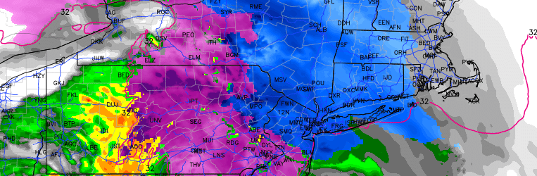
A storm system developing over the Central United States will shift northward today, bringing enhanced lift for precipitation and forcing the development of snow from southwest to northeast throughout the area. As this lift shifts northeastward, snow will become steadier and heavier later this afternoon throughout the area. This snow will be falling as a result of increased lift for precipitation, owing to an increased southerly flow in the mid levels of the atmosphere as a result of warm air advection.
This warm air in the mid levels will continue to shift northeastward from the Mid Atlantic into the Northeast States, shifting precipitation from snow to sleet across much of Northern NJ and NYC by later tonight. In the low levels, however, cold air will remain stout — creating the potential for not only sleet, but ice accretion as well if the depth of the mid level warm layer becomes wide enough to support freezing rain. This will create treacherous conditions on roadways tonight across Northern NJ and the suburbs of NYC in SE NY and Connecticut.
While the event will be of lower impact in Central and Southern NJ due to warmer air introducing rain as a main precipitation type, hazardous and slick roads are still expected for a period of time. Across Northern NJ, NYC, LI and CT, however — the frozen precipitation will impact the PM commute and continue into tonight.
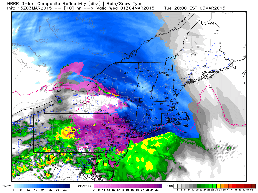
HRRR precipitation type valid for 8:00PM tonight.
Snowfall accumulations of 1 to 3 inches are expected in Northern NJ, NYC and surrounding areas by the time precipitation shifts to rain, with a light to moderate accretion of ice and sleet on top of the snowfall. Although rain will be falling by Wednesday morning, continued road hazards are possible in the areas where temperatures are still near freezing and snow and ice still remain on the roads.
Stay tuned for further updates — with up to the minute information on our social media feeds.