-2")
Spring begins Friday…with another snowstorm
A disturbance in the mid levels of the atmosphere shifting from the Ohio Valley to the East Coast will force the development of a surface low pressure system, which will move off the East Coast on Friday. Terminology like this has become all too familiar over the past several months, hasn’t it? Nevertheless, this surface low will develop close to the Mid Atlantic coast on Friday, aiding in the development of enhanced mid and upper level atmospheric lift for precipitation. With cold air in place over New England, anchored by a high pressure shifting northeastward, the result will be: More snow.
Snow is expected to spread from southwest to northeast throughout the area on Friday morning. Initially light, it will quickly increase in intensity as a band of enhanced lift moves through the area. Moderate snow is expected to continue through Friday afternoon and evening, when it will accumulate up to 3 to 5 inches throughout the area. The higher amounts of that tier will be more common in bands of heavier precipitation — where heavy snow continues for prolonged periods of time.
Making the forecast all the more challenging for forecasters will be the fluctuating precipitation intensity and melting possibility when predicting accumulations. Warmer ground and surfaces will melt light snow on contact, but heavier and steadier snow will have no problem accumulating at all. With surface temperatures expected to be hovering near freezing, the forecast certainly has the potential to “bust” in a snowy or non-snowy direction if forecast models are off by just a few degrees.
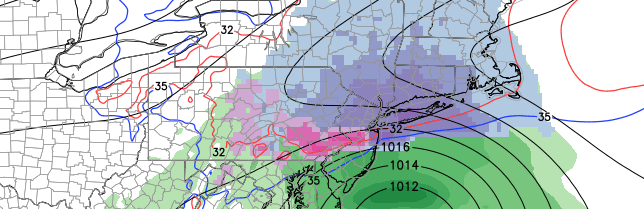
Causing additional concern in the forecast is mid level warming, which shifts from Southern NJ northward during the day Friday. This could change precipitation over from snow to rain during some of the moderate to heavy precipitation. Essentially, a warm layer in the mid or low levels of the atmosphere will melt snowflakes as they fall. So, concern also exists regarding precipitation type from Southern NJ to around Sandy Hook. Farther north, over New York City and points north — the issue becomes the amount of precipitation, not the type as it appears that the atmospheric column will be more than cold enough for snow.
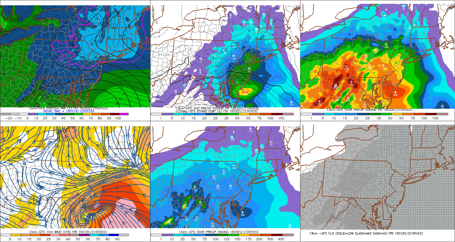
GFS model showing heavy snow throughout the area on Friday afternoon.
This creates increasing confidence that the 3-5″ snowfall amounts will fall within a very narrow band, angled from southwest to northeast from Eastern Pennsylvania through New Jersey and toward New York City and Long Island. The exact location of this band will be very difficult to forecast even a few hours before the event. With warming and borderline surface temperatures to the south, and less precipitation to the north, this band will become the “focal point” for impacts from this storm system.
Travel is likely to impacted, no matter your location, on Friday afternoon and evening. Snowfall will be most noticeable on non-paved/warm surfaces, but some road accumulation is still likely. Leave extra time and prepare for travel delays. Snow will wrap up by Friday evening.