-2")
Rain, fog, and thunderstorms tonight, clearing and windy Saturday
Today has seen a strong temperature gradient across the region. Out ahead of a cold front, there has been a persistent southerly flow, which has helped to warm the airmass. It has also allowed for a strong temperature gradient to form, as from NYC and westward, temperatures are in the 60s, but east of NYC, temperatures are primarily stuck in the upper 40s to low 50s with dense fog.
This is because as you go further east, the southerly winds have a strong fetch from the frigid Atlantic Ocean. This helps to cool temperatures off substantially in Long Island. Given that the airmass as a whole is somewhat warm and muggy, the cold low-level temperatures on Long Island end up being much closer to their dewpoints, which means a much more saturated low-level atmosphere. This has helped to create dense fog on Long Island, and this is expected to last for the rest of the day and night.
Further west, with surface temperatures a bit warmer but in the same airmass, fog will be patchy, but not as dense as it will be on Long Island.
As far as the rain is concerned, while a few scattered showers are possible during the next few hours, the area will be primarily rain-free for the evening and early-overnight, save for some fog-related drizzle. After midnight is when rain and some embedded thunderstorms could return.
The atmosphere will be far too stable for any severe thunderstorms, but we will have a strong southwesterly low-level jet stream, thanks to the cold front and associated storm system. The front will be too far away for the next several hours for any organized rain, but as it approaches the area after midnight, more lifting in the atmosphere combined with the low-level jet stream, low-level wind shear, and instability in the mid-levels of the atmosphere could lead to some weak thunderstorms.
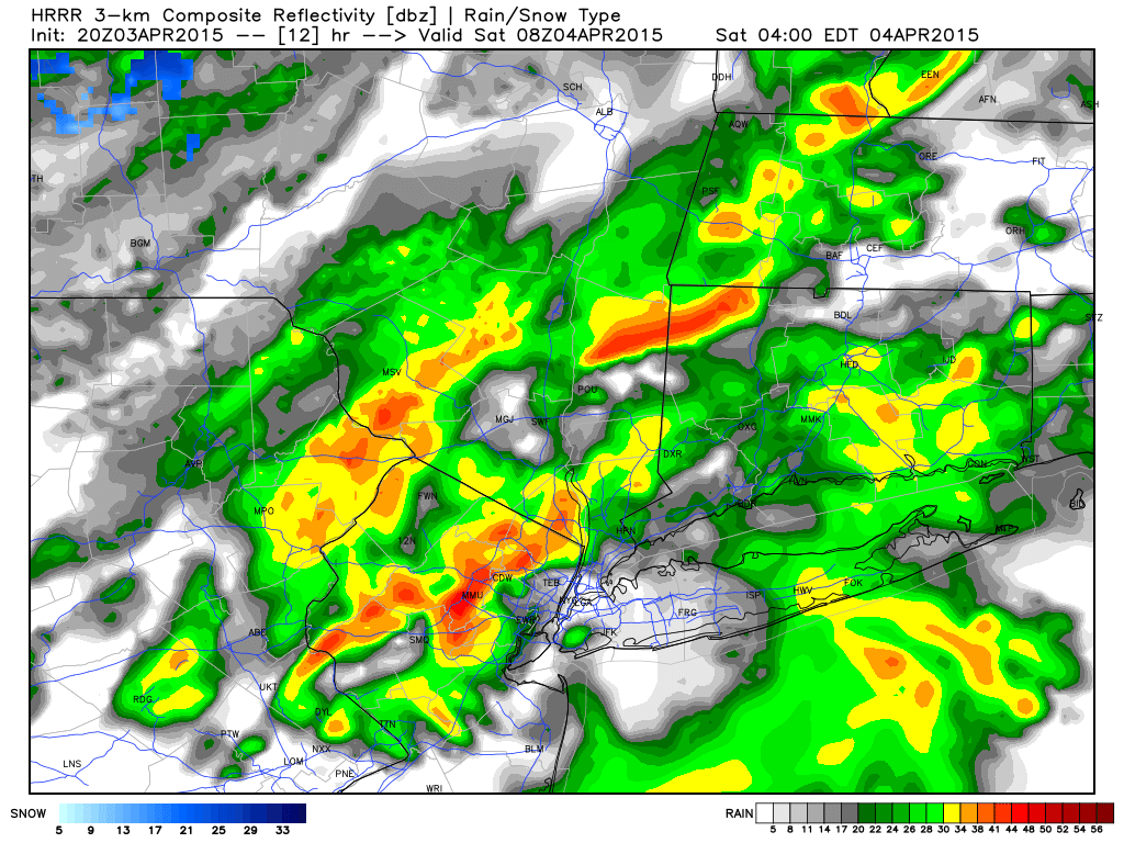
Today’s NAM model valid for 4:00am shows some moderate instability in the mid-levels of the atmosphere. This could lead to a few rounds of thunder for some locations during the overnight.
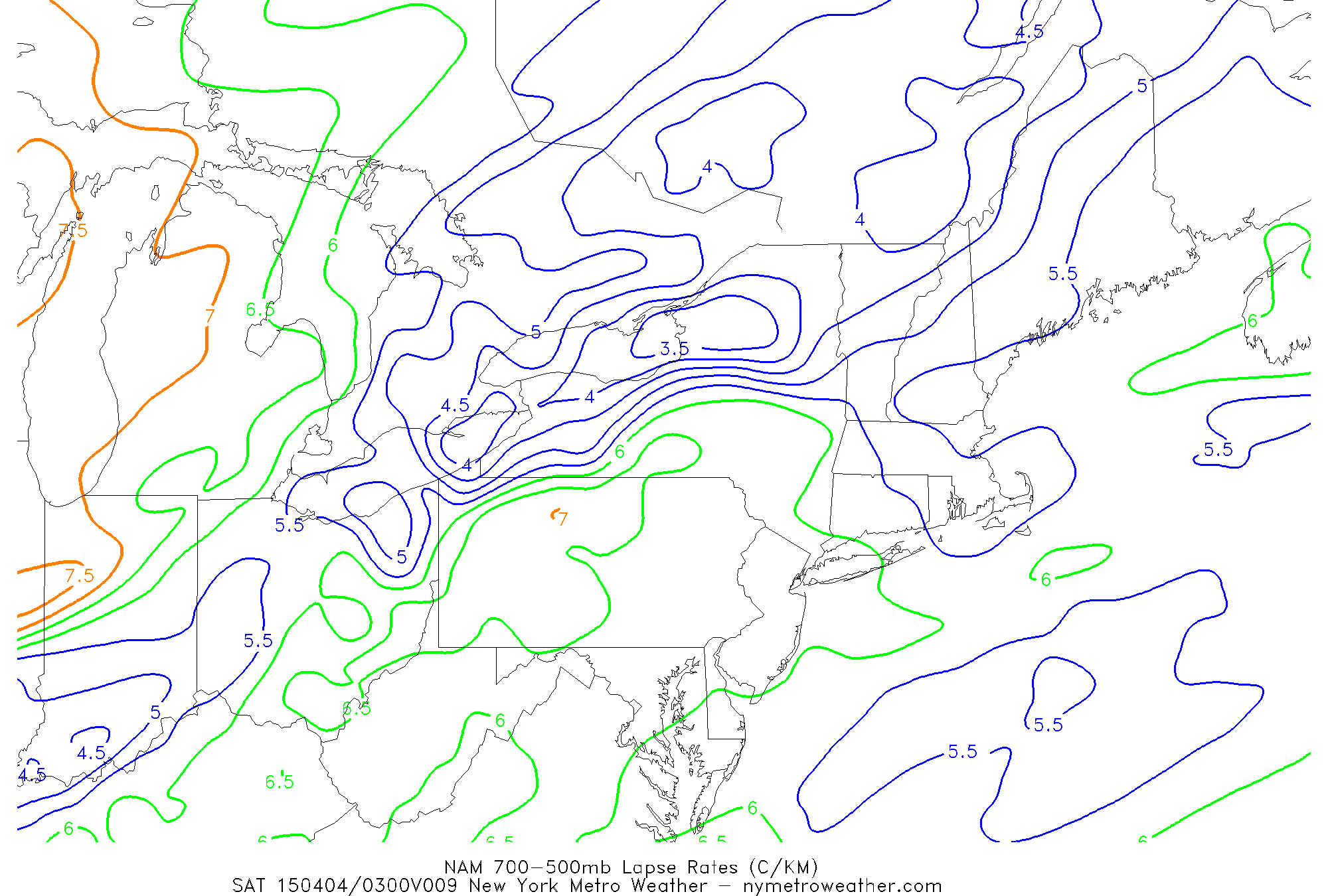
The above image shows lapse rates — which represents the temperature differential in a layer of the atmosphere. This specific layer is in the middle of the atmosphere. The higher the decline in temperature with height, the more unstable the atmosphere is. While these values shown above aren’t particularly impressive, they are high enough to generate some vertical cloud growth — enough for ice particle formation in these clouds — which is necessary for thunder and lightning formation.
More specifically, the above image shows 700-500mb lapse rates anywhere from 6 to 6.5 degrees C, which is sufficient for thunderstorms.
While not everyone will see thunderstorms, and it will not be raining all the time, the amount of moisture in the atmosphere combined with the front and above mentioned factors will lead to periods of heavy rain, rumbles of thunder, and wind gusts from 30-40mph. This should occur from anywhere between after midnight through 5:00am.
The Storm Prediction Center gives the area a 2% chance of a tornado within 25 miles of a point in our area. The reason for this is because of the strong low-level wind shear — winds near the surface will generally be light (except for gusts) out of the SE, while winds just above the around could be up to 40mph out of the southwest. The turn and increase in winds with height creates the necessary rotation for a tornado. However, the atmosphere will be very stable at the same levels where the winds are turning, which means that rotating updrafts will be tough to come by. Additionally, the strongest instability shown in the above image only correlates to unidirectional winds, so there is no juxtaposition between rotation and instability. Thus, we wouldn’t worry much about a tornado. We will still be keeping and eye on it, however.
By daybreak tomorrow, the cold front will have pushed through the area, which will allow precipitation to end. Skies will initially be mostly cloudy, but should gradually clear throughout the day. Winds will be shifting to the west and northwest, and combined with increased sunshine and cooling temperatures aloft, there will be enough instability to mix strong wind gusts — up to 40 mph — throughout the day tomorrow. Temperatures will generally be in the low to mid 50s.
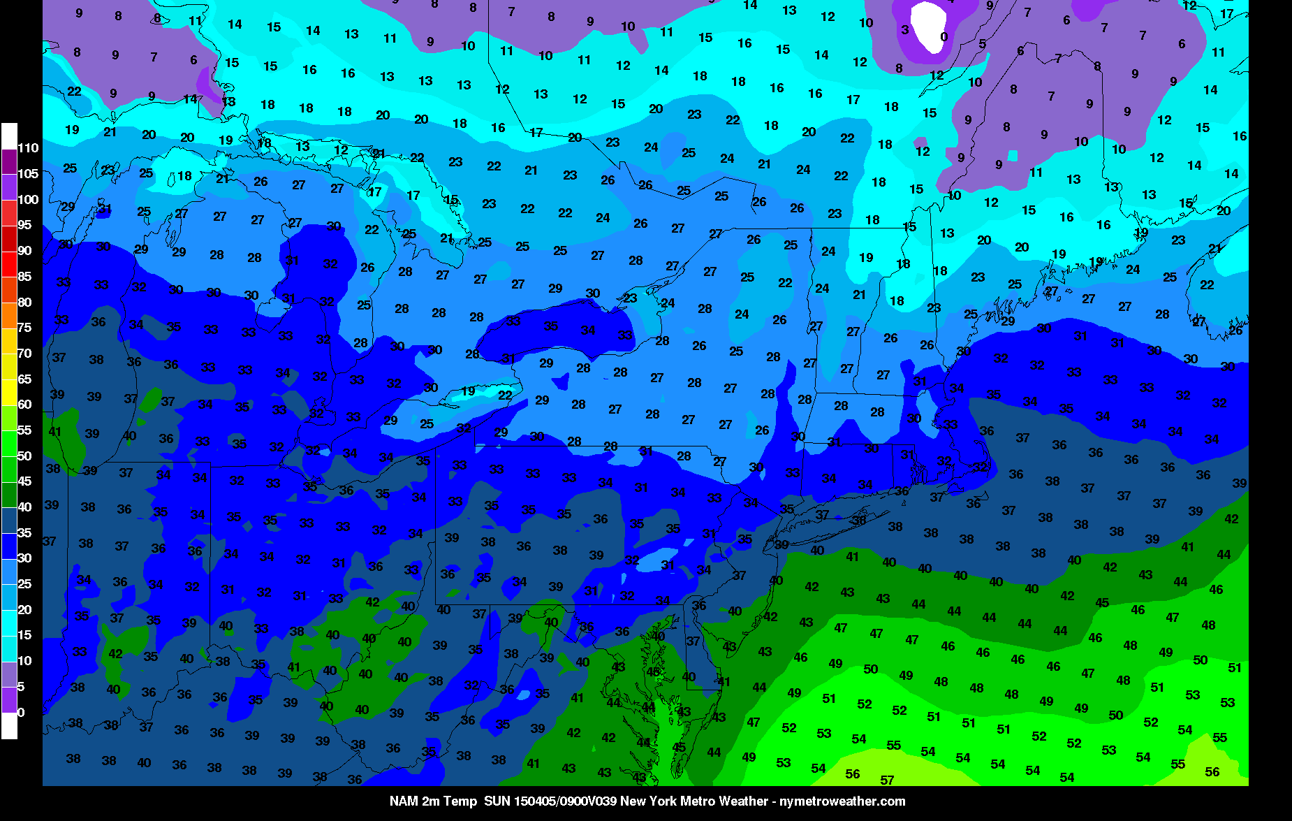
Today’s NAM model valid for Sunday morning shows temperatures falling back into the 30s.
The chilly weather returns on Saturday night, as temperatures will fall back into the low to mid 30s. Fortunately, temperatures should still rebound somewhat nicely on Sunday — back into the upper 50s — but with increasing clouds and perhaps a scattered shower during the evening.
As far as sustained, nice Spring weather is concerned: don’t count on it. Monday looks gorgeous, though, as another ridge with southerly winds builds back in, allowing temperatures to soar well into the 60s to around 70 in most locations, with upper 50s to around 60 for the coast — with partly cloudy skies.
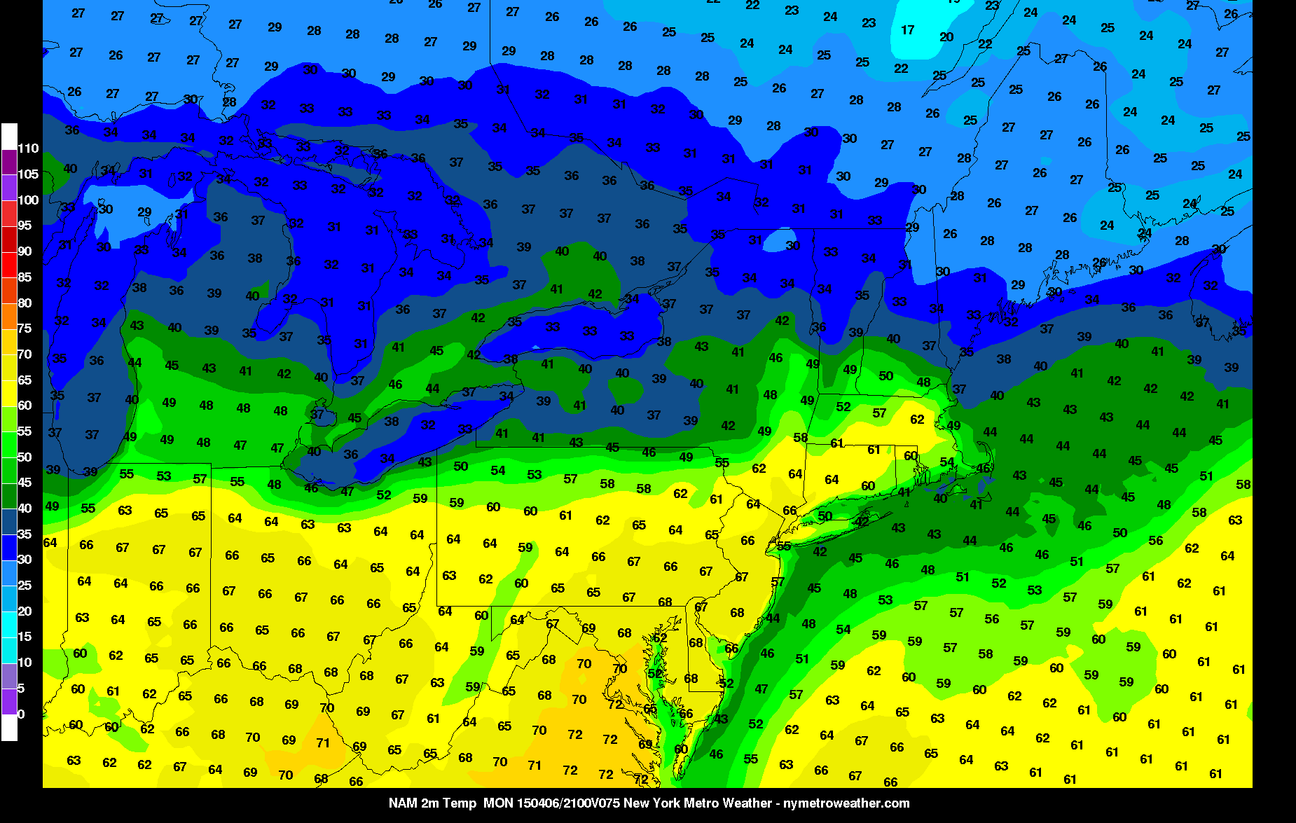
Today’s NAM model shows a true spring-like day for most locations on Monday, with temperatures soaring well into the 60s.
Unfortunately, Tuesday through Thursday looks to go back into the Spring doldrums, as a backdoor cold front associated with a strong High Pressure system in SE Canada looks to charge through the area. South of this front, temperatures will remain in the 60s and 70s, but north of the front will have temperatures in the 40s with fog and rain. Unfortunately, our area will be on the north side of this boundary.