Warmup with showers, storms on Friday
Despite a large mid level ridge, a backdoor cold front made any semblance of warmth exceptionally fleeting over the past few days. Thursday will be no exception, as east and northeasterly winds keep low clouds socked in with showers and drizzle dominating the forecast. Meanwhile, across the Central United States, a powerful cold front has begun its trek east from the Plains and will eventually end up in the Mississippi and Ohio Valleys by late Thursday and early Friday. Severe weather will be possible throughout the Central United States today.
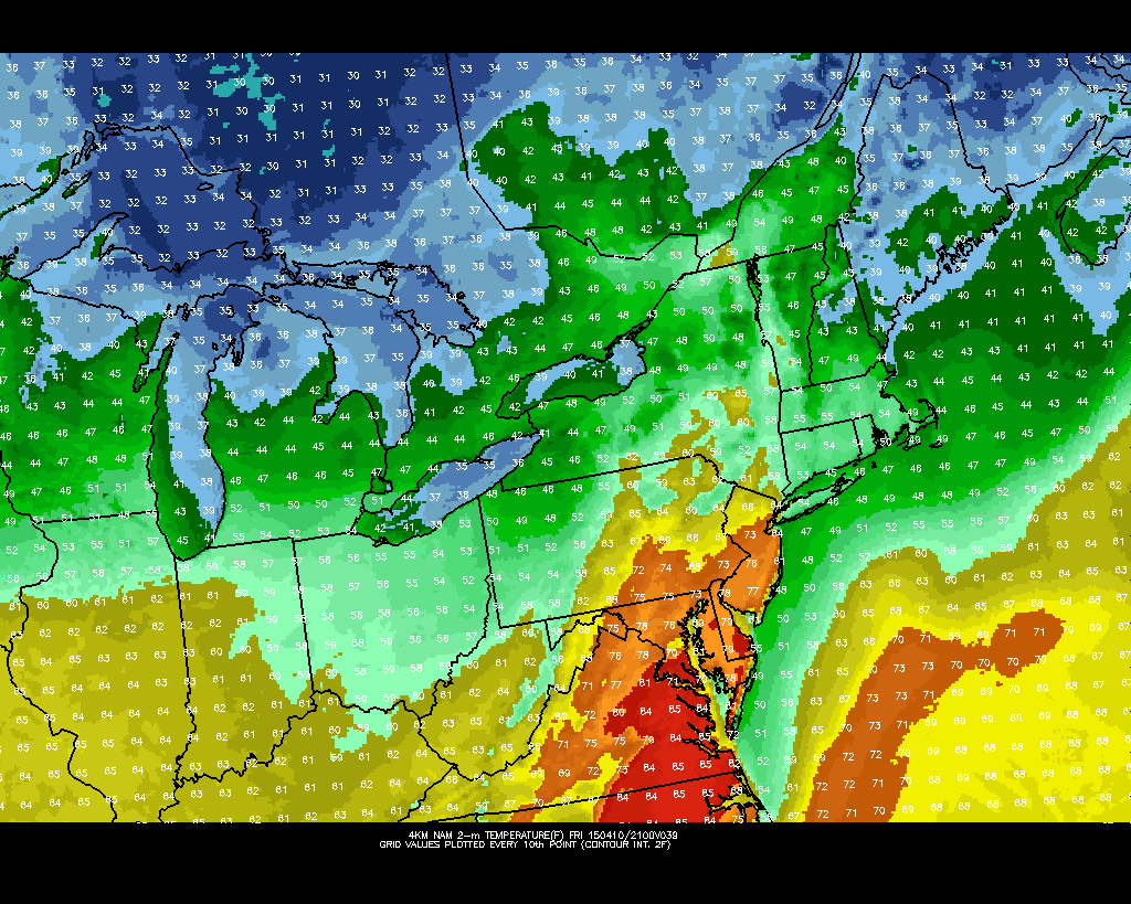
For our area, this signals two things: The end of any potential above average regime, and the likelihood of an increased southerly flow right ahead of the front. The latter of the two will be most important, as east/northeasterly winds will swing around to southerly on Friday. This will help to scour out the backdoor cold front and allow warmer air to surge northward from the Mid Atlantic States into parts of Southern New England. Temperatures will rebound, into the 60’s and potentially 70’s in much of New Jersey.
With the approaching cold front will come an increased likelihood of showers and thunderstorms on Friday. A few of these storms could be noteworthy, producing stronger than normal wind gusts and potentially some small hail. The Storm Prediction Center has issued a Slight Risk of severe weather across parts of Central and Southern New Jersey, southward into the Mid Atlantic States. Obviously, these areas have the best chance of seeing any stronger storms — but overall we feel the potential in most of New Jersey and New York City is rather low for severe weather.
Nevertheless, after scattered showers and storms the cold front will swing through, bringing cooler air with it on Saturday. That said, the weather will feel much more pleasant when compared with what we’ve been dealing with this week. In fact, full sun and light winds on both Saturday and Sunday should bring temperatures into the 60’s — and the winds out of the west will mitigate any major effects from the cold ocean. With a pleasant weekend ahead, at this point, we just have to get through a dreary Thursday.


