-2")
PM Update: Departing storms, continually unsettled
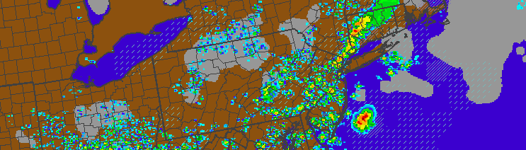
Showers and thunderstorm, none severe, moved through the NYC area during this afternoon and early evening. Sparked by a mid level disturbance and surface cold front, the storms were mainly of the “Garden variety”, although some of them packed some gusty winds. Tropical moisture in place added to threat for heavy rain, which did result in some localized flooding. But overall, a lack of instability in the atmosphere kept any severe weather threat from materializing.
The same was not true over Southern NJ, where better surface instability led to the development of a few supercells, which caused wind damage over Southern New Jersey earlier today. For most of the region, however, the good news is this: This front will slide southward and bring cooler, less humid, and more stable to the area tonight.
The forecast will take a cooler turn on Wednesday and Thursday, with high temperatures in the 70’s and 80’s but lower humidity values. That being said, the pattern will remain unsettled with some showers and storms possible each day. Thursday, more specifically, could feature some strong thunderstorms, mainly away from the coast. The Storm Prediction Center has placed parts of New Jersey (west of NYC) in a Slight Risk for severe storms.
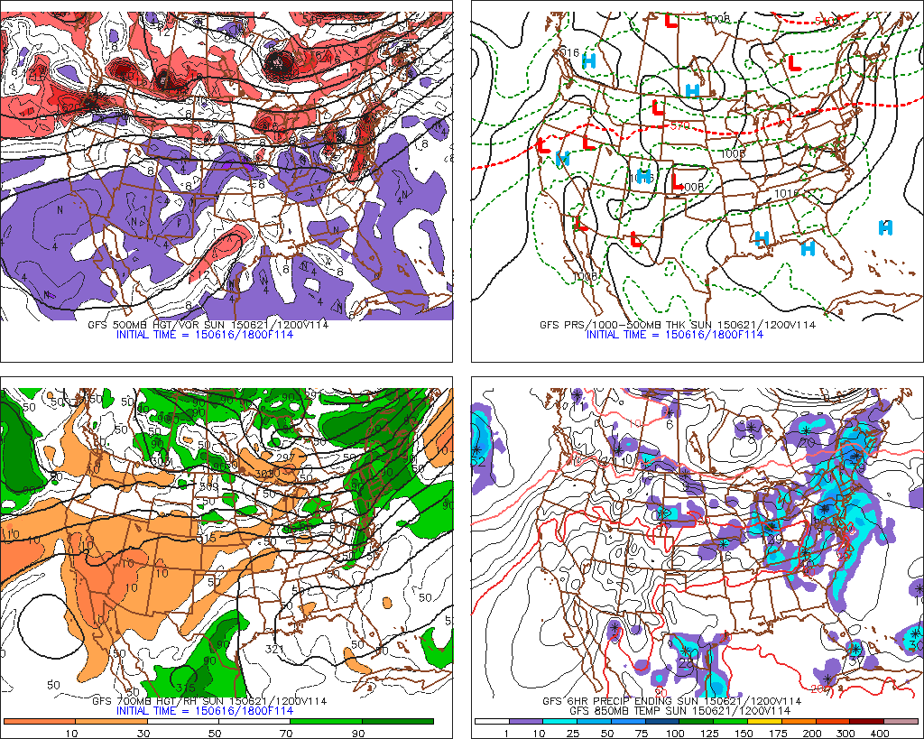
The GFS model shows the remnants of TS Bill affecting the area this weekend.
This weekend, much of the forecast begins to hinge on the development and track of Tropical Storm Bill, currently making landfall in Southern Texas. This system is forecast to move north/northeast through the Plains, and then along the periphery of a ridge into the Ohio Valley and eventually the Northeast.
The exact track of the Tropical remnants will dictate whether or not our area will see heavy rain, thunderstorms, or some severe weather. The pattern, overall, will remain quite unsettled. Warm weather will continue — with thunderstorm threats essentially each day. More organized threats for severe thunderstorms may begin to emerge by early next week, as well.