-2")
Remnants of TS Bill will impact weekend forecast
While Tropical Storm Bill is making headlines today impacting parts of Texas, with rains expected in the Plains this week, we aren’t out of the woods here in the Northeast. A Tropical Storm thousands of miles away will eventually become engulfed in the mid and upper level atmospheric flow, bringing tropical moisture northeastward into the Ohio Valley and eventually the Northeast. For our area, this will have a major impact on the weekend forecast.
Forecast models are struggling with the exact intensity of TS Bill as it moves inland, as well as the timing of it’s absorption into the mid and upper level atmospheric flow. These two factors are very important for our areas forecast, as they will dictate the timing of a surge of tropical moisture into the Northeast US. Showers, thunderstorms, and even areas of heavy flooding rains are possible near where the center of the remnant low pressure tracks.
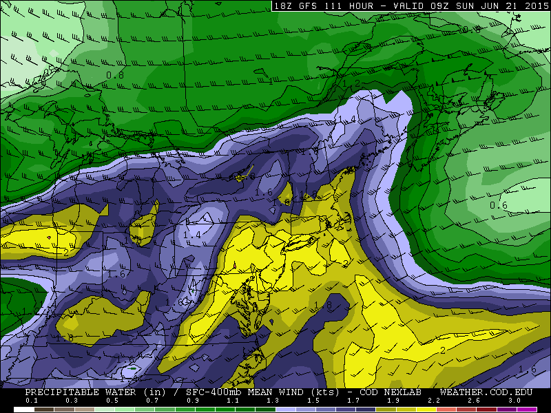
GFS model showing very high atmospheric moisture content this weekend.
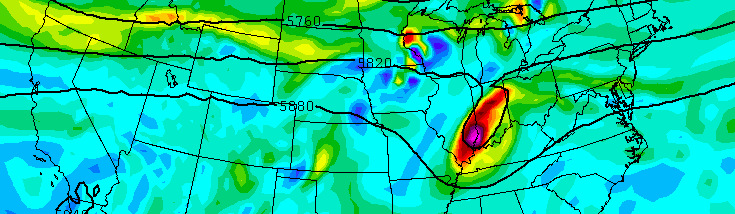
Perhaps most notable will be the impact the remnants of TS Bill have on the potential for organized severe weather in our area. Forecast models had been persistent in indicating the advection of an EML (Elevated Mixed Layer) into the Northeast United States during the upcoming weekend into early next week. EML’s are integral parts of some of the more widespread severe weather events in this part of the country.
Yet, the progression of TS Bill as currently modeled would likely inhibit the movement of the EML from the Plains States into the Northeast United States. Models, accordingly, have backed off the potential for severe weather and moved more toward the idea that parts of Saturday into Sunday could feature heavy rain with tropical downpours and high humidity.
We’ll be carefully watching over the next few days — and will have the latest information as we get it. Tropical systems, like this one, are extremely difficult for forecast models to get a handle on. Slight differences and intricacies in the atmospheric pattern can have large impacts on the sensible weather that occurs. And so, our confidence is very low moving forward. We’ll have to carefully watch forecast models over the next several days.