-2")
TS Bill’s remnants still an uncertainty this weekend
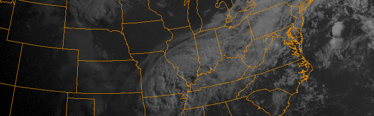
Much has been made over the past few days in regards to the potential for heavy rain on Sunday. The remnants of Tropical Storm Bill are anticipated, by many forecast models, to move northeastward from the Ohio and Mississippi Valley’s into the Northeast States. A weak developing surface low near the area of the mid level disturbance is expected to aid in the development of heavy rain from the Mid Atlantic northeastward toward parts of the Northeast as well, as the system shifts toward the coast.
The problem, however, is that remnants of Tropical systems are unpredictable by nature. The high moisture, high energy, and intricate nature of the pattern in the mid levels of the atmosphere makes it very difficult on forecast models to try and pin down specifics. For us, this means an uncertain weekend forecast. And, yes, the potential that Sunday may turn out to be not quite a washout at all.
Very heavy rain and embedded storms would be likely on Sunday if the remnants of Bill track toward our area.
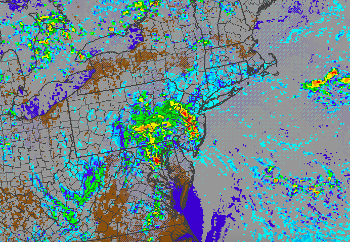
When looking at specifics on forecast models, it’s easy to see why there is a large envelope of solutions. The energy associated with the remnants of TS Bill is forecast by the NAM and some other high resolution models to move farther north through the Mid Atlantic States, and remain more consolidated. The result is a stronger, more consolidated surface low pressure system, and better atmospheric dynamics. These models suggest that early on Sunday into Sunday afternoon, very heavy rain will be possible throughout parts of New Jersey to NYC and Long Island.
Other models, like the GFS for example, are much more strung out and farther south with the energy associated with the remnants of TS Bill. While heavy rains do still occur (this is tropical moisture, after all), they do so farther south over the Mid Atlantic. On the GFS, our area actually avoids any heavy rain on Sunday morning and early afternoon. Not all is won, however, as the atmosphere ends up destabilizing further (without the morning rain) and thunderstorms move into our area later in the day.
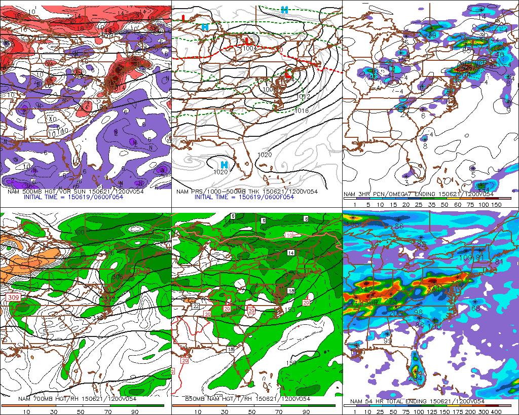
The NAM shows very heavy rainfall into our area on Sunday morning. The GFS, and some other models, are not as enthused.
From a meteorological standpoint, the setup is convoluted, and the setup is complicated. Intricacies within the pattern will determine whether our area sees very heavy synoptic rain in the morning on Sunday, or thunderstorms with lightning and flash flooding in the afternoon. And we’ll be working hard to forecast over the next day or so.
From a sensible weather standpoint, the setup is much more simple: Sunday will be a very unsettled day, with heavy rain possible; whether it be in the form of synoptic heavy rainfall, or thunderstorms with lightning and gusty winds.