-2")
Fourth Forecast: Clouds possible, but not a certainty
Summers most loved holiday is almost here — and most already have their American Flags and sparklers ready. The weather, however, may not be so eager to cooperate. We’ll start with the good news: Medium range forecast models which had been showing a total washout for Independence Day have since backed off. The bad news? It still looks like an onshore flow will promote the development of low clouds and the intrusion of a marine layer, at least early in the day.
What will become interesting is forecasting both the erosion of that marine layer by the afternoon and evening hours, and the potential for a weak coastal storm system to scoot on by to our south and east. This looks most likely to occur on the night of July 3rd (Friday) into Independence Day morning, as a low pressure system develops in the Ohio Valley and then transfer offshore to the Mid-Atlantic Coast. Sheesh — you’d almost think this were a mid-winter forecast!
The culprit in us having to discuss all of this, to begin with, is a large and anomalous ridge on the West Coast of the United States. Portland, Seattle, and Vancouver are all experiencing summer weather with clear skies and temperatures in the 80’s and 90’s. Us? We’re dealing with a parade of mid level disturbances and notably cool temperatures, as troughiness in the mid levels of the atmosphere remains stout.
One of these aforementioned disturbances will move through the Ohio Valley and eventually off the East Coast on Friday Night into Saturday morning, and forecast models agree that an area of rain will move from the Mid Atlantic off the East Coast. This is most likely to graze Washington DC into Philadelphia and Southern New Jersey — with precipitation becoming spottier farther north near New York City.
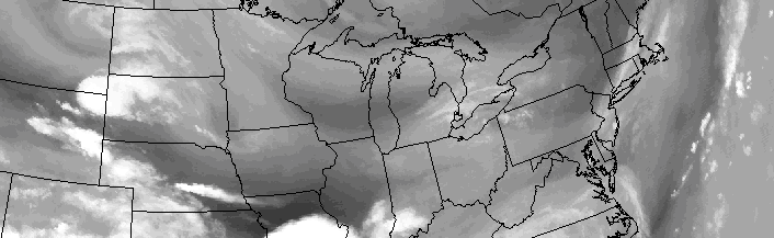
The GFS model shows a coastal storm sliding eastward on Independence Day.
Clouds, however, are likely to develop inland from the cooler ocean waters. Winds to the east/northeast to the north of the aforementioned disturbance will promote a marine layer with low clouds and drizzle shifting inland. Later in the day on Saturday, if this coastal system shifts eastward quick enough, these clouds will erode and clearer skies will take over for the firework displays on Independence Day.
This, still, will be a very tough forecast in terms of clouds and precipitation as the holiday approaches. Only minuscule and intricate changes in the mid and upper levels of the atmosphere could drastically change the forecast. So, while we aren’t expecting a washout by any means, keep an eye on the forecast over the next few days to get a good idea as to exactly how things will pan out this weekend.