-2")
Afternoon Roundup: Showers and thunderstorms late tonight
The stretch of hot weather has continued into today, where temperatures could touch 90 degrees once again. For some of the warm spots, this marks the seventh consecutive 90-degree day. Most of us, however, missed out on a day or two of 90-degree temperatures, so this could be the fifth 90-degree day in seven days.
Fortunately, the past several days, including today, have been much less humid. This has helped it feel quite comfortable outside during the past few days and has also led to gorgeous nights, as many Met fans at Citi Field last night could probably attest to.
Unfortunately, however, southerly winds ahead of a cold front will be increasing later this afternoon and particularly tonight, which will help bring up some more moisture, making it feel more uncomfortable and perhaps fueling some thunderstorms.
The increase in southerly winds may actually prevent some locations along the coast from hitting 90 degrees; NYC has actually been stuck in the upper 80s, while Newark has already hit the lower 90s. Regardless, the rest of the afternoon looks mostly sunny, as any thunderstorm activity should generally remain well to the west.
Here’s what we can expect, along with other general weather highlights:
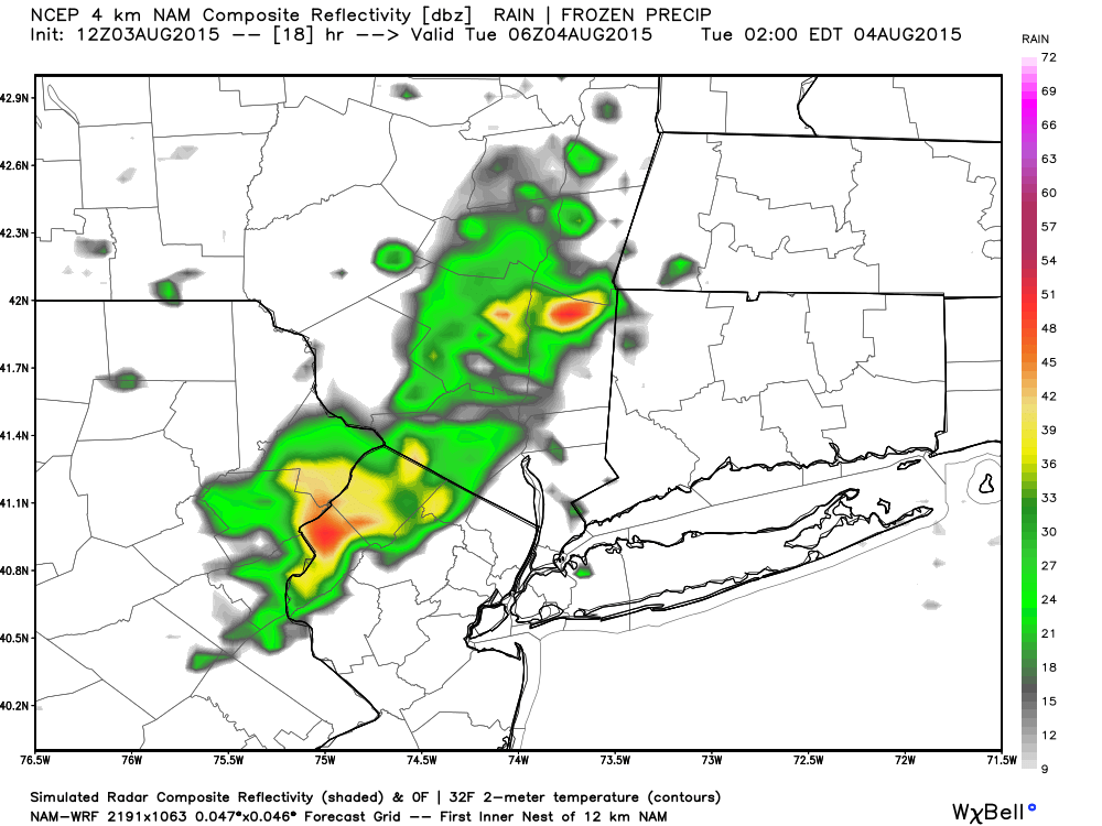
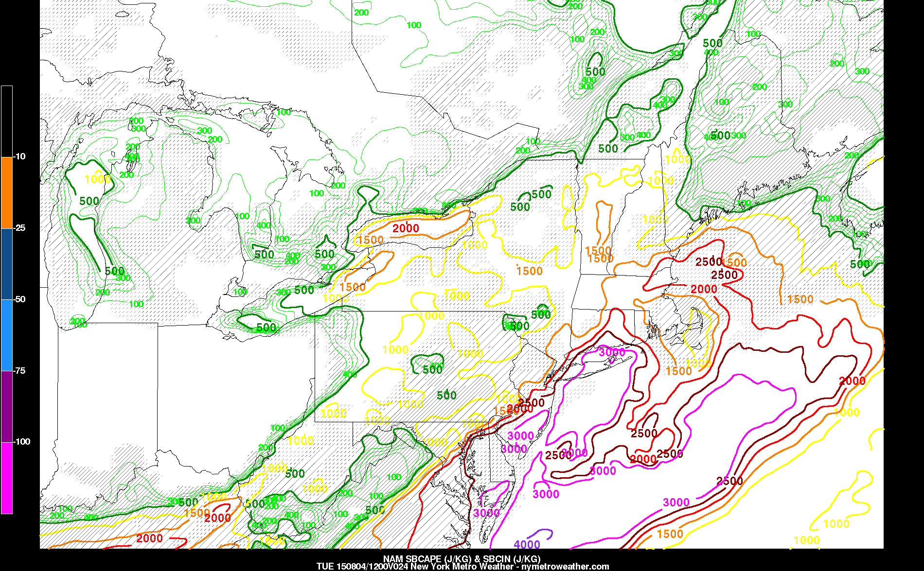
- As a cold front approaches the area tonight, it will begin to slow down. This will give ample time for southerly winds to increase out ahead of it and pool much more low-level moisture in the area. This could increase CAPE values to near 3,000 J/KG along the coast, with values a bit less inland. When this is combined with increasing mid-level winds and thus moderate wind shear, a few strong thunderstorms are possible during the overnight and early tomorrow morning.
- A secondary effect of this is gusty winds, even not in thunderstorms. The southerly winds could be sustained at 15mph at times, and gust to 25mph.
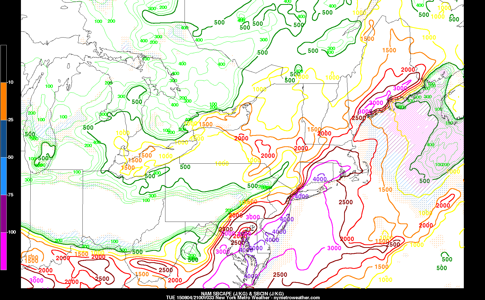
- The cold front will stall near the area on Tuesday, so the airmass may not necessarily stabilize. The lift from the cold front may once again trigger some showers and thunderstorms during the afternoon, some of which could be strong again. High temperatures should once again be in the upper 80s to low 90s. The forecast is tricky because if the front stalls a bit further east, the airmass will be a bit more stable and thunderstorms would be weak; but if it stalls closer to our area, instability would be quite high with daytime heating, making even a few isolated severe thunderstorms possible. Currently, we are thinking something in the middle, where some strong storms are again possible, but not severe weather.
- The cold front will finally clear on Tuesday night, leading to a beautiful day on Wednesday, with temperatures in the mid 80s, sunny skies, and low humidity.
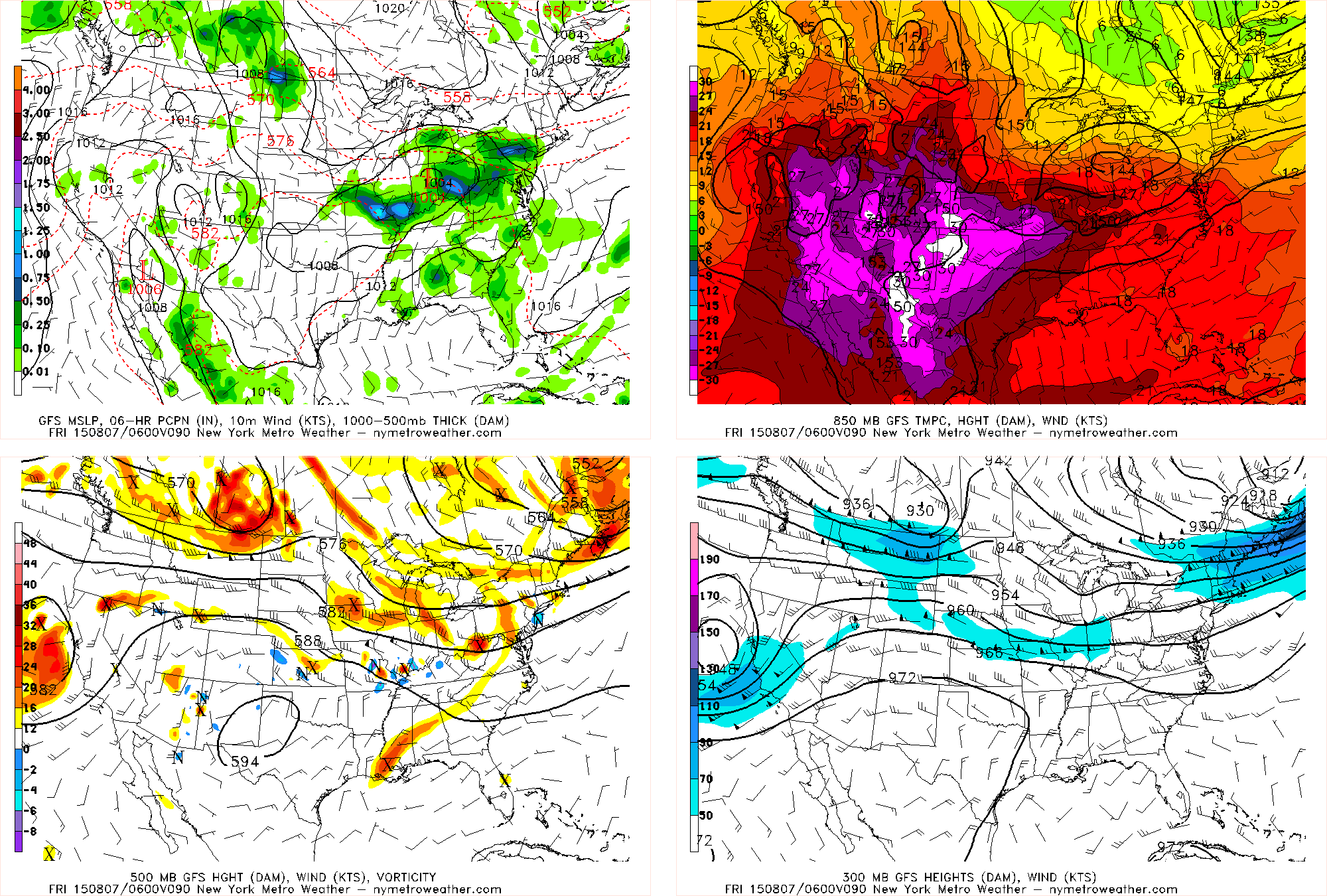
- Thursday will be a transition day: A trough digging down from Canada and an impulse moving through the Midwest will combine to form a storm system that will produce rain and chilly weather. Thursday won’t bad bad weather-wise (unless the storm speeds up), but increasing clouds will portend a rainy Thursday night and Friday.