-2")
Heavy rain, gusty winds likely on Wednesday
The interaction between tropical moisture — remnants of Hurricane Patricia — and a strong mid level atmospheric disturbance over the North Central US will aid in the development of steady rain on Wednesday. As forcing for precipitation increases during the morning hours, steady rains will develop from southwest to northeast throughout the area. Atmospheric moisture content will increase throughout the day, as a psuedo-warm front moves through New Jersey and New York.
Precipitable water values between 200 and 300 percent above average are a testament to the tropical moisture involved in Wednesday’s rains. During the late morning and afternoon, a low level jet stream is expected to strengthen, further aiding in the potential for heavy rains. While heavy rain isn’t expected to be constant, sporadic heavy rains could cause localized flooding, despite the moderate drought conditions in much of Northern New Jersey, New York and Connecticut.
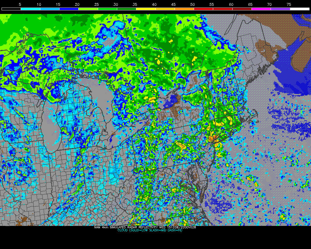
NAM model showing heavy rain in the area on Wednesday afternoon.
In addition to heavy rain throughout the late morning and early afternoon, the potential exists for strong wind gusts — especially on Wednesday afternoon and evening. After the passage of a warm front on Wednesday morning, a low pressure system to our northwest will strengthen, allowing a cold frontal boundary to sweep through Pennsylvania and eventually toward the East Coast. Moisture pooling near and ahead of this cold front, juxtaposed with locally stronger forcing for precipitation, will aid in the development of heavier rains and possibly embedded thunderstorms.
Making matters worse will be the aforementioned low level jet. With its strengthening will come strong winds just above the surface — at 925mb — on the order of 50-60 knots. These winds will strengthen throughout the afternoon and evening, with the approach of the cold frontal boundary. While instability will be very limited, any juxtaposition of instability, forcing for embedded thunderstorms, and moisture could allow these winds to mix down to the surface.
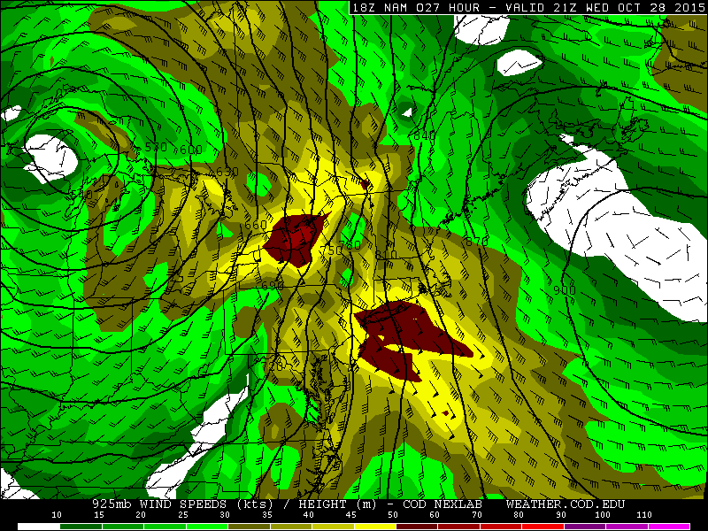
NAM model showing winds at 925mb — just above the surface — over 50 knots throughout the area on Wednesday evening and Thursday morning.
These strong wind gusts are expected to remain isolated, but the possibility will still exist along the front. The potential may be slightly higher in parts of the Mid Atlantic States, and again on Long Island late Wednesday Night as the low level jet strengthens additionally.
Rain will remain possible until Thursday morning, when some clearing is expected. Temperatures will additionally spike on Thursday afternoon before a secondary cold front moves through Thursday evening.