-2")
Warming Trend Through Monday, Changeable Weather for Mid-Late Week
After a chilly Sunday morning with temperatures in the upper 20s to lower 40s, warmer temperatures returned this afternoon. High pressure building to our south and higher 500mb heights led to a more west-southwest flow to develop today, which allowed 850mb temperatures to rise between 6°C to 8°C later this afternoon. This led to temperatures reaching the upper 50s to lower 60s across the region. With the previous storm system completely departing, the pressure gradient lessened, leading to much calmer winds.
Clear skies and calm winds will continue tonight, with temperatures dropping into the low-to-mid 40s in most locations — perhaps a few mid-to-upper 30s in higher elevations and the pine barrens. Tomorrow (Monday) looks like another winner with mostly sunny skies. High temperatures in the afternoon will be in the upper 50s to lower 60s.
Today’s 6z NAM valid for Tuesday afternoon shows temperatures only in the upper 40s.
It appears more changeable weather is in store for rest of the week, as we will be seeing a pattern we’re more accustomed to seeing during the early Spring months. Confluence and high pressure behind a shortwave trough digging over New England will cause a backdoor cold front to push through the region Monday night. This will cause temperatures to drop to the upper 30s to lower 40s. Accordingly, forecast guidance is showing a maritime airmass with light northeast winds and temperatures holding in the 40s during the day on Tuesday. High temperatures will likely be in the upper 40s to lower 50s in the afternoon.
The next disturbance from the Central Plains will be forced by the strong mid-level ridge to track north and phase with another low over the Upper Midwest. But a cold front from this system will still come our way. During the day on Wednesday, clouds will increase ahead of this front. It will become breezy with winds turning southeast and temperatures rising into the mid-to-upper 50s by afternoon.
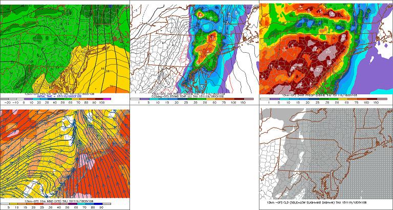
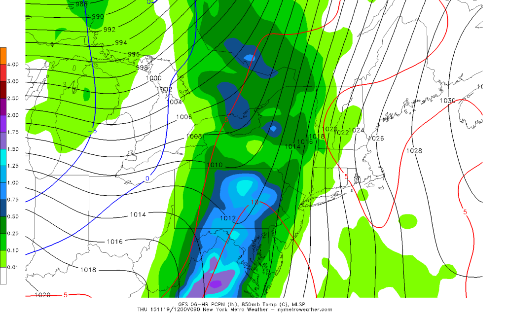
Today’s 6z GFS shows showers with heavy rainfall and strong southeasterly winds for Thursday (Image courtesy of PSU Ewall)
The cold front will pass through the area on Wednesday night and Thursday. A strong 850mb southerly jet and high precipitable water values ahead of the front will support showers, along with the possibility of heavy rain and gusty winds. Temperatures could also rise into the mid-to-upper 60s with the southerly flow.
Behind this front, high pressure from Canada will the region for Friday and Saturday. While skies will clear, chillier weather will return, with lows generally in the upper 30s and highs in the low 50s next weekend.