-2")
Cool start, unsettled trend by midweek
The week will begin, to the disappointment of many, with colder weather behind a front which shifted through the area on Sunday morning. The anomalously warm, and almost spring-like, airmass which settled into the area during the latter half of last week and this weekend will have been shunted southward. Behind the front will come cooler, less humid air. Monday morning is likely to be quite crisp, with low temperatures in the 20’s and 30’s away from the coast and in the mid 30’s even in the city.
The week will be marked by a transitional weather pattern, beginning with cold air and ending with a gradual warming trend. In between, periods of rain and unsettled weather are expected during the middle part of the week. A low pressure system moving through the Mississippi Valley and eventually reforming off the East Coast will be to blame, with increasing moisture and lift for precipitation by Tuesday and Wednesday.
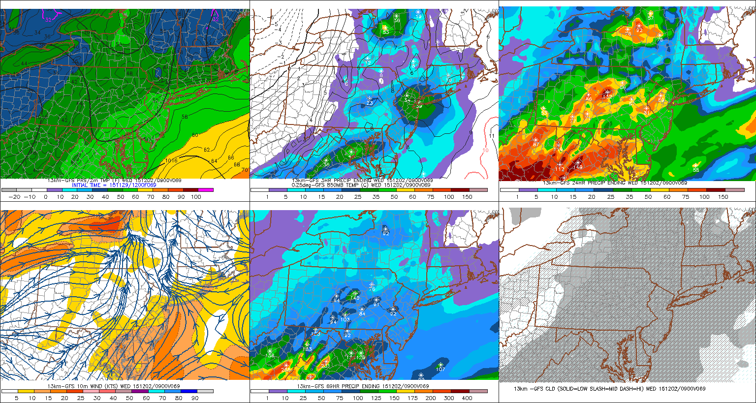
GFS model showing unsettled weather during the middle part of the upcoming week.
One notable recurring theme this Autumn has been the progressive nature of colder air. This has been, to date, the warmest November on record in New York City. The global circulation pattern is simply not supportive of sustained cold air in our area — and that looks to remain the case for several weeks. Not surprisingly, the chilly air on Monday morning will be transient. By Tuesday, temperatures will begin to warm as a warm front approaches the area.
Forecast models are in good agreement that the approaching warm front and low pressure system will bring chances for unsettled weather and rain on both Tuesday and Wednesday. The steadiest rain is likely from Tuesday Night into Wednesday morning, as lower pressure moves off the Mid Atlantic Coast into the Northwest Atlantic. By later Wednesday, a cold front will move through the area, bringing in cooler air and decreasing atmospheric moisture content.
The recurring theme we discussed earlier will again appear by late week. The cooler air which moves in Wednesday will quickly moderate, as mid level heights rise again. Temperatures toward the end of the week and into the weekend are expected to again moderate — but an active pattern will continue, with multiple storm systems in the medium and long range.