-2")
Interior wintry weather expected on Tuesday morning
Skies will remain mostly cloudy through this afternoon and evening, as a cold front approaches from the northwest. Despite the cloudcover, a deep west-southwest flow will help temperatures will rise into the lower to middle 60s. A cold front will slowly move through the region with some scattered showers late this afternoon and early tonight. Precipitable water values near 1.25 to 1.50″ could support some heavy downpours with these showers.
A much colder airmass will follow behind this front late tonight and tomorrow, as a strong Canadian high pressure starts to build into the Northeast. Temperatures will drop into 30s for most areas by dawn. Cold air will continue to advect into region during the day tomorrow, on light north to northeast winds. Model soundings indicate mixing to 900mb-925mb where temperatures are -6C to -8C. Despite some sunshine, temperatures will slowly rise into the upper 30s to lower 40s for highs tomorrow afternoon. These temperatures are seasonal for this time of year.
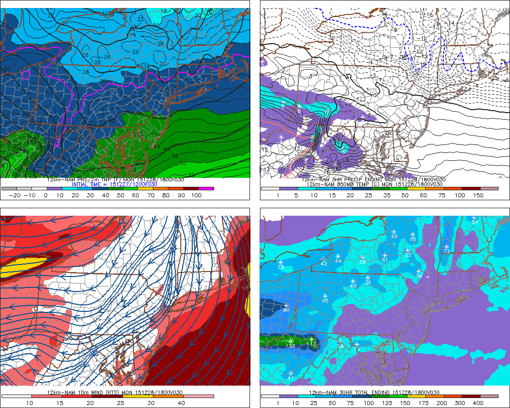
The NAM showing temperatures in middle to upper 30s early tomorrow afternoon over NYC metro
Due to the lack of high-latitude blocking and a strengthening southeast ridge, the Canadian high will begin to move out of the Northeast on Monday night and Tuesday. A low pressure system that produced blizzard conditions and severe weather for the Southern Plains this weekend will track into the Great Lakes on Tuesday. Thereafter, a secondary low will form off the Delmarva coast and track northeast south of Long Island later in the day. This new low pressure area will not develop in time to prevent more warm air intrusion in the low and mid levels of the atmosphere by Tuesday morning.
Precipitation should start to spread from southwest to northeast late tomorrow evening. Model soundings show a warm tongue between 700mb and 850mb. Some dry air in the lower levels could cause wet-bulb temperatures to fall into lower to middle 30s, during the onset of precipitation.
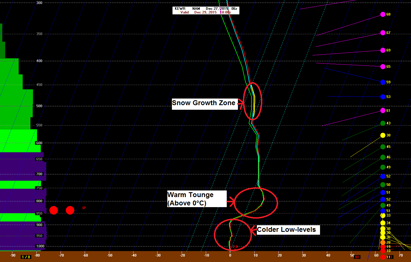
NAM sounding for Newark, NJ early Tuesday morning
Therefore, we expect precipitation in the form of sleet and rain for New York City, Long Island, tomorrow night. Then–as more easterly winds bring warmer air off the ocean–precipitation will change completely to rain by the Tuesday morning rush hour. Over Central and Southern New Jersey, the entire column will likely be warm enough for just rain.
Further inland, colder temperatures aloft and near the surface, will support mix of snow, sleet, and freezing rain. This wintry mix will continue into early Tuesday morning–possibly becoming heavy at times. Before enough warm air changes precipitation completely to rain by early Tuesday afternoon.
The National Weather Service has issued Winter Weather Advisories for interior portions of New Jersey, New York State, and Connecticut from Tuesday morning through Tuesday evening.
Only very minor snow/sleet accumulations are expected, before a changeover to rain in most locals on Tuesday. However, some icing from freezing rain inland could occur. Especially in the highest elevations over Northwest New Jersey and the Lower Hudson Valley. Rain could also fall heavy at times, before tapering off to light showers and drizzle late in the afternoon and early evening.
This system will move out region Tuesday night, with fair returning briefly on Wednesday. Another frontal system may produce some showers Wednesday night and Thursday morning. Before clearing out for sunshine and turning colder for New Year’s Eve’s night. High temperatures both days will be upper 40s to lower 50s.